Download
1 / 1
10 likes | 273 Vues
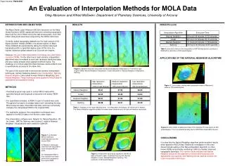
Paper Number P42A-0567. An Evaluation of Interpolation Methods for MOLA Data. Oleg Abramov and Alfred McEwen: Department of Planetary Sciences, University of Arizona. INTRODUCTION AND OBJECTIVES. RESULTS. RESULTS (cont).

E N D
Paper Number P42A-0567 An Evaluation of Interpolation Methods for MOLA Data Oleg Abramov and Alfred McEwen: Department of Planetary Sciences, University of Arizona INTRODUCTION AND OBJECTIVES RESULTS RESULTS (cont) The Mars Orbiter Laser Altimeter (MOLA) instrument on the Mars Global Surveyor (MGS) spacecraft has been collecting topography data from the orbit of Mars during the last several years. Over 600 million data points have been acquired by the MOLA instrument. Currently, global topography datasets are the main source of the digital elevation models (DEMs) of localized regions on Mars. These datasets are generated by taking the median observed topography within a specified degree area. At this time, the highest resolution global dataset is at 32 pixels per degree. However, the use of data interpolation techniques can yield higher-resolution DEMs. On the other hand, most common interpolation algorithms were formulated to work with randomly distributed data, and give visible artifacts when applied to MOLA tracks. The challenge is to find an algorithm that minimizes visible artifacts and is quantitatively accurate at the same time. The goal of this project was to test several common interpolation techniques, namely Delaunay-based Linear Interpolation, Splining, Nearest Neighbor (also called Inverse Distance Weighting), and Natural Neighbor. These techniques were applied to MOLA data for quantitative and qualitative testing. Table 2. Execution times for the interpolation of 80732 data points to produce a DEM with a resolution of 200 pixels/degree. APPLICATIONS OF THE NATURAL NEIGHBOR ALGORITHM Figure 2. Medium resolution (equivalent to 250 pixels/degree) interpolations. From left to right: Original DEM, Natural Neighbor interpolation, Linear Interpolation, Nearest Neighbor interpolation, Splining. Figure 4. Color-coded, shaded relief perspective view of Milankovic crater at 100 pixels/degree. METHODS • Pedr2tab program was used to extract MOLA data within • specified latitude and longitude constraints from binary PEDR • files. • For quantitative analysis, a DEM of a part of Iceland was used. • The general concept is to sample data from it simulating the way • MOLA acquires data, interpolate that data, and then numerically • compare the interpolated DEM to the original DEM. • For qualitative analysis, the interpolation techniques were • applied to the MOLA data of the Korolev crater region. • The interpolation software was: Natgrid for Natural Neighbor, IDL • for Linear, GMT for Splining, and custom C code for Nearest • Neighbor. Visualizations were created in OpenDX. Table 1. Summary of the mean absolute error for interpolation techniques. All values are in meters. The Natural Neighbor algorithm yields the lowest mean absolute error at high and medium resolutions. Figure 5. Color-coded, shaded relief map of the Cerberus Fossae region at 200 pixels/degree.This is a potential landing site for 2003 Mars Exploration Rovers. Figure 1. a) Random MOLA tracks are superimposed over the known DEM. b) Elevation values are obtained from the DEM at each simulated MOLA point. An interpolated DEM is then created from these points and compared to the original DEM. CONCLUSIONS It is clear that the Natural Neighbor algorithm yields excellent results when applied to MOLA data. Additional investigation in this area should include testing of the Natural Neighbor algorithm on other known DEMs and possibly combining it with the median observed topography technique. The current results indicate that Natural Neighbor should be the algorithm of choice when accuracy and appearance are required, and Splining can be used as a quick first-order interpolation technique. Figure 3. Interpolation techniques applied to the MOLA data of Korolev crater. Clockwise from top left: Natural Neighbor, Linear, Nearest Neighbor, Splining. The resolution is 200 pixels/degree. b. a.