Download
1 / 17
170 likes | 292 Vues
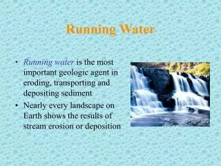
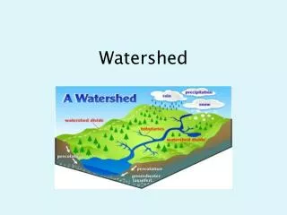
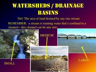
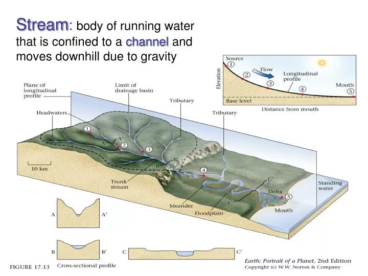
Stream : body of running water that is confined to a channel and moves downhill due to gravity. Drainage Basin : total area drained by a stream. Larger streams have larger drainage basins.

E N D
Stream:body of running water that is confined to a channel and moves downhill due to gravity
Drainage Basin:total area drained by a stream. Larger streams have larger drainage basins. The size and composition of the sediment carried by the stream depends on the nature of the drainage basin.
One last thing about contour lines is that they “V” upstream when they cross a river drainage. Blue represents water features on topographic maps, and the line and three dot pattern of the streams on this map indicate an intermittent stream – sometimes it flows and sometimes it doesn’t. (*) Next, notice how the contour lines form a “V” and that the “V” points towards the top of Squaw Peak (higher elevation), The rule of thumb is that the “V’s” point upstream,(*) Contour Lines:
In this illustration of North Mountain Park all the stream drainages will be highlighted in purple. It includes the blue stream lines as well as the unmarked drainage. What was done was to draw a line that connects the tips of the “V”s.
Flood Plain: area habitually flooded by a stream at high water. Contains fine-grain sediment deposited during flooding Natural levee: low ridges formed along sides of main stream channel during flooding. Fig. 10.27
Base Level • Base level ‑ the lower limit to which streams can erode. • Sea level is the ultimate base level. • Local or temporary base level: a lake or another stream that an upland stream flows into. Could also be a waterfall.
Stream Valleys • Stream valleys‑form and evolve from stream erosion. • Small, steep walled, deep valleys: gullies. • Large, steep walled, steep sided valleys: canyons.
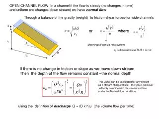
average width (m) V W D water velocity (m/sec) average depth (m) Discharge Volume of water per unit time that passes a specific point on the river. Q = m3/s
WaterWatch 0.1 in of rain 1.2 in of rain This is from a rain gauge at the Reedy River downstream of downtown Greenville.. http://waterdata.usgs.gov/
WaterWatch Big storm Rapid response Why? This is from a gauge on the Reedy River downstream of downtown Greenville. Note the rapid peak and relatively rapid decline. http://waterdata.usgs.gov/
WaterWatch Big storm Slow response Why? This is from a gauge in a rural area. Note the slow peak and decline. http://waterdata.usgs.gov/
WaterWatch Big storm This is from a gauge from below one of the dams on the Catawba River. The weird pattern is caused by controlling outflow from a hydroelectric dam. http://waterdata.usgs.gov/
WaterWatch This is from a gauge on the Waccamaw River near the coast. Note the cycles ~ 2 per day. http://waterdata.usgs.gov/