Watershed
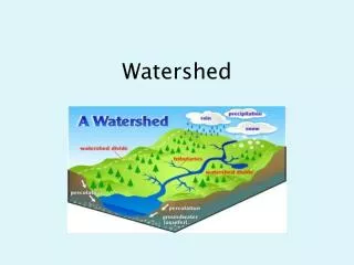
Watershed. Defining Factors- Watershed. Gravity: force of nature that pulls water downhill. 2. Topography : the form of the land; hills, valleys, plains and other features that influence where and how water will flow. Definition- Watershed. AKA: water basin & catchment basin

Watershed
E N D
Presentation Transcript
Defining Factors- Watershed • Gravity: force of nature that pulls water downhill. 2. Topography: the form of the land; hills, valleys, plains and other features that influence where and how water will flow.
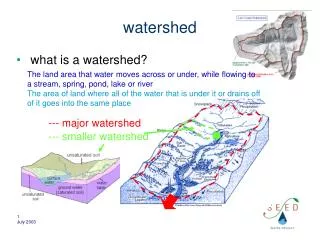
Definition- Watershed AKA: water basin & catchment basin The entire physical area/basin drained by a distinct stream system, separated from other watersheds by ridge-top boundaries.
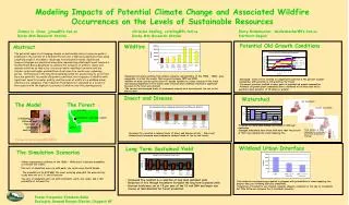
Watershed Puzzles • Cross county, state and national lines. • Each is a part of a larger picture. • Larger watersheds contain smaller watersheds.
The Great Divide An area of high elevation that runs through: • North America • Central America • South America From the Seward peninsula in North Western Alaska through the Isthmus of Panama and finally through the Tierra del Fuego , near the southern tip of South America.
Continental Divide All the water in North America eventually empty into 3 oceans: • Pacific • Atlantic • Arctic
Divergence This peak, shed waters to the Pacific, Atlantic and Arctic Oceans Triple Divide Peak- Montana
United States There are 2,267 watersheds in the United states including Alaska and Hawaii.
Tale of Three Rivers • Mississippi- 4th largest in the world- drains into the Gulf of Mexico. • Columbia- 4th largest river in U.S.- It has the greatest flow of any river draining into the Pacific Ocean. • Chesapeake – largest watershed of the Atlantic Seaboard. It drains into the Atlantic Ocean.
Mississippi River • 4th longest in the world. • 10thlargest in the world. • Largest drainagesystem in North America. Drains all or parts of 31 states. Its headwaters are in Northern Minnesota and its mouth is Mississippi river delta at the Gulf of Mexico
Gulf of Mexico The Gulf of Mexico is part of the Atlantic Ocean.
Columbia River • 4thlargest River in the United States. • Basin includes parts of 7 states. • Headwaters are in British Columbia, Canada. • Mouth is in Astoria, Oregon. • Drains into the Pacific Ocean.
Chesapeake River • Drains portions of 6 states including Washington D.C. • Largest East coast basin draining into the Atlantic Ocean. • Chesapeake bay is the largest estuary in the United States.
Texas Watersheds There are 23 majorriver basins that are confined within the state, shared with neighboring states, or shared along an international border. All of the state’s water drains into: • Mississippi River • Gulf Coast • Rio Grande River
Texas Rivers • 15 Major Rivers. • 3,700 named streams Texas river mouths are located in 7 major estuaries including: Colorado River Guadalupe River All of the state’s water drains into: • Mississippi river- such as: Red river • Gulf Coast- such as: Sabine, Brazos and Colorado. • Rio Grande such as: Pecos River.
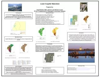
Dripping Springs: Onion Creek Watershed Onion Creek is a small tributary of the Colorado River. • Onion Creek watershed spans an area of 211 sq. miles • Headwaters- Dripping Springs, TX • Mouth – Colorado River (elevation 374 ft.) • Length- 79 miles (127 km) Source of falls at McKinney State Park.
Colorado River TX- Watershed • 18th longest river in the United States. • 5thlongest river in Texas (862 mi.) • Longest river in Tx. having both the headwaters and the mouth located within the state. • Headwaters- on the LlanoEstacado near Lamesa. (south of Lubbock) • Mouth- Matagorda Bay- near Bay City. Estacado-large, semi-arid plateau (plain) in the S. Western U. S.
Watershed Vocabulary • Tributary- a river or stream flowing into a larger river or lake. • Mouth of River- where water and sediments empty into a larger body of water. • Headwater- source of the river or stream. • Estuary-tidal mouth of a large river- where the tide meets the stream. (A type of wetland) • Watershed Divide- a relatively high ground that separates watershed basins.