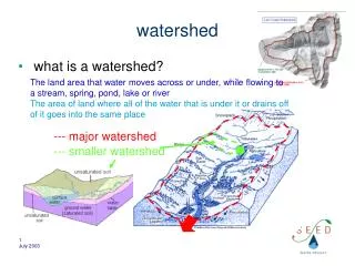
The Watershed
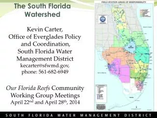
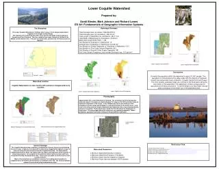
Watershed Parameters. Minimum Watershed Elevation-0 Meters Maximum Watershed Elevation-516 Meters Minimum Slope (decimal degrees)-0 degrees Maximum Slope (decimal degrees)-59.50 degrees. Lower Coquille Watershed. Prepared by: Sandi Biester, Mark Johnson and Richard Lowes

The Watershed
E N D
Presentation Transcript
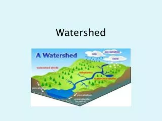
Watershed Parameters • Minimum Watershed Elevation-0 Meters • Maximum Watershed Elevation-516 Meters • Minimum Slope (decimal degrees)-0 degrees • Maximum Slope (decimal degrees)-59.50 degrees Lower Coquille Watershed Prepared by: Sandi Biester, Mark Johnson and Richard Lowes ES 341 Fundamentals of Geographic Information Systems Hydrologic Summary Total Drainage Area (sq meters): 269,258,378 m2 Total Drainage Area (sq. kilometers): 269.25 km2 Total Length of Watershed (sq. kilometers): 28.317 km Total Width of Watershed (sq. Kilometers): 23.93 km Watershed Length/Width Ratio: 1.183 Total Number of Subbasins in Watershed: 12 Average Area of Subbasins in Watershed: 22.438 km2 Total Number of Stream Segments or Tributaries in Watershed: 1613 Total Number of First Order Stream Segments: 815 Total Number of Second Order Stream Segments: 381 First Order Stream Frequency (total number/Drainage Area: 3.03 per km2 The Watershed The Lower Coquille Watershed is 1059 Sq. miles in area, it is the largest watershed to originate in the Oregon Coastal Range. The majority of the watershed lies within Coos County, with small areas touching on Douglas and Curry Counties. The river contains three major tributaries; the North, the Middle, and the South Forks. They join the mainstream, and flow into the Pacific Ocean at Bandon1. Lower Coquille watershed DRG Lower Coquille Watershed DEM Conclusions Currently the population within the watershed is about 16, 801 people. The population is concentrated in the valley areas with the majority of clustered around the incorporated towns of Bandon, Coquille, Myrtle Point and Powers. The more densely populated areas are confined to the flood plains along the main stems of the watershed. The watershed contains a large area for agriculture and forestry production. In fact the large Coos Bay timber industry grew up because of the timber out of the watershed area5. You can insert Watershed Location Coquille Watershed is in Coos County with sections in Douglas and Curry Counties Lower Coquille Annual Precipitation Lower Coquille Watershed Vegetation Physiography Approximately 70% of the Watershed is Forested. The coniferous forests on productive soils and slopes in the basin are mostly Douglas Fir; however, Port Orford Cedar is also an important component of the forests. In the lowlands the forests are made-up of oak savannas in the drier areas and Douglas Fir, cedar and hemlock in the wetter areas. Land uses in the valley areas are mostly residential and industrials sites, crop and pasturelands, and gravel extraction. Pastureland does extend into the hills above the flood plains in some areas. The steep slopes above the valleys are very sparsely populated. Timber production, agriculture and some mining are the predominant land uses4. Lower Coquille DOQ Soil classification of the Coquille Watershed Bedrock Geology of the Coquille Watershed • References Cited • Coquille Watershed Association http://www.coquillewatershed.org/Coquille_Facts.html • Natural Resources Conservation Service http://www.or.nrcs.usda.gov/programs/csp/csp_data/2005/coquille-factsheet.pdf • Pacific Coast Watershed Partnership http://www.pacificwatersheds.net/coastalnetwork/coquille.htm • Pacific Coast Watershed Partnership http://www.pacificwatersheds.net/coastalnetwork/coquille.htm • Introduction to the Coquille Watershed http://www.coquillewatershed.org/Coquille_Facts.html General Geology The Coquille Watershed was created by a combination of events that occurred following the last Ice Age. A high sea level caused the valley to be clogged with sediments to give a series of valley-fill materials which form the Coquille Formation. The Watershed is comprised primarily of deep, silty loams, silty clay loams, and clay loams which is prone to erosional processes. An exception to this exists on former marine terraces which are comprised of sandy and sandy-loam soils. These areas are prone to wind erosion as well as water erosion2. Most of the formations are sandstone; however, the Looking glass formation is conglomerate at the bottom and transitions to sandstone at the top. The various bedrocks shown all have naturally high sedimentation rates3.