Download
1 / 10
100 likes | 229 Vues
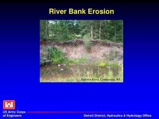
This study explores the phenomenon of bank erosion, emphasizing its causes and effects, particularly in West Bengal. It discusses the hydraulic geometry formulated by Leopold and Maddock and factors contributing to bank erosion, including water fluctuations, sediment load, and human actions. The research highlights various mapping techniques to assess bank erosion, such as superimposing channel sections over time, utilizing cadastral maps, and creating thematic maps indicating erosion levels and damage. The findings provide valuable insights for managing and mitigating bank erosion.

E N D
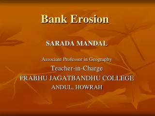
Bank Erosion SARADA MANDAL Associate Professor in Geography Teacher-in-Charge PRABHU JAGATBANDHU COLLEGE ANDUL, HOWRAH
Hydraulic Geometry • Formula given by Leopold and Moddack in 1953 : Q = WDV • Q= Quantity of water • W= Width of the channel • D= Depth of the flow • V= Velocity of water
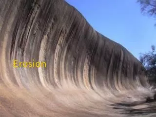
Factors of Bank Erosion • Fluctuation in quantity and volume of water • Sediment load • Characteristics of bank material • Distortion of equilibrium in soil water • Meandering of channel • Nature of the drainage basin (e.g. underlying structure, nature of rainfall, nature of weathering etc.) • Braiding of channel • Characteristics of soil profile • Human action
Mapping of Bank Erosion 1) Superimposition of the same channel-section for two separate time-period a) Identification of locations of area of erosion and deposition along the left bank and right bank b) Calculation of length of erosion c) Calculation of area of erosion d) Calculation of volume of erosion e) Calculation of rate of erosion per year
Mapping of Bank Erosion 2) Mapping from cadastral map 3) Mapping from topographical sheet 4) Mapping by Prismatic Compass Survey 5) Thematic map by showing loss and damages 6) Mapping by showing bank-material, process of erosion and level of erosion