Download
1 / 10
100 likes | 119 Vues
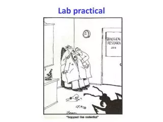
Locus Lab: Practical and Useful Location Aware Applications. Gunnar Misund Associate Professor gunnar.misund@hiof.no Østfold University College Faculty of Computer Science Halden, Norway. Outline. Project OneMap The Been-There-Done-That Framework and Location Aware Mobile Applications.

E N D
Locus Lab: Practical and Useful Location Aware Applications Gunnar Misund Associate Professor gunnar.misund@hiof.no Østfold University College Faculty of Computer Science Halden, Norway
Outline • Project OneMap • The Been-There-Done-That Framework and Location Aware Mobile Applications
Project OneMap • Long term effort contributing to the fusion of standard web technologies and geographic content, often referred to as the GeoWeb. • Open/free content • Open managment • Open standards/formats • Student effort www.onemap.org
Project OneMap • 3 main R&D activities: • Methods for managment of vast amounts of geospatial data • 3D visualization of 2D map data • Mobile, location aware applications www.onemap.org
Student Based R&D • By the end of 2005 we will have between 25 and 30 registered scientific publications (ForskDok), involving 14 student authors • Foundation for research based education • So far, around 40 students have been involved in various OneMap projects • 9 master students have graduated during the two last years, and 11 more will finish their thesises in 2006 (hopefully)
Been-There–Done-That (BTDT) • Been-There-Done-That (BTDT) is a framework for developing and deploying mobile, location aware applications • The clients are typically mobile phones, but may also be PDAs and laptops • Advanced Location Based Services • Currently almost exclusively ”one way” communication (content pushing), the user is only a consumer • We involve the user. In addition to being a consumer, the user is also a producer of content • Based on 2 years of research and developmement • 12 students have so far been involved
Client-Side BTDT Framework • Positioning • GPS, Gazetteer, Cell ID • Multimedia • Images (Megapixel Quality), Video, Audio, Text • Connectivity • GSM (2G, 9.6kbps), GPRS (2.5G, <144kbps), EDGE/UMTS (3G, 384kbps), WLAN • All this results in • A Full Fledged Programmable Mobile Computer with Advanced Multimedia Capabilities (both as presentation and recording) • With high performance and capabilities (~400MHz, ~1GB storage)
Server-Side BTDT Framework • Open and widely adopted geodata protocols (WMS, WFS, OGC) • Many providers of free and high quality georeferenced services (maps, weather, traffic, etc) • A rather recent development
Ongoing BTDT Projects • Georeferenced Multimedia Album • Capture images, video, text and sound tracks with your mobile phone and autimatically store them in a georeferenced form (Locate the stored information on an actual map) • Geotagging • Mark a location on a map with a captured image or other data • Featuring both a map browser and content viewer (consumer) and a storage module to upload and store images (producer) • Search and Rescue • Collaborative support for smaller SAR operations • All team members are marked on a map, and various methods will be implemented to enhance cooperation • Grass Roots Journalism • Images, video, speech notes and text can be produced, georeferenced and published in real-time • Locus Times: Experiments on real time mobile multimedia reporting
Ongoing BTDT Projects (cont.) • Dynamic Traffic Information Management • Clients can both report situations and get notified of situations that are in their vicinity • Automatic detection of potential traffic problems • Traffic flow in realtime based on the positions of the participating vehicles • Electronic Fisheries Logbook • All fishing vessels are obligated by law to maintain a logbook • Reporting mandatory catch data (location, type of gear, species, quanta etc.) in real time in the field with mobile terminal and GPS • A tool for monitoring and coordinating the coastal fishing fleet • Mobile Assistant for The Disabled in Urban Areas (Oslo) • Together with the Norwegian mapping authorities, Oslo municipality, Handikapforbundet, Blindeforbundet, Miljøverndepartementet • Collaborative Mapping • Using the movement of people to create maps • Simplyfing the field work and enabling private entities to create their own, personal maps