Download
1 / 76
780 likes | 924 Vues
Global Tectonics. Introduction. Each rocky body, whether planet or moon, started with a hot interior. Each has been kept warm over time by energy released by the decay of radioactive isotopes ( 同位素 ).

E N D
Introduction • Each rocky body, whether planet or moon, started with a hot interior. • Each has been kept warm over time by energy released by the decay of radioactive isotopes (同位素). • Despite radioactive heating, rocky bodies have cooled considerably since their formation, so that their outer layers have stiffened into lithospheres.
Introduction (2) • The interior of Earth remain hot and geologically active. • The mantles of Earth lose internal heat by convection (對流), the slow flow of solid rock. • Hot rock rises upward to near the surface. • Earth’s stiff lithosphere is broken into a collection of near-rigid plates.
Introduction (3) • Most large-scale geologic events, like earthquakes or volcanic eruptions, originate within Earth’s interior. • Many other processes in the Earth system, such as the hydrologic and biogeochemical cycles, are profoundly affected by plate tectonics.
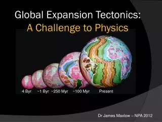
Plate Tectonics:From Hypothesis to Theory • Plate tectonics is a scientific theory that explains two centuries of often puzzling observations and hypotheses about our planet Earth. • The continents are drifting very slowly across the face of our planet. • Continental drift is a concept with a long history.
Plate Tectonics:From Hypothesis to Theory (2) • A century ago geologists puzzled over the fit of the shorelines of Africa and South America. • They noted that fossils of extinct land-bound plants and animals, glacial deposits, and ancient lava flows could be matched together along coastlines that today are thousands of kilometers apart. • Coal was found in Antarctica(南極洲). • Coal forms in tropical climates, implying that Antarctica has moved in the past.
Plate Tectonics:From Hypothesis to Theory (3) • Faced with puzzling data, scientist developed hypotheses to explain them. • Alfred Wegener proposed the most comprehensive early hypothesis for “Continental Drift” in 1912.
Plate Tectonics:From Hypothesis to Theory (4) • His theory was widely rejected because: • Ocean floor was too strong to be plowed aside. • Wegener had not proposed a plausible force that could induce the continents to drift. • Attempts to test Wegener’s hypothesis with observations had mixed success.
Plate Tectonics:From Hypothesis to Theory (5) • In 1960, the Theory of Plate Tectonics was born. • Plate tectonics is the process by which Earth’s hot interior loses heat. • We can measure the slow drift of plates worldwide using satellite navigation systems. • The basic premises of plate theory are secure because they can be tested against a wide variety of observations.
What Earth’s Surface Features Tell Us • The rocks beneath our feet are solid, but they are not rigid. • Topography: the relief and form of the land above sea level. • Bathymetry: topography on the ocean floor. • Earth bulges around its equator and is slightly flattened at the poles. • All evidence points to centrifugalforce caused by Earth’s rotational spin.
Isostasy (地殼均衡): Why Some Rocks Float Higher Than Others • The continents average about 4.5 km elevation above the ocean floor. • They stand notably higher than the ocean basins because the thick continental crust is relatively light (average density 2.7 g/cm3). • The thin oceanic crust is relatively heavy (average density 3.0g/cm3). • The lithosphere floats on the asthenosphere.
Isostasy (2) • The principle of isostasy governs the rise or subsidence of the crust until mass is buoyantly balanced. • Because of isostasy, all parts of the lithosphere are in a floating equilibrium. • Low-density wood blocks float high and have deep “roots,” whereas high-density blocks float low and have shallow “roots.”
Earth’s Surface: Land Versus Water • The ocean covers 71 percent of Earth’s surface. • Land occupies only 29 percent. • Sea level fluctuates over time. • When climate is colder and water is stored as ice: • Sea level falls. • The shoreline moves seaward. • When climate gets warmer: • The ice melts. • Sea level rises. • The shoreline advances inland.
Earth’s Surface: Land Versus Water (2) • Undersea mid-ocean ridges form a continuous feature more than 60,000 km long. • Mid-ocean ridges mark where two oceanic plates spread apart. • New lithosphere forms in the gap. • Passive margins have few earthquakes and little volcanic activity.
Earth’s Surface: Land Versus Water (3) • The continental shelf steepens slightly at 100-200 meters below sea level. • The continental slope is the flooded continental margin. • The continental rise descends more gently from the base of the continental slope. • Earthquakes and volcanoes are common along active margins.
Earth’s Surface: Land Versus Water (4) • Ocean trenches occurs where oceanic lithosphere and continental lithosphere converge at the boundary between two plates. • Because oceanic lithosphere is the denser of the two, it descends under the active continental margin and sinks into the deeper mantle. • The large, flat abyssal floors of the open ocean lie 3 to 6 km below sea level.
What Earth’s Internal Phenomena Tell Us • Rocks are poor conductors of heat, so Earth moves its internal heat by moving the rock itself. • The circulation of hot rock is maintained by mantle convection.
Geothermal Gradients • A gradient is a progressive change in some physical or chemical property. • The geothermal gradient varies widely with geography from 5oC/km to 75oC/km.
Mantle Convection • Conduction is the process by which heat moves through solid rock. • Earth’s heat can move in a second process called convection. • Convection can happen in gases, in liquids, or, given enough time, in ductile solids. • A prerequisite condition for mantle convection is the thermal expansion of hot rock.
Mantle Convection (2) • Rock expands as its temperature increases. • Its density thereby decreases slightly. • The hot rock is buoyant relative to cooler rock in its immediate neighborhood. • A 1 percent expansion requires an increase of 300-400oC and leads to a 1 percent decrease in density. • Viscosity is the propensity of rock to ductile flow.
Mantle Convection (3) • Rock does not need to melt before it can flow. • The presence of H2O encourages flow in solid rock. • Convection currents bring hot rocks upward from Earth’s interior. • The rock in the lithosphere is too cool for convection to continue. • Heat moves through the lithosphere primarily by conduction. • The lithosphere-asthenosphere boundary is 1300-1350oC, depending on depth.
Mantle Convection (4) • Oceanic lithosphere is about 100 km thick. • The geothermal gradient in oceanic lithosphere is 1300oC/100km, or 13oC/km. • Average continental lithosphere is 200 km. • The average geothermal gradient in continental lithosphere is about 13500C/200 km, or 6.70C/km.
Earth’s Convection: Driven From the Top • Below the lithosphere, rock masses in the deeper mantle rise and fall according to differences in temperature and buoyancy(浮力). • The densest lithosphere is most likely to sink back into the asthenosphere and the deeper mantle. • Ocean floor and the continents are slowly moving (up to 12 cm/yr).
Plates and Mantle Convection • When continents split apart, a new ocean basin forms. • The Red Sea was formed this way 30 million years ago. • Subduction(隱沒): the old lithosphere sinks beneath the edge of an adjacent plate.
Global Positioning System • In the 1960s, the U.S. Department of Defense established a network of satellites with orbits that could be used for reference in precisely determining location. • The Global Positioning System (GPS) detects small movements of the Earth’s surface.
Global Positioning System (2) • It is accurate within a few millimeters. • Two measurement methods: • A GPS campaign: researchers establish a network of fixed reference points on Earth’s surface, often attached to bedrock. The position is re-measured every few months or years. • Continuous GPS measurement: the receivers are attached permanently to monuments, and position is estimated at fixed intervals of a few seconds or minutes.
20070315 Four Types Of Plate Margins And How They Move • The lithosphere currently consists of 12 large plates. • The seven largest plates are: • North American Plate. • South American Plate. • African Plate. • Pacific Plate. • Eurasian Plate. • Australian-Indian Plate. • Antarctic Plate. • All are moving at speeds ranging from 1 to 12 cm a year.
Plates have four kinds of boundaries or margins • Divergent margin (also called a spreading center): magma rises to form new oceanic crust between the two pieces of the original plate. • Convergent margin/subduction zone: two plates move toward each other and one sinks beneath the other. • Convergent margin/collision zone: two colliding continental plates create a mountain range. • Transform fault margin: two plates slide past each other, grinding and abrading their edges.
Seismology and Plate Margin • Earthquakes occur in portions of the lithosphere that are stiff and brittle. • Earthquakes usually occur on pre-existing fracture surfaces, or faults. • There are distinctive types of earthquakes that correlate nicely with motion at plate boundaries.
Three Types of Faults and Their Earthquakes • Strike-slip faults are vertical or near vertical fracture surfaces (at a plate boundary these are also known as transform faults). • Motion is entirely horizontal. • Thrust faults are fracture surfaces that dip at an angle between the horizontal and the vertical (convergent motion within a volume of rock). • Motion is partly horizontal, partly vertical. • Normal faults are fracture surfaces that also dip (divergent motion with and between bodies of rock). • Motion is partly horizontal, partly vertical, but opposite to the motion on a thrust fault.
Type I: Divergent Margin • Where two plates spread apart at a divergent boundary, hot asthenosphere rises to fill the gap. • As it ascends, the rock experiences a decrease in pressure and partially melts. • The molten rock is called magma.
Type I: Divergent Margin (2) • Midocean ridges occur in oceanic crust. • Found in every ocean. • Form a continuous chain that circles the globe. • Oceanic crust is about 8 km thick.
Type II: Convergent Margin/Subduction Zone • Over 70 million years, oceanic lithosphere can drift 1500 to 3000 km from the spreading center. • As the plate cools, it grows denser. • The principle of isostasy demands that the plate subsides as it grows denser. • The process by which lithosphere sinks into the asthenosphere is called subduction.
Type II: Convergent Margin/Subduction Zone (2) • The margins along which plates are subducted are called subduction zones. • These are active continental margins. • The sinking slab warms, softens, and exchanges material with the surrounding mantle.
Type II: Convergent Margin/Subduction Zone (3) • Under elevated temperature and pressure, the crust expels a number of chemical compounds. • Water (H2O). • Carbon dioxide (CO2). • Sulfur compounds. • A small addition of these volatile substances can lower the melting point of rock by several hundred degrees Celsius.
Type II: Convergent Margin/Subduction Zone (4) • The hot mantle rock immediately above the sinking slab starts to melt. • Magma rises to the surface to form volcanoes. • Subduction zones are marked by an arc of volcanoes parallel to the edge of the plate.
Volcanoes At Subduction Zones • At a plate boundary, the plunging plate draws the seafloor down into an ocean trench, often 10 km deep or more. • If the overriding plate is oceanic lithosphere, volcanoes form a series of islands called a volcanic island arc. • Mariana Islands. • Aleutian阿留申 Islands.