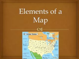
Understanding Old Maps: Key Features for New Colonists
Old maps provide crucial insights for understanding geographical knowledge and navigation during the time of new colonists. Important elements include the title, which indicates what the map depicts, and the author, whose identity hints at the map’s purpose. Legends explain symbols, while landmarks help map readers interpret the geography. Dates reveal when maps were created, giving context to the knowledge available then. Orientation shows cardinal directions, and grids or scales assist in locating and measuring distances, enhancing our understanding of these historical artifacts.

Understanding Old Maps: Key Features for New Colonists
E N D
Presentation Transcript
Map Elements TALL DOGS
Title • The title tells you what a map is of and what it shows • Some maps may show the same physical area, but different details Louisiana Purchase
Author • The person who made the map • Who made the map often gives clues to the map’s purpose Meriwether Lewis
Legend • Also known as the key, it tells you what the symbols on the map stand for.
Landmarks • Something that helps a map reader make sense of the map. • Compare the map to the land the reader sees. • Rivers, mountains, major buildings
Date • Tells you when the map was made • Also provides clues about geographical knowledge and technology of the time 1806
Orientation • Also known as the compass rose • Shows the cardinal directions: North, East, South, and West. (Never Eat Soggy Waffles)
Early Chinese maps were oriented with south at the top of the page
Grid or Scale • The grid gives you the ability to locate something quickly on the map • It can be alpha/numeric as highway maps or city maps often are • latitude and longitude lines on a globe or large map
Scale • Tells you what distance on the Earth is represented by a measurement on the map • This allows you to use one map for a general view, and another for details