What is Hydrography?
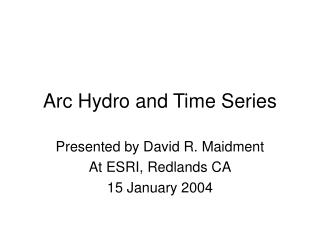
What is Hydrography?. Surveying Puget Sound, 1927. What is Hydrography?. International Hydrographic Organization (IHO) Definition:

What is Hydrography?
E N D
Presentation Transcript
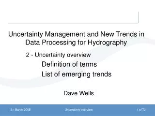
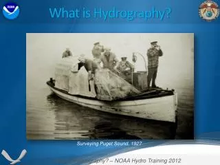
What is Hydrography? Surveying Puget Sound, 1927
What is Hydrography? • International Hydrographic Organization (IHO) Definition: • Hydrography is the branch of applied sciences which deals with the measurement and description of the physical features of oceans, seas, coastal areas, lakes and rivers, as well as with the prediction of their change over time, for the primary purpose of safety of navigation and in support of all other marine activities, including economic development, security and defense, scientific research, and environmental protection. (14 September 2011, www.iho.int)
Three Aspects • Coastal Hydrography is concerned with the development of ports and harbors, coastal erosion problems, the utilization of harbor and coastal conservation services and, especially, the safety of navigation in coastal waters. • Off-shore Hydrography is concerned with • The provision of hydrographic data as an extension of the coastal zone normally encompassing the continental shelf • The development of mineral deposits, including hydrocarbons • Provision of data for fisheries management • Oceanic Hydrography is concerned with the acquisition of hydrographic data in the deep ocean areas for the depiction of sea-floor geomorphology. (USM and UNB Intro to Hydrography, GGE1001)
Why Hydrography is Important 71% of the Earth surface is covered with water, yet only about 10% of the seafloor has been surveyed by echo sounders at a resolution of 1 minute or better. –IHO, 2011
NOAA’s Charting Responsibility 3.4 Million Square Nautical Miles
Critical Areas and Priorities • NOAA Maintains approximately 1,000 nautical charts encompassing U.S. Territorial waters and the EEZ • Nearly 50% of all soundings on current charts were acquired utilizing leadlines prior to 1940 • These areas are prioritized into categories: • Critical Areas; • Emerging Critical Areas • Resurvey Areas • Priority Areas • Divided into Priorities from 1 to 5 Leadline Sounding Operations C&GS, 1928 NOAA Hydrographic Survey Priorities, 2011
Critical Areas and Priorities • Prioritized by the following factors: • Shipping Tonnage and Trends • Vintage of Surveys in the Area (Year, Equipment, Process) • Under-keel Clearance of Vessels • Potential for Unknown Dangers to Navigation due to dynamic bottom or human influence • Requests for surveys from Pilot’s Associations, the U.S. Coast Guard, and the Marine Community through NOAA’s Regional Navigation Managers NOAA Hydrographic Survey Priorities, 2011
Critical Areas and Priorities • Of the 43,000 SNM identified as Critical in 1994, only 14,980 SNM remains • Nationally, 36,545 SNM of modern, Full Bottom Coverage completed since 1994 • NOAA, through ships and contractors, survey approximately 1,300 – 1,600 SNM per year with existing resources and funding levels NOAA Hydrographic Survey Priorities, 2011
Why do we survey? Bigger, Taller, Longer Ships • Emma Mærsk • Length: 1,302 ft • Beam: 184 ft • Draught: 51 ft
Hydro & Homeland Security • The Oceanographer of the Navy requested NOAA to provide side scan sonar imagery of shipping channels and harbors to the Naval Oceanographic Office (NAVO) • NOAA collected data at 34 strategic commercial ports • NAVO collected data at 14 military ports • NAVO processes and stores data • This data is used as a baseline for comparison Klein 5000 Side Scan Sonar Detailed Side Scan Sonar Imagery
Hydro & Homeland Security • If a threat condition occurred, the Navy will use the baseline data of pre-existing objects so they can search for new objects, utilizing mine counter-measure assets more effectively to determine if a mine has been placed on the seafloor.
Single Beam Multi Beam Leadline Pre - 1940 1998 - Present 1940 - 1998 Bottom Coverage by Survey Method
Shallow Water Multibeam • Direct measurement of Depth • Multibeam sonar systems are rigidly attached to the survey vessel • Less swath width than Side-Scan Project: OPR-O190-RA-11
Side-Scan Sonar • Underwater Imagery • Although depths can be correlated, not a direct measurement • Used to look for features • Features will be surveyed with Multibeam • Side-Scan “Towfish” are towed behind the survey vessel • Very wide coverage swath Side-Scan Image of USS Monitor
Hydro Types Side Scan Sonar Ship’s Multibeam
NOAA Hydrographic Fleet Thomas Jefferson Norfolk, VA 1992 Rainier Newport, OR 1968 Navigation Response Teams (NRT’s) Six Teams, Nationwide R/V Bay Hydro II Solomons, MD Fairweather Ketchikan, AK 1968 / 2004
Other Hydro-Capable NOAA Vessels Henry Bigelow Nancy Foster Gloria Michelle Ronald Brown Hi’ialaki Pisces Bell M. Shimada Okeanos Explorer Oscar Dyson
NOAA’s Navigation Services: Nautical Charting • Nautical Charts • 1,000 Paper Charts • 998 Print-on-Demand • 380 Electronic Navigation Charts (ENCs) • Coast Pilot • Nine Volumes encompassing U.S coastal and intracoastal waters • Notice to Mariners • Provides Updates for all charts and Coast Pilots
NOAA’s Navigation Services: Navigation Response Teams (NRT’s) • Small teams located around the country • NRT-1; Gulf of Mexico • NRT-2; Southeast • NRT-3; Northwest • NRT-4; Great Lakes • NRT-5; Northeast • NRT-6; Southwest • Highly mobile units providing site surveys and rapid disaster response
Products for Safe Navigation National Spatial Reference System Nautical Charts Real Time Tides and Currents Hydrographic Surveys Research and Development Models and New Technologies