Download
1 / 51
5.31k likes | 15.88k Vues
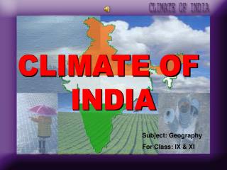
CLIMATE OF INDIA. Subject: Geography For Class: IX & XI. PRESENTED BY:. ASHUTOSH KARASHARMA MISHRA. Address: (Personal) At: Srikrisna Nagar Po: Loisingha Dist: Bolangir Orissa-767020. Address: (Official) At: JNV, Koraput Po: OMP Line Dist: Koraput

E N D
CLIMATE OF INDIA Subject: Geography For Class: IX & XI
PRESENTED BY: ASHUTOSH KARASHARMA MISHRA Address: (Personal) At: Srikrisna Nagar Po: Loisingha Dist: Bolangir Orissa-767020 Address: (Official) At: JNV, Koraput Po: OMP Line Dist: Koraput Orissa Phone No: 9437146288 E-mail: canyon_geo@yahoo.com Tiger_sir@rediffmail.com
Familiarize students with the terms, key concepts and basic principles associated with the climate of India. • Provide them idea about the mechanism of Indian monsoon. • Study the climate of India through the understanding and analysis of local climate. • Explore the causative factor of the spatial variations in the climate of the country. • Understand and analyze the variation of climatic phenomenon in the cycle of seasons. • Make students aware of the change in climate (global warming) at local level to understand it at national and global level.
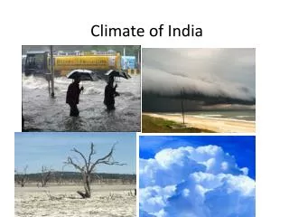
Watch Out Weather News……………. Hot weather season Monsoon season Tropical Cyclone Cold Weather Season Four Videos Embedded: Please right click over the dark square to choose Play or Stop one after another.
CONTENTS OF THE LESSON Part-I Climatic Diversity of India Part-II Factors Affecting Climate of India Rhythm of Seasons Part-III Part-IV Distribution of Rainfall Change of Climate Part-V Please click on the box to navigate to the pages
Why does weather change spatially & temporally? Let us examine…
Drass -450C in December night Tawang 190C in June 550C temperature in June Thar desert Diurnal range of temperature 300C Jaisalmer receives 9cm rainfall Cherrapunji & Mawsynram have 1080cm rain Tiruvanantapuram & Chennai 200C in December night Kerala Diurnal range of temperature 80C MONSOON REGIME IS THE UNITY OF INDIA
MORE DIVERSITIES………………….. • Churu in Rajasthan records a temperature of 50°C or more on a June day. • Snow fall over the Himalayas. • Most parts of India receives rainfall during June to September. • Tura of Meghalaya receives rainfall in a single day is equal to the total rainfall of Ten years in Jaisalmer of Rajastan. • It is 19°C in Tawang (Arunachal Pradesh) on the same day. • Only rainfall over rest of India. • Tamilnadu coast remains dry during these months. • Very low rainfall in North west Himalayas and western Rajastan which is equal to 10cm per year. MONSOON REGIME IS THE UNITY OF INDIA
Lets divide the class into five groups namely A, B, C, D and E. • Collect the data of temperature and rainfall of different cities of India from web site www.allrainfallreports.com . • Collect the rainfall and temperature data of your town and compare it with the data of other cities of India. • Make a comparative study of temperature and rainfall data of different districts of Orissa. (Source- Climatological survey of Orissa 1987-2003 & District statistical handbooks) • Write about the climate of your district and upload it to www.climateofindia.pbwiki.com . • Make a power point presentation of all the activities you have done. CLICK ON ICON TO DOWNLOAD TEMPLATE
FACTORS AFFECTING INDIAN CLIMATE FAQ RELATED TO LOCATION & RELIEF RELATED TO AIR PRESSURE & WIND • Latitude Surface pressure & wind • Altitude Upper air circulation • Relief Western cyclones • Distance from Sea • The Himalayan Mt. • Distribution of Land & water
EQUATORIAL REGION LATITUDE FAQ TROPIC OF CANCER High range of Temp High Temp Low range
THE HIMALAYAS- CLIMATIC BARRIER Cold Wave Cold Wave Cold Wave Cold Wave Monsoon Wind Monsoon Wind Monsoon Wind Monsoon Wind
DISTRIBUTION OF LAND & WATER FAQ HIGH PRESSURE IN WINTER LOW PRESSURE IN SUMMER ARABIAN SEA BAY OF BENGAL INDIAN OCEAN
SIMLA DELHI KOLKOTA MUMBAI CHENNAI DISTANCE FROM SEA Coastal areas have equable climate where as Interior parts have extreme climate.
AGRA 160C in Jan DARJILING 40C in January ALTITUDE FAQ Temperature decreased from low to high altitude HIGH ALTITUDE Decrease in Temperature LOW ALTITUDE
RELIEF FAQ Receives high rainfall Western Ghat Mt. Monsoon Wind Receives low rainfall Monsoon Wind Monsoon Wind
SUB TROPICAL LOW PRESSURE SUB TROPICAL HIGH PRESSURE INTER TROPICAL CONVERGENCE ZONE SUB TROPICAL HIGH PRESSURE SUB TROPICAL LOW PRESSURE SURFACE WIND POLAR HIGH NORTH-EAST TRADE WIND SOUTH-EAST TRADE WIND POLAR HIGH
JET STREAM IN WINTER TIBET
WESTERN DISTURBANCE Mediterranean sea
EL-NINO EFFECTS FAQ 1990 Delay in Monsoon Equatorial Warm Current Peru El-Nino Homboldt Cold Current
SOUTHERN OSCILLATION Darwin Tahiti
Prepare a ppt. answering the following: • Collect the data on the effect of El-nino over different parts of world and prepare a presentation and upload it to www.climateofindia.pbwiki.com. • Explain the factors affecting the climate of your region in a word/pdf file and upload it to www.think.com or www.climateofindia.pbwiki.com page. • Invite your friends to your www.think.com or www.epal.com site to explain about the climate of their region. • Explain how jet stream affect the climate of India in word/pdf file and upload it to the suitable web page. • Compare how relief affect the climate of your region. CLICK ON ICON TO DOWNLOAD TEMPLATE
RHYTHM OF SEASONS HOT WEATHER RETREATING MONSOON COLD WEATHER SOUTH WEST MONSOON Let us discuss each of them individually
Tropical Cyclone COLD WEATHER SEASON • It extends from December to February. • Vertical sun rays shift towards southern hemisphere. • North India experiences intense cold where as this season is not well defined in south India. • Light wind blow makes this season pleasant in south India. • Occasional tropical cyclone visit eastern coast in this season. Rhythm of Seasons
TEMPERATURE- JANUARY 100C` 150C 200C 200C 200C 250C 200C 250C Rhythm of Seasons
PRESSURE- JANUARY 1018 HIGH PRESSURE 1019 1018 1018 1017 1016 1015 1014 Rhythm of Seasons
WIND DIRECTION- WINTER Northern Plain Ganga Delta Bay of Bengal Rhythm of Seasons
WINTER RAINFALL RAINFALL DUE TO WESTERN DISTURBANCES RAINFALL DUE TO NORTH EAST WIND Rhythm of Seasons
May 480C April 380C March 300C HOT WEATHER SEASON • It extends from March to May. • Vertical sun rays shift towards Northern hemisphere. • Temperature rises gradually from south to north. • Highest Temperature experiences in Karnataka in March, Madhya Pradesh in April and Rajastan in May. Rhythm of Seasons
TEMPERATURE- JULY 250C 200C 300C 250C 200C 300C 300C Rhythm of Seasons
PRESSURE- JULY 997 998 999 1000 1001 1003 1002 1004 1005 1006 1007 Rhythm of Seasons
BARDOLI CHHEERHA LOO KALBAISAKHI MANGO SHOWER BLOSSOM SHOWER STORMS IN HOT WEATHER SEASON FAQ Rhythm of Seasons
SOUTH WEST MONSOON SEASON • It extends from June to September. • Intense heating in north west India creates low pressure region. • Low pressure attract the wind from the surrounding region. • After having rains for a few days sometime monsoon fails to occur for one or more weeks is known as break in the monsoon. HIGH TEMPERATURE LOW PRESSURE Rhythm of Seasons
MONSOON WIND Arabian sea Branch Bay of Bengal Branch INTER TROPICAL CONVERGENCE ZONE EQUATOR SE Trade SE Trade SE Trade SE Trade Rhythm of Seasons
ONSET OF SW MONSOON 15th June 15th July 1st July 10th June 5th June 1st June Rhythm of Seasons
RETREATING MONSOON SEASON • It extends from October to November • Vertical sun rays start shifting towards Northern hemisphere. • Low pressure region shift from northern parts of India towards south. • Owing to the conditions of high temperature and humidity, the weather becomes rather oppressive. This is commonly known as the ‘October heat’ LOW PRESSURE Rhythm of Seasons
WITHDRAWAL OF MONSOON 15th Sept. 7th Sept. 30th Sept. 7th October 15th October Rhythm of Seasons
Prepare a ppt. answering the following: • Explain the seasonal difference of climate of your region in a word/pdf file and upload it to www.climateofindia.pbwiki.com. • Search friends from different parts of India and seek their comments and compare the seasonal difference in climate of different parts of India by using www.think.com. • Prepare an analysis of yearly temperature and rainfall data by using different graphs and upload it to www.climateofindia.pbwiki.com. • Collect photographs of monsoon and upload to www.think.com or www.climateofindia.pbwiki.com. CLICK ON ICON TO DOWNLOAD TEMPLATE
DISTRIBUTION OF RAINFALL > 200cm 100-200cm 50-100 cm < 50cm
VARIABILITY OF RAINFALL • The variability of rainfall is computed with the help of the following formula: C.V.= Standard Deviation/ Mean * 100 • Variability of less than 25% exist in Western coasts, Western Ghats, northeastern peninsula, eastern plain of the Ganga, northern India, Uttaranchal, SW J & K & HP. • Variability of more then 50% found in Western Rajastan, J & K and interior parts of Deccan. • Region with high rainfall has less variability.
Prepare a power point presentation answering the following: • Why there is variation of rainfall in different parts of India? Explain in a word/pdf file and upload. • Calculate the variability of rainfall of your region. • Compare the variability of rainfall with the total rainfall of your region. • Measure the rainfall in your school and record it in a spread sheet for analysis. • Read out the rainfall and temperature data of your school daily in the morning assembly. CLICK ON ICON TO DOWNLOAD TEMPLATE
IMPACT OF GLOBAL WORMING FLOOD FOREST FIRE SPREAD OF TROPICAL DISEASES SINKING COAST SEA LEVEL RISE MELTING OF ICE INCREASE INGREEN HOUSE GASES RISE IN TEMPERATURE TSUNAMI & EARTHQUAKE EXCESSIVE SUN STROKE FOOD SCARCITY LOSS OF BIODIVERSITY CLIMATE CHANGE
SOME INTERESTING FACTS • Temperature increased by 0.60C in 20th century. • Eleven out of twelve hottest years are within 1995 to 2006. • Annual rate of increase of CO2 is 1.9ppm after 1995. • Concentration of methane increased from 700ppb in 1750 to 1745ppb at present and Nitrous Oxide from 270ppb to 314ppb where as CFC increased from zero to 533ppb. • Rising of temperature to 30C will lead to melting of all ice on earth surface and sea level rise upto 15 feet. • Existence of large cities like Venis, Bankok, Sanghai, Kolkota and Dhaka will be in danger. FAQ
KOLKOTA MUMBAI CHENNAI CLIMATE CHANGE & INDIA • India has long coast line and rise of sea level will submerge large area. • A population of 7.1 million living in coastal areas will be affected. • Production of crops like wheat, rice etc will decrease. • The natural disasters like cyclone, floods and drought will increase in frequency as well as intensity.
WHAT CAN BE DONE??? • Switch off the light, fan, TV and other energy using gadgets when they are not in use. • Do not use those equipments that pollute or consume more energy. • create public awareness. • use renewable energy resources like solar, wind, biomass etc. • International conferences like Earth Summit, 1992, Kyoto protocol, Copenhegen summit, 2009 are some steps to bring consensus for crusade against Climate Change.
Ask elders of your family or village about their perception of change in climate and explain it in a word/pdf file and upload it to www.climateofindia.pbwiki.com . • Give an analysis of change in temperature of your region by collecting data of fifteen years from climatological survey of orissa. • Explain what you can do to reduce the impact of climate change. • Ask your friends through www.think.com about their contribution to reduce the impact of climate change. • Prepare a power point presentation explaining all above. CLICK ON ICON TO DOWNLOAD TEMPLATE
TEST YOUR KNOWLEDGE • Name the factors affecting climate of India . • What is meant by El-nino? • Why the south western part of peninsular India receives high rainfall? • Name the important green house gases. • How altitude affects climate? • How distance from sea affect climate? • What is meant by mango shower? • What is meant by Inter Tropical Convergence Zone? Answer Answer Answer Answer Answer Answer Answer Answer
EVALUATION RUBRIC Evaluate the classroom presentation of other groups and assign marks.
CITATION • Abraham, K.R.; Dash, S.K. and Mohanty, U.C., 1996: Simulation of monsoon circulation and cyclones with different types of orography; Mausam, 47, 235-248. • Ashok K., S. Lizuka, S.A Rao, N. H. Saji and W. Lee, 2009 : Processes and boreal summer impacts of the 2004 El Nino Modoki: An AGCM study. Geophysical Research Letters, 36, L04703, doi:10.1029/2008GL036313, 1-5. • Bannerji, S. K., 1950 : Methods of forecasting monsoon and winter rainfall in India. Ind. J. Met. and Geophys., 4, 343-346. • Bhalme, H.N. and Jadhav, S.K., 1984: The southern oscillation and its relation to the monsoon rainfall. J.Climatol., 4, 509-520. • Krishnakumar V. and K. ‑M. Lau, 1997 : Symmetric Instability of Monsoon Flows. Tellus 49 A, 228‑245. • Physical Geography of India, NCERT, class-IX • Economic & Commercial Geography of India, C.B. Memoria. • Regional Geography of India, R.L. Singh. • www.imd.gov.in • http://tinyurl.com/q4a6mg • http://timesofindia.indiatimes.com/articleshow/4755025.cms • http://www.nws.noaa.gov/ost/climate/STIP