Download
1 / 8
340 likes | 808 Vues
Geography and Climate of India. Chapter 7 Sections 1 and 2. The region known as South Asia (Indian Sub-continent) is considered a sub-continent At one time used to be its own separate land mass Collided with Asia and formed the Himalayas Himalayas-8000 meters (5 miles) high

E N D
Geography and Climate of India Chapter 7 Sections 1 and 2
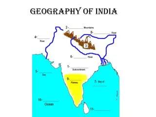
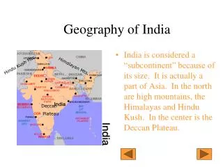
The region known as South Asia (Indian Sub-continent) is considered a sub-continent • At one time used to be its own separate land mass • Collided with Asia and formed the Himalayas • Himalayas-8000 meters (5 miles) high • Contains 1/5 of the world’s population
South Asia (Indian Subcontinent contains many countries): • Nepal • India • Bangladesh • Pakistan • Sri Lanka • Maldives • Afghanistan******
Divided into several Regions: • Himalayas- Northern Mountains • Extremely high elevations • Cooler Climate • Indo-Ganges Plains- Northern Plains • Made up of Rivers (Indus and Ganges) which flow down into central India from the Himalayas • Climate ideal for farming because of rivers, but dry • Deccan Plateau-South Central India • Area between the Western and Eastern Ghats • Extremely Dry • Coastal Plains-Extreme south and southwest, northeast • Areas along the coast with tropical climates • Tropical=Rain Forests
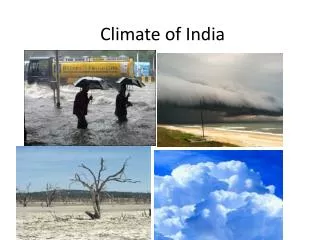
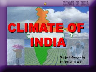
Weather: • Defined by Monsoons • Monsoons-seasonal changes in the direction of the winds • Summer-Winds come from Southwest and push moisture from Indian Ocean bringing rain • Winter-Winds come from Northeast pushing dry air from Asia across the sub-continent • Due to the geography different regions are effected differently by the monsoons (Mainly based on changes in elevation
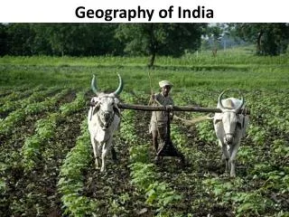
Agriculture • Based in each region on the amount of rainfall that it receives as well as its geography • Deccan Plateau- Sugarcane (dryer) • Coastal Plains-Indo-Ganges Plains- rice, tea, peppercorns (Need water) • Northwest deserts (Thar Desert)- Sorghum, Millets • Himalayas- Potatoes and Barley
Resources • Plentiful Resources • South Asia • Iron ore • Manganese • Bauxite • Copper • Northern Plains • Coal • Mica • Limestone • Gypsum • Missing Resource • Oil (has led to the development of nuclear power by the government)
People • Over 1.25 billion people in region • India Second Most populated in the world • Bangladesh and Pakistan in top 10 • ¾ of people depend on farming • Many diverse people have migrated from: • Middle East • Europe • Other parts of Asia • Most people separated into regional and local groups • Leads to wide variety of customs and practices • Also many languages • Nepal 13 languages • India 700 languages and dialects (15 official, 35 regional) • Largest spoken is Hindi-30 percent • English also spoken though not an official language • Due to British colonization