Download

1 / 10
170 likes | 683 Vues
Geography of India. I can describe the geographical features of India. Important Vocabulary Title the top of your notebook page Important Vocabulary. As we study Ancient India, you will continue to add to this list and write down definitions.

E N D
Geography of India I can describe the geographical features of India.
Important Vocabulary • Title the top of your notebook page • Important Vocabulary. • As we study Ancient India, you will continue to add to this list and write down definitions. • For today’s lesson, write down each of the following words. SKIP A LINE between each word. • Subcontinent • Hindu Kush • Himalayas • Monsoons
Class Discussion: In what ways would you describe India’s geography? Would the people of ancient India have been protected from outside forces? Why/why not?
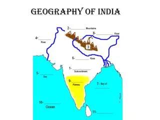
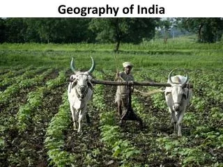
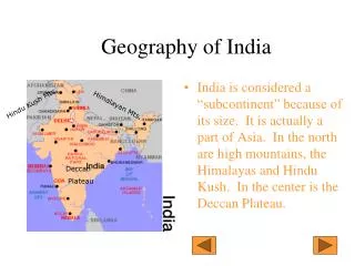
Physical Geography of India India is a SUBCONTINENT, which is a large landmass that is like a continent, only smaller. The subcontinent includes present-day Bangladesh, Bhutan, India, Nepal, and most of Pakistan. Bhutan Pakistan Bangladesh Nepal India
Geographers think the kite-shaped Indian subcontinent used to be a separate land. It inched north until it hit Asia. The collision pushed up mountains where the two lands met. What that collision created so many millions of years ago is still growing. Inch by inch, year by year. The mountains are one of the most awe-inspiring features of planet Earth.
Mountains Those high mountains tower over the northern borders of India. They form several mountain ranges including the Hindu Kush and the Himalayas. HINDU KUSH: A large mountain range that separates India from Western Asia. It covers 60,000 square miles. HIMALAYAS: The world’s largest mountain range. It covers 420,000 square miles. The 10 tallest mountains on Earth are located here, including Mt. Everest (29,029ft)
Waterways In addition to tall mountains, the subcontinent has several great rivers. These include the Ganges and the Indus Rivers. Like other rivers you have studied, these two rivers carry water for irrigation. The deposited silt made the land very fertile. The first Indian civilization was located near the Indus River valley. INDUS RIVER GANGES RIVER The Arabian Sea, Indian Ocean, and Bay of Bengal surround India. Ancient Indians sailed these waters to other ancient lands, such as Mesopotamia. This travel helped encourage trade.
Climate The tall mountains help block cold north winds from reaching much of India. As a result, temperatures are generally warm there. In addition, a seasonal winds called, MONSOONS, shape India’s climate. Because of the monsoon, India has a dry season in the winter a rainy season in the summer. India’s summer monsoon provides rain for India’s crops. But these rains can also cause severe floods.
WRITING ASSIGNMENT On a separate piece of paper, write a summary that describes India’s geography. Include the 4 vocabulary words in your summary. Your summary should have an intro sentence, supporting details, and a concluding sentence. When you finish, you may color your map and glue it into your notebook.