Weather Fronts: A Comprehensive Guide
Explore the intricate world of weather fronts, from the boundary zones between polar and tropical air masses to the characteristics of cold, warm, and occluded fronts. Learn about the formation of fronts, how they influence weather patterns, and the different types of precipitation associated with each front.

Weather Fronts: A Comprehensive Guide
E N D
Presentation Transcript
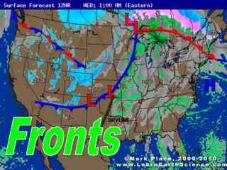
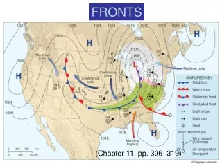
FRONTS (Chapter 11, pp. 306–319)
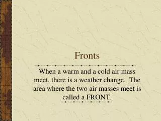
Fronts occur in the boundary zone between polar and tropical air masses.
World War I Aerial Photograph “No man’s land” trenches trenches
Ben Franklin’s Storm (Nov. 2, 1743) 500 mb Boston L L Philadelphia
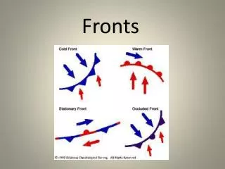
Norwegian Cyclone Model polar/tropical air mass boundary waves form along fluid density boundaries cold front moves faster than warm front (pp. 322–324) cold front catches warm front warm air is pinched upward storm dies
Typical Cold Front • Convective precipitation • 50–100 mile wide • band along front
Cold Front Cross-Section Cold fronts are rapidly advancing cold (dense) air wedges. Warm (often moist) air is forced upward along and ahead of the surface front.
Typical Warm Front • Clouds and precipitation • precede surface front • Stratiform clouds starting • about 750 miles from front • Stratiform precipitation starting • about 350 miles from front “Overrunning”
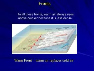
Warm Front Cross-Section Warm fronts are receding cold (dense) air wedges. Warm air gradually fills in the space vacated by the cold air.
WARM AIR Warm Front Cross-Section COLD AIR
OCCLUDED FRONTS • Heavy precipitation along front • Convective or stratiform • Short duration
Cold Occlusion Warm Occlusion coldest air is behind cold front coldest air is ahead of warm front
(QUASI-) STATIONARY FRONT Partly cloudy or cloudy with widespread stratiform precipitation
Cyclone Family Cold Air Warm Air (pp. 306–319)
Quick Summary—Fronts (Chapter 11): • Fronts are boundary zones between polar and tropical air masses. • Fronts are stable—the colder, denser air is close to the surface and warmer, less dense air is above it. • Cold front weather: cumuliform clouds, showery, convective precipitation along the front. • Warm front weather: stratiform clouds and precipitation in the cold air well ahead of the front. • Occluded front weather: very heavy precipitation of short duration in the vicinity of the front.