British Columbia
90 likes | 246 Vues
This overview explores the various factors influencing soils in British Columbia, Canada, including climate, parent material, vegetation, topography, drainage, and time. We examine the uniqueness of forest soils found under coniferous forests and grassland soils in the province’s interior, highlighting the diverse landscapes shaped by the Pacific Ocean's proximity and the region's mountainous terrain. British Columbia's rich natural resources, including its mining and fisheries, further detail the interplay between landforms and human industry.

British Columbia
E N D
Presentation Transcript
British Columbia Soils and Landform Samantha Kim , Kyle DeBenetti, Oriana Brine
The factors that influence to soil in Canada Climate Affects the kind and rate of weathering and erosion Parent Material Affects the rate of weathering and erosion Vegetation Affects the amount and type of organic content Topography and Drainage Affects the amount of sunlight received Time Influences the maturity of the soil Factors of Soils
The factors that influence to soil in British Columbia The elevation Almost no soils, bare rock or ice field Forest soils and grassland soils. The Pacific Ocean Latitude The landscapes Forest soils Find under Open coniferous forests The dense rainforest conditions of the Coast Mountains Grassland soils Find in The province’s interior and in the Peace River District Factors of Soils(Con’d)
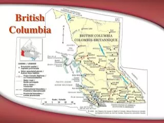
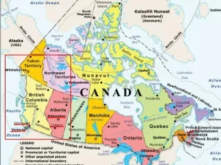
The second largest country in the world Spanned 7,730 kilometres (4,803 miles) from coast to coast Covered 9,970,610 square kilometers (6,195,737 square miles) Much of the land is covered with rivers and forests (App. 25% of the country is covered in forest.) The country's tallest mountain is Mt. Logan (5,951 meters or 19,524 feet) in the southwestern portion of the Yukon Territory. Surrounded by oceans and its southern border The Pacific Ocean borders the western side of British Columbia Connected to the U.S., and Alaska in the northwest Topography of Canada
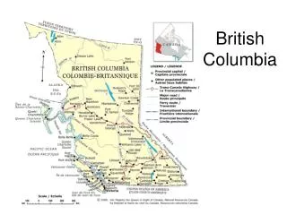
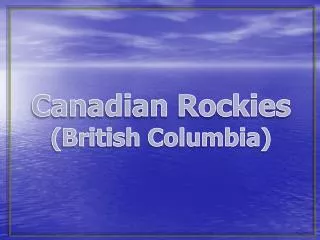
British Columbia The Western Cordillera (Mountain) Region Rocky Mountains Lie on the border between Alberta and British Columbia British Columbia’s mainland One of the most scenic areas in the country. The population Heavily concentrated in Victoria and Vancouver. Regional District Greater Vancouver 1,947,550 Capital (Victoria) 334,542 City of Victoria 76,691 Gulf Islands 14,328 Aboriginal heritage 5% of the province's total population (approximately 170,000) Topography of British Columbia
Mining The principal industry of British Columbia The country is rich in gold, silver, copper, lead and coal, and has also iron deposits. Fisheries The products are salmon, halibut, cod, sturgeon, herring, shad. Shipping The Canadian Pacific Railway Company has two lines Of mail steamer running from Vancouver and Victoria Income per year Mines $9,777,42 Fisheries $2,101,533 Forests $1,046,718 Animals $471,231 Agriculture $119,426 Manufactures $1,883,777 Miscellaneous $1,106,643 Human Use
Sources • Internet • http://www.bc.worldweb.com/TravelEssentials/Topography/8-460.html • http://www.agsci.ubc.ca/wine/bc.htm • http://81.1911encyclopedia.org/B/BR/BRITISH_COLUMBIA.htm