Download
1 / 105
1.05k likes | 1.21k Vues
Draft Status of the U.S. petrale sole resource in 2012 STAR Panel. Melissa Haltuch 1 , Kotaro Ono 2 , Juan Valero 3 1 NWFSC, Seattle 2 UW, SAFS, Seattle 3 CAPAM, La Jolla 13 May 2013. Outline. Introduction Data Fishery Independent Biological Fishery Dependent Previous Modeling

E N D
Draft Status of the U.S. petrale sole resource in 2012 STAR Panel Melissa Haltuch1, Kotaro Ono2, Juan Valero3 1NWFSC, Seattle 2UW, SAFS, Seattle 3CAPAM, La Jolla 13 May 2013
Outline • Introduction • Data • Fishery Independent • Biological • Fishery Dependent • Previous Modeling • Responses to 2011 STAR panel • General Model Description • Base Case Model • Sensitivity Analysis • Retrospective Analysis • Historical Assessment Analysis • Likelihood Profile • Harvest Projections
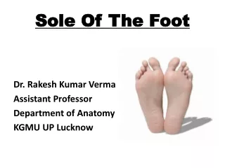
Introduction - Biology • Right eyed flounder • Gulf of Alaska to Baja California • Soft bottoms • 550 m depth • No genetic work • Adults migrate seasonally • No strong indication of multiple stocks
Introduction - Fishery • 1876 off of San Francisco, CA • 1884-1885, established by 1937 in OR • Began about 1932, established by 1936 in WA • Early concerns about stock depletion in the 1950s • Targeting of winter spawning aggregations developed through the 1950s and 1960s • By 1980s winter catches exceeded summer catches in many years
Introduction - Management • Management actions since the late 1990s • Area closures • Trip limits • Gear modifications • IFQ
Triennial survey 1977 (excluded) Depth: 91-457 meters 1980-1992 Depth: 55-366 meters 1995-2004 Depth: 55-500 meters Run by RACE until 2004 when run by FRAM Random trawls on systematic line transects
NWFSC survey 1999-2002 surveyed 183-1280 meters Did not always go as far south 2003 through 2008 55-1280 meters 32.5° to 48.17° Random trawl locations Random vessels chosen each year
Surveys Triennial Two time series: 1980-1992 and 1995-2004 Excluded the Conception area (S of 36°) Biomass and length frequencies NWFSC One time series: 2003-2012 All areas Biomass, lengths, and age-at-length
Survey post-stratification Post-stratify depth using fish length Ontogenetic movement to deeper water Lai et al (2005) used Bayesian change-point analysis Haltuch et al (2009) used a frequentist approach and came to same result Significant split just greater than 100 m
Survey stratification for GLMM/GLM Strata collapsed to satisfy condition of at least 3 positive observations in each year/area/depth stratum Depths Triennial (Early and Late): 55-100 meters and 100+ m NWFSC: 55-100 m, 100-183 m, 183+ m Areas Triennial Early Shallow: Vancouver/Columbia, Eureka, Monterey/Conception Deep: Vancouver/Columbia/Eureka, Monterey/Conception Late: Shallow: Vancouver/Columbia, Eureka, Monterey/Conception Deep: Vancouver/Columbia, Eureka, Monterey, Conception NWFSC Shallow/Middle – Vancouver/Columbia, Eureka, Monterey, Conception Deep – Combined Eureka-Columbia/Vancouver
Model based biomass estimates • Delta-GLMM • NWFSC: random year:vessel effects • Triennial: NO random vessel effects • Fixed effects: year, strata, depth, year:strata • Lognormal errors • MCMC’s to determine variability
Summary of survey data • NWFSC survey has higher catch rates than the triennial survey, resulting in larger biomass estimates • 2004 triennial survey catch rates are on average higher than rest of triennial series • Trend in NWFSC survey peaks in 2004, declines through 2008, and increases after 2009 • Smaller and younger fish observed in 2008-2010
Biological Data - Weight-Length • NWFSC Survey
Biological Data – Maturity at length • Oregon • Washington • 2002
Biological Data – Natural Mortality • 1940s Catch Curve • M: 0.18-0.26 • F: 0.19-0.21 • Hoenig’s Method • 0.15 max age of 30 • (female petrale sole live at least 30 years) • Hamel prior • M median: 0.206, SD: 0.16 • F median: 0.151, SD: 0.206
Ageing Precision and Bias • 3 Labs • Cooperative Ageing Lab • OR and CA commercial (1986-present), NWFSC Survey • WDFW • CDFG (only samples pre ~1980s) • Surface ages • pre 1980s • OR 2001-2004 • Combo method • OR 1981-1984, 1987-1988, 1991-1997 (reader issues) • WA ~1990 – 2009 • Break and Burn • NWFSC survey • OR (1985-1986, 1989-1990, 1998-1999, 2007-present) • WA (2009-present) • CA (1986-present)
Ageing Error Methods • Punt et al. 2008; simulation tested • Estimate ageing error assuming one reader is unbiased • based on bomb radiocarbon age validation • Data pooled across reader • Early surface age error estimate for pre-1990s samples • Sample sizes – 100’s of double and triple reads • Model selection – AIC • Shape of bias, shape of error, minus age, and plus age
WCGOPObserverLengths Summer Winter
WCGOP Observer Data 2002-2010– SummerSpatial distribution of observed catch
WCGOP Observer Data 2002-2010 – WinterSpatial distribution of observed catch
Commercial Length Comps – North Summer Winter
Commercial Age Comps Summer Winter
CPUE standardization steps: Data filtering Identify the covariates to use/test Build a regression model that best fits the data Create an index of abundance with some credibility interval
1. Data Filtering Spatial Spatially defined fishing grounds • 2003-2008 • Summer – May-October • Shoreward of 75fm • remove tows with flatfish catch rates in lower 10% • Winter – Nov-Feb • Seaward of 150fm • Remove tows with petrale catch rate in lower 10% Data quality Remove • Tows outside EEZ • mid-water trawls • Tow duration ≤0.2 hours • Difference between map and logbook depths > 70 fm • Tows ≥ 300 fm (S); ≥ 400 fm (W) • Tow duration ≥ 4 hours (S); ≥ 6 hours (W) • Vessels < 5 years in fishery (sensitivity test) • Winter Nov-Dec data Output: average CPUE (lbs/hr) by fishing trip
2. Covariates to test • Models for each fleet separately: • North winter, North summer, South winter, South summer • Time: year, bimonth • Space: spatial grid • Vessel effects: port, vessel ID, gear, targeting
3. Model building • Build a regression model • Data contains a lot of zero in addition to the positive data delta (hurdle) model • Mixed effect model with vessel as random effect • Choose covariates through model selection (AIC) • Check model assumptions
Changes from 2011 • Summer data filtering corrected • Changed the “reference level” of the covariates during the index standardization to be the mean (continuous) or most frequently observed (categorical) • index of abundance can be interpreted as index per “reference” unit • calculate a confidence interval • Finer spatial stratification • Aggregate tow level data to trip level data • Greater independence • fishing tactics covariates • Sensitivity to random vessel effects • WA and OR aggregated into North fleet
The 2011 best main effect models (determined after model selection) Explained deviance
The 2011 best main effect models + removed tows outside EEZ Explained deviance
The 2011 best main effect models + removed tows outside EEZ + change “reference” levels Explained deviance