Download
1 / 11
130 likes | 321 Vues
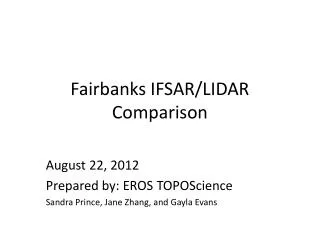
Fairbanks IFSAR/LIDAR Comparison. August 22 , 2012 Prepared by: EROS TOPOScience Sandra Prince, Jane Zhang, and Gayla Evans. Purpose. Tracy Fuller questioned the acceptability of the IFSAR data with 5 meter for the 1/9-arc-second data layer.

E N D
Fairbanks IFSAR/LIDAR Comparison August 22, 2012 Prepared by: EROS TOPOScience Sandra Prince, Jane Zhang, and Gayla Evans
Purpose • Tracy Fuller questioned the acceptability of the IFSAR data with 5 meter for the 1/9-arc-second data layer. • At the time the data was accepted into the NED 1/9-arc-second we did not have any lidar to do the comparisons. • Since we have received the Fairbanks lidar which is a very small dataset but acceptable for resolution comparisons.
The CONUS_NED_19_AK_FRBNKNS10 source data are at a resolution of 4feet. • The CONUS_NED_19_AK_IFSFURG110 source data have a resolution of 5 meters.
Analysis • IFSAR data are much coarser that the Lidar. • IFSAR does not have the resolution or detailed required of a lidar dataset
CONUS_NED_19_AK_FRBNKNS10_RLF @ 1:12,000 scale The surface of the water shows the TIN artifact and the overpass Is incompletely removed in the Fairbanks data. However, the IFSAR data shows no road definition at all and the terrain Looks over-smoothed. CONUS_NED_19_AK_IFSFURG110_RLF @ 1:12,000 scale
147°26'24.722"W 64°50'52.015"N IFSAR Lidar
Lidar 147°19'29.35"W 64°51'39.323"N IFSAR
147°24'57.769"W 64°48'36.911"N Lidar IFSAR
147°23'11.695"W 64°47'28.372"N IFSAR Lidar
147°33'40.051"W 64°52'0.615"N Lidar IFSAR
Conclusions • The Alaska IFSAR data is not acceptable for inclusion in the NED 1/9-arc-second data layer. • The Alaska IFSAR data should be prepared for the NED 1/3-arc-second layer.