Enhancing Discovery of the Ansari Paper Map Collection through Web-Scale Integration
10 likes | 125 Vues
The Ansari Map Library's collection of nearly 200,000 paper maps is vital for GeoSciences research at the University of Nevada, Reno. However, the absence of an accessible discovery layer for users prompted a solution leveraging a geospatial relational database. By implementing a Model-View-Controller (MVC) architecture and integrating tools like Google Maps, ArcGIS Server, and Microsoft SQL Server, a user-friendly interface was developed. This allows users to access diverse GIS data related to specific locations with just one click, significantly enhancing the research capabilities of faculty, students, and researchers.

Enhancing Discovery of the Ansari Paper Map Collection through Web-Scale Integration
E N D
Presentation Transcript
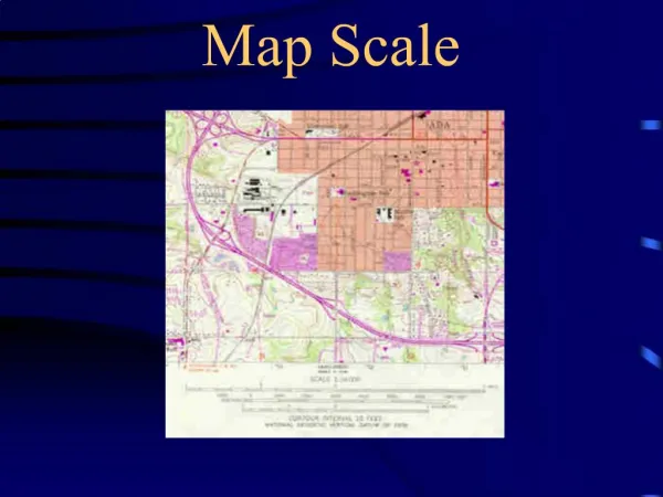
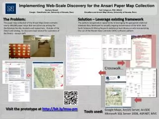
Implementing Web-Scale Discovery for the Ansari Paper Map Collection Zachary Newell Google DataWorks Lab, University of Nevada, Reno Tod Colegrove, PhD. MSLIS DeLaMare and Ansari Map Library, University of Nevada, Reno The Problem: Solution – Leverage existing framework The paper map collection of the Ansari Map Library contains nearly 200,000 paper maps that see active use among the GeoSciences faculty, students and researchers. Outside of the dated card catalog, no discovery layer existed for customers of the library – except staff. The authors recognized an opportunity to leveraging the geospatial relational database they developed to simplify ongoing maintenance of the W.M. Keck Earth Sciences & Mining Research website at keck.library.unr.edu incorporating the use of the Model-View Controller (MVC) software pattern: Crosswalk… Or Visit the prototype at http://bit.ly/msu-pm Google Maps, ArcGIS Server, ArcSDE Microsoft SQL Server 2008, ASP.NET, MVC Tools used: All the data on the new keck site is inter-related. With a single click on a map a user can access all the GIS data we have for that location.