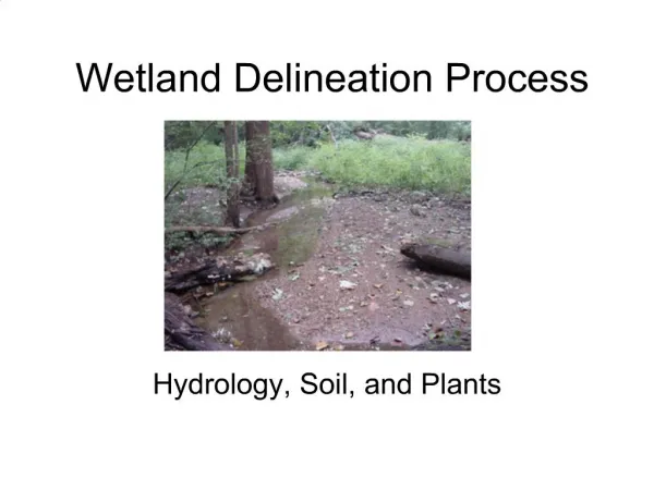
Wetland Delineation
Wetland Delineation. Charles D. Jansen March 25, 2003 EVSC 468. Contents. Definition Three Attributes The Process GIS Application Uses of Application Sources Pics. http://www.state.nj.us/pinelands/images/wetlands.gif. Definition. Many definitions for wetlands

Wetland Delineation
E N D
Presentation Transcript
Wetland Delineation Charles D. Jansen March 25, 2003 EVSC 468
Contents • Definition • Three Attributes • The Process • GIS Application • Uses of Application • Sources • Pics http://www.state.nj.us/pinelands/images/wetlands.gif
Definition • Many definitions for wetlands • Fish and Wildlife Service (FWS) • “Wetland are lands transitional between terrestrial and aquatic systems where the water table is usually at or near the surface or the land is covered by shallow water. For purposes of this classification, wetlands must have one or more of the following three attributes: (1) at least periodically, the land supports predominantly hydrophytes; (2) the substrate is predominantly undrained hydric soil; and (3) the substrate is nonsoil and is saturated with water or covered by shallow water at some time during the growing season of each year.”
Three Attributes • Hydrology – degree of soil saturation/flooding • Hydrophytes – wetland vegetation • Hydric Soils – soil wet enough to periodically produce anaerobic conditions These attributes help to first identify and then determine the general location of a wetland compared to the surrounding uplands.
Three Attributes • Hydrophyte Classification Indicator Category Probability Obligate wetland (OBL) > 99% Facultative wetland (FACW) 67-99% Facultative (FAC) 34-66% Facultative Upland (FACU) 1-33% Upland Plants (UPL) < 1%
The Process • Definition of wetland delineation • “The detailed examination and surveying of the specific boundaries of wetlands on a particular parcel of land.” - NWI • Various manuals on delineation. • Corps Manual, EPA Manual, Federal Interagency Manual On site delineation www.fhwa.dot.gov/environment/ strmlng/nov01nl.htm
Process • EPA Simple Method Step 1. Separate into vegetation units Step 2. Develop species list, estimate cover class, and indentify dominants Step 3. Modified? No – OBL species dominant, then wetland. UPL species dominant, then nonwetland. FACW, FAC, or FACU species dominant, then next step.
Process • EPA Simple Method (cont’d) Step 4. Hydric soils? Yes – hydrology indicators? No – then nonwetland. Hydrology indicators yes – then wetland. Step 5. Complete other vegetation units Step 6. Delineate upland/wetland boundary based on previous steps.
Process • Photointerpretation • Use remote sensing such as aerial photography • Visually notice the contrast of green and the texture to determine upland from wetland • Challenges: seasonal changes, cloud/snow cover, different scales, different wetlands • Best time Spring (May) • Best scale 1:40,000 • Estuarine, Palustrine, Riverine, Lacustrine and Marine
GIS Application • National Wetlands Inventory (NWI) procedure 1. Maps compiled through manual photointerpretation w/ Cartographic Engineering 4X Mirror Stereoscope. 2. Delineated wetland boundaries manually transferred from photos to 7.5 min USGS quadrangles. 3. Digital wetlands data… a. Manually digitized or b. Scanned from 1:24,000 scale maps by means of Wetland Analytical Mapping System (WAMS)
GIS Application • WAMS or geo-WAMS • Link between Water Analysis Simulation Program v.4 (WASP4) and Arc/Info • Spatial/temporal analysis of data • Model input configuration/editing/conversion • Model output interpretation/reporting/display • Model calibration/confirmation/application
GIS Application • The Charles D. Jansen Method of Wetland Delineation…
Vegetation unioned with… …Geology.
Union the two layers… 1. 2. 3. …to form one layer with both attributes.
By using SQL we can isolate polygons with attributes that meet wetland requirements… …to delineate the possible locations of wetlands seen here isolated in bright blue.
Uses of Application • Refuge Management • Everglades National Park (ENP) • Wetland Permitting • Army Corps of Engineers (ACE) • Wetlands Conservation • Natural Rersource Conservation Service (NRCS) and “Swampbuster” • Wetland Restoration Planning • South Everglades Restoration Project (SERP)
Sources • Wetlands Indicators: A Guide to Wetland Identification, Delineation, Classification, and Mapping by Ralph W. Tiner • Florida Department of Environmental Protection http://www.dep.state.fl.us/gis/datadir.asp • GIS Data Depot http://www.gisdatadepot.com/readme/nwi/nwi.html • National Wetlands Inventory http://www.nwi.fws.gov