Download
1 / 9
90 likes | 204 Vues
This guide covers the steps to efficiently complete GPS trail mapping and surveying for mountain biking trails in North Carolina. It includes methods for post-processing GPS data, differential correction, and editing geometry for accuracy. Key phases of surveying, where satellite coverage and PDOP values varied, are detailed. The discussion also emphasizes the importance of planning and stakeholder input for effective data collection and trail map creation using tools like ArcGIS and Pathfinder Office. Future recommendations aim to enhance trail mapping efforts.

E N D
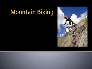
GPS Mountain Biking TrailsCarolina North • Steps to complete Trail Mapping • GPS Survey • Post-Processing of GPS Data • Differential Correction • Attribute/Geometry Editing • Trail Map Creation • Future Considerations
GPS Mountain Biking TrailsCarolina North • GPS Survey • 2 Phase (Trail 3 & Trail 2 & Trail 3 Loop) • Phase 1: class time • poor sat coverage • high PDOP vals (productivity over precision) • PDOP = 20, elevation=5 degrees • 4-5 sats, PRNs: 09, 18, 21, 24 • Phase 2: saturday late morning/early afternoon • better coverage into the afternoon • lower PDOP vals • PDOP = 6, elevation = 15 degrees • 5-8 sats, PRNs: 02, 06, 07, 10, 21, 24, 26, 29
GPS Mountain Biking TrailsCarolina North • Post-Processing of GPS Data • Differential Correction & Attribution Correction • Pathfinder Office • Geometry Editing • ArcGIS
GPS Mountain Biking TrailsCarolina North • Differential Correction & Attribution Correction • Differential Correction using Hillsborough CORs data • Attribution correct consisted mostly of recorded by field & file naming due to input errors
Differential Correction SummaryHillsborough CORs • Differential Correction Summary: • 4 files processed. • In these files: 1789 (98.5%) of 1816 selected positions were code corrected bypost-processing • Estimated accuracies for 1789 corrected positions are as follows: Range Percentage ---------- ---------- 0-15cm - 15-30cm - 30-50cm - 0.5-1m 2.6% 1-2m 46.4% 2-5m 48.6% >5m 2.3%
GPS Mountain Biking TrailsCarolina North • Geometry Editing - ArcGIS • Smoothing of trail features – MAO = 3 • Deletion of erroneous trail vertices • due to extremely high (12+) PDOP values on position recording. Coordinated ArcGIS with Pathfinder Office to determine • Movement of Trail Nodes based on satellite background image
GPS Mountain Biking TrailsCarolina North • Future Recommendations • Spend more time planning for GPS survey • Utilize QuickPlan for best collection times • Gather more input from all stakeholders to plan the data dictionary • Tom's team • Mountain Bikers