Coastal zone planning and management
610 likes | 1.09k Vues
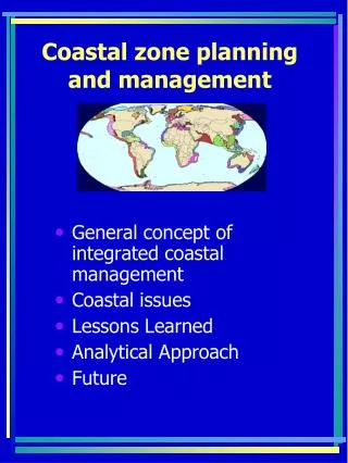
Coastal zone planning and management. General concept of integrated coastal management Coastal issues Lessons Learned Analytical Approach Future. What is ICZM?.

Coastal zone planning and management
E N D
Presentation Transcript
Coastal zone planning and management • General concept of integrated coastal management • Coastal issues • Lessons Learned • Analytical Approach • Future
What is ICZM? • In general, it’s a interdisciplinary and comprehensive strategy or framework based on the best available science to be implemented at the community level and national level; • The prime goal is to overcome sectoral and intergovernmental fragmentation that exist in today’s coastal management efforts;
http://www.conservation.org/Marine/map.htm • the most biologically valuable areas • the most threatened marine areas • the most critical areas for marine conservation
Production • Productivity is highest in coastal waters and upwelling zones due to higher nutrient concentrations Average Global Primary Production (Chl a) March 6-13 2001 Terra MODIS NASA/GES/DISC/DAAC
After 40 years of coastal management planning we are still trying to develop simple, effective and widely applicable models and approaches; and we still need successfully implemented examples of ICZM! • Today, the environmental problems in coastal areas have been exacerbated by habitat destruction, water contamination, coastal erosion and resources depletion; increasing social and cultural degradation as well as poverty! Go to list of issues in coastal conditions ppt.
What went wrong and what did we learn? • The root cause of this crisis is a failure of both perspective & governance; • Oceans & coasts are the largest public domain and has to be managed holistically for the benefit of local communities, recognizing their socio-economic and cultural heritage values; • Involvement of local communities in the planning and decision-making process; • Increased use conflicts can be managed simply by controlling where certain activities are undertaken, but sustainability can only be attained when environmental conditions are appropriate; • Interdependence of land and sea! Watershed and ecosystem management approach; • Use suitability and use conflict analysis support the interdisciplinary and holistic aspects of coastal planning and sustainable development; indicating where better information is needed;
Objectives and goals of the responsible coastal planning and management • Optimize benefits from coastal and marine resources, specifically for local communities • Identify desired uses • Minimize conflicts • Prevent environmental degradations • But How?
General concept for integrated coastal management • Resource assessment: comprehensive inventories of coastal natural and human resources (e.g. physical and biological data, resource uses, cultural heritage, traditional land uses and activities, etc.); includes long term in depth biocomplexity research studies; • Impact assessment: assessing the coastal zone vulnerability to various activity impacts; interactions between uses and resources; a tool to help making decisions and evaluate options for the mitigation and environmentally sound management (e.g. spatial and use conflict analysis, GIS models); based on the best available knowledge and acknowledging uncertainties; • Policy and regulatory framework: a basic tool for training and education, and for local community participation in decision making process; based on analysis of existing institutional and legal mechanisms develop comprehensive policy framework to address coastal issues;
Socio-cultural & Economic assessment: understanding of socio-economic incentives at the local level in suggesting alternative income-generating programs; the simpler the national rules the better they are understood and followed on the local levels; the capacity of the community to regulate its own activities and uses; to enforce local rules is an important determinant of perceived management success; • Implementation: how to apply science and develop and implement the BMPs? Comprehensive BMPs are ‘living documents’ open to revision, expansion; provide consistent national standards and practices for implementation; • Monitoring and evaluation: assess cumulative effects of changes and update management program elements to reflect changing needs and circumstances; multidisciplinary data as a ‘feedback loop’ evaluation of our activities and their impacts;
Still the question is how do we solve coastal problems and do better management and conservation of natural and human resources? And what is/should be the driving force and approach in coastal management?
My general premise is that “the environment sets the limits for responsible and sustainable development". Why?Understanding ecosystem's "function, health and resilience" is an imperative for successful application of adaptive coastal management. http://alpha.es.umb.edu/faculty/af/frankic.html
Site suitability and use conflict analysis: an optimal allocation for user functions • Finding suitable sites for existing and potential use/activity in the marine and coastal environment is one of the most critical challenges facing coastal planning and management.
Analytical Approach –Summary: • Optimal sites are selected based on environmental suitability analysis and GIS models. Environmental indicators required for potential activity sites were selected and generic protocol was developed. Often a modified version of the activity protocol has to be created and applied based on available and spatially explicit data. • GIS use-suitability modeling: application of available environmental suitability indicators from developed protocols; includes evaluation of the model with existing activity sites. • GIS use-conflict modeling and analysis: identification of exiting and potential uses,and use conflicts. • Characterization of management issues and options. Providing outcome scenarios and recommendations, identifying gaps to help guide future scientific research, monitoring and decision-making processes.
Phase One: • The most important step is to identify the environmental conditions necessary for each use/activity to succeed. • Based on extensive literature review and present knowledge, the environmental use suitability indicators (parameters or criteria), for activity to be long-term sustainable, can be identified and derived. • Note: ESRI ArcInfo and ArcView software were used to write algorithms to model protocols, and perform GIS use conflict modeling and analysis.
Suitability Indicators Desirable Undesirable Water quality Closed for direct marketing of shellfish; no potential for future productivity Approved, seasonally approved for shellfish harvesting Fecal coliforms Cfu/100 ml 200 > 200 Salinity (%◦) Unsuitable for shellfish growth Suitable for shellfish growth Nitrate mg/l 1 Phosphate mg/l 0.1 Suspended solids/ sediments (mg/l) 10 Mex. Wave height (m) < 0.5 > 0.5 Dissolved oxygen (mg/l) > 5 < 2 Current/exposure < 1 knot > 1 knot Bathymetry (m) > 1 < 1 Proximity to natural or improved channels < 50 feet to navigational channel > 50 feet Threatened or endangered species and habitats Absent Present Designated shellfish grounds No present or planned private lease or public ground within affected area Private lease or public oyster ground in proximity Dredging Does not require dredging Requires frequent dredging Adjacent wetlands Suitable buffer could be maintained around marine site Cannot maintain suitable buffer area Existing use of site Not presently used for recreational, tourism uses, fishing, crabbing, etc. Presently used for recreational activities and fishing, crabbing SAV Absent Present Shoreline erosion Shoreline protected by natural or planted riparian vegetation No shoreline stabilization Finfish habitat Unimportant area for spawning or nursery for any commercial or recreational species Important spawning and nursery area
Environmentally Suitable Indicators Excellent Good Poor Beach area capacity (m²/person) 8 -10 6 - 8 6 Sea Temp. (C) for swimming > 25 Water supply (l/day/person ) 200 – 250 100 - 200 < 100 Dissolved oxygen (mg/l) > 5 Water quality (E.coli) Drinking Swimming (*) 0 100 40 - 50 100 - 200 50 (MPN/100 ml) 200 (MPN/100ml) Suspended solids/ sediments (mg/l) > 5 Bottom type Sand, small gravel mud Current/exposure Sheltered bays Bathymetry (m) 0-5 Shoreline slope (%) topography 2-5 Beach area access (buffer zone 2000m) Within buffer zone Energy supply Sufficient, solar and alternative resources present Sewage systems (Waste water treatment) Present Protected areas, Nature Reserves, MPAs Present Cultural Heritage Preservation Present Food Supply, local mariculture, autochthon products Sufficient and present on site Sustainable Infrastructure & landscape Design Present
Seed clams are planted in beds approximately 14 x 50 feet. Each bed may be planted with 40,000 to 50,000 seed clams.
http://www.deq.state.va.us/coastal/documents/task11-07-04a.pdf aquaculture clam netting issues
Suitability Indicators General On-bottom oyster h. clam s. clam pH 7.0-8.5 6.75-8.75 6.75-8.75 Temp. (C) 20-28 Opt. 15-25 Opt.21-31 Opt. 10-20 Salinity (%◦) 10-35 10-35 18-20 ideal 10-25 Suspended sediments (mg/l) 15 10 - 25 Dissolved oxygen (mg/l) >5 >3.64 Bathymetry (m) 0-2 0-2 0-2 0-2 Bottom type Solid, oyster reefs Firm, and sandy Soft, muddy-sand Areas of activity Mainly subaqueous fixed structures (piers) Mainly eastern shore Accessibility (nearest boat ramp) 500-5000 meters Other physical attributes Prefer riparian areas, and wetlands; Exclude condemned areas; Exclude SAV habitats Regulatory Factors Species type native Fecal coliforms Cfu/100 ml 14 Nitrate mg/l 0.8 Phosphate mg/l 0.08 Dissolved oxygen (mg/l) > 5 Turbidity NTU < 25 Buffer zone ≥30 meters*
Ranking Hard clams Oysters Optimal =< 2 meter depth SAV absent >= 20 ppt outside condemned areas 0-2 meter depth SAV absent > 7ppt outside condemned areas Suitable =< 2 meter depth 15-20 ppt SAV absent inside condemned areas 0-2 meters depth SAV absent > 7 ppt inside condemned areas Unsuitable SAV present < 15 ppt SAV present < 7 ppt Shellfish aquaculture suitability criteria (modified protocol)
Phase Two: • GIS use-suitability modeling : Identification of areas in which environmental conditions for each specific use are found • This includes spatial analysis (aerial photos and satellite images); integration of GIS coverages (data layers) for e.g.: temp, salinity, bathymetry, water quality, substrate types, benthic biocenoses, slope, hydrology, geology-pedology, critical habitats and protected species/areas, etc. • GIS application of available environmental suitability indicators from developed protocols and evaluation of use suitability models;
Creating GIS Environmental Data Layers for site suitability analysis www.shsu.edu/~gel_geo/geography/coursestech.html
http://geology.com/nasa/chesapeake-bay-satellite-studies.shtmlhttp://geology.com/nasa/chesapeake-bay-satellite-studies.shtml
Site suitability analysis for hard clam aquaculture in Chesapeake Bay, Virginia (Source: VIMS/CCRM, A. Frankic) http://web.vims.edu/bio/sav/historic_field_observations/2006_observations.html
Aerial photo/ Digital Orthophoto Quadrangles (DOQs) – Hungars Creek: Clam nets in SAV beds in 2002 (source: D. Wilcox, VIMS)
Site suitability analysis for oyster aquaculture in Chesapeake Bay, Virginia Source: VIMS/CCRM, A. Frankic
Existing Aquaculture Optimal % # Suitable % # Unsuitable % # Oyster commercial 32 sites 72% 23 19% 6 9% 3 Hard clams 99 sites 82% 81 3% 3 15% 15
Phase Three: • Identification and mapping of coastal, marine and land uses • Performing the GIS use conflict analysis and modeling (21 models); The goal is to identify areas that, although suitable for aquaculture on the basis of suitable environmental assessment (from Phase Two), may be less desirable due to incompatible uses that are present or planned (tourism, recreation, fishing, protection, agriculture, etc.)
Example of identified land uses for aquaculture site suitability analysis (Ch. Bay, Virginia) (Source: VIMS/CCRM, A. Frankic)
Model Suitable area (Acres) Aesthetic conflict area SAV historic area potential for restoration Dredging area for boat access Agriculture (shoreline length/km) Hard clams 199297 65051 5903 388 1406 Oyster 404589 138336 25179 662 1404
Phase Four: • Identification of all possible management issues that could be caused by or related to aquaculture development in certain area (includes local community knowledge and participation); • Assessment of existing policies, regulations and laws related to e.g. aquaculture, identify and characterize management issues and conflicts; • Analysis will incorporate socio-economic considerations, and each management issue will be presented with adequate management options and recommendation scenarios;
Use conflicts and management issues: • Aquaculture and SAV • Aquaculture and other uses of the water column • Incompatible adjacent land use, and • Water quality impairments.
Adjacent Coastal activity/use Management issues Management options Outcomes Terrestrial: Residential Agriculture commodity (e.g. crops, tomato farms; livestock; organic farms) Water quality (NPS urban runoff, storm water runoff, wastewater runoff) Socio-economic issues – aesthetics; 1) priority use zones 2) areas with multiple uses If priority area for aquaculture no permits for other activities; Storm water permitting Retention ponds; Irrigation ponds; creating riparian/wetland buffers; Erosion and sediment control; Water quality recommendations (classes for aquaculture through regulation – tier I-III) Suitable if buffers exists; Socio-economic cost benefit analysis (advantages and disadvantages of management options) Water quality (agricultural runoff, pesticides, nutrients, erosion, sedimentation) Industry Sewage power plants Wastewater discharge, Sediment contamination Out falls; elevated water temp. Buffers Designating priority use zones To be determined by environmental and socio-economic assessments Marina Water quality (wastewater discharges) 200 m buffer (match regulations, ½ mile DOH) Suitable depending on water quality Navigation (potential conflict everywhere) Physical damage Buffer - 100 feet for oysters Suitable for aquaculture outside buffer Piers Recreational fishing and boating; Water quality Buffer area in residential priority zones Permit required for >100 feet in active lease Suitable for aquaculture Beaches(public); and bare areas as potential beaches Water quality (pathogen contamination) 2 m in-shore buffer; buffer maybe reduced with public facilities Suitable or optimal with adequate facilities; Bathing lease (1/2 acre) Recreation: (rec. fishing, boating and hauling) Wild harvest Golf courses In vicinity of residential areas; water quality issue; Physical/spatial issue Designating priority use zones No wake zones Buffer zones Suitable for aquaculture Protected areas Sanctuaries Habitat restoration/protection: Clam (brood stock area) Oyster reefs; B. crabs; SAV restoration Buffers: 100 feet for SAV Vicinity is a plus/optimal outside buffer areas, except SAV restoration areas;
Conclusion: • This analytical approach support interdisciplinary aspects for coastal planning, and indicate that use suitability models are useful for discriminating environmental potential among sites but they are inadequate as predictors for long-term sustainability. Why? • The major shortcoming is inability to integrate socio-economic considerations as measurable indicators in use suitability assessment and use conflict models of ICZM!
Use conflict analysis in Chesapeake bay • http://rmapnt52.wetlan.vims.edu/shallowwater/viewer.htm • Shallow Water Use Conflict • Aquaculture in USA: • http://resourcescommittee.house.gov/index.php?option=com_jcalpro&Itemid=27&extmode=view&extid=285
Economy (production, services, goods, income, profit) • Society (social, political and cultural systems) • Environment (natural resources, water, air, soil, raw materials, health) • This “triple bottom line’ is used as a framework for measuring and reporting corporate performance against economic, social and environmental parameters (John Elkington) http://www.sustainability.com/
Identification and implementation of socio-economic indicators for the integrated coastal area management.Table with 32 suggested indicators: Source: UNESCO/IOC/COOP, Halifax Meeting, Canada February 2004: www.phys.ocean.dal.ca/~lukeman/COOP/hfx_april_04.html NEXT STEPS:
1 Resident Population (census data) 17 Pesticide Use in Watershed 2 Population Density 18 Coastal Energy Production (% of National Production by type) 3 Land Use/Land Cover Patterns/Composition 19 Level/Value of Commercial Fish Landings by harvest area, gear type, species, weight, and value; 4 Employment in Industry Sectors 20 Artisanal Fishing Effort by harvest area, value, species and type; 5 % Population with Potable Water 21 Number/Value of Recreational Fishing Days 6 % Population with Internet Access 22 Seafood Consumption Patterns gram/person/day 7 Change in User Conflict 23 Seafood International Trade Value/Quantity/Terms & Direction 8 Property Values 24 Groundwater Extraction 9 Income/wealth Distribution 25 Number of Tourists (% of National) per day or # of bed nights 10 % Altered Coast 26 Number/Attendance at Recreational Bathing Beaches 11 Public Access Points/km of coastline 27 Number of Shipping Vessels Entering/Transiting Coastal Waters 12 Water dependent use industry/ coastal industry 28 Aquaculture – Total Hectares, by type, weight, value and species type 13 Value of Products dependent on Coastal Habitats 29 Value Change in Seafood Due to Chemical Contamination 14 Non-Use Values of Coastal Habitat(Bequest/Existence/Option) 30 Value Change in Seafood Due to Pathogenic/Toxic Contamination 15 % Population Served by Wastewater 31 Social mitigation cost of Invasive Species (public & private) 16 Fertilizer Use in Watershed 32 Number of Beach Closings
VARIABLE VARIABLE 1 Sea level 20 Fisheries: landings and effort 2 Water temperature 21 Primary production 3 Currents 22 Total organic C and N 4 Changes in bathymetry 23 Neutral red assay 5 Salinity 24 Incident solar radiation 6 Surface waves 25 Total suspended solids 7 Sediment grain size 26 Cholinesteraze (pesticides) 8 Benthic biomass 27 Cytochrome p450 (e.g. oil) 9 Changes in shoreline position 28 Metallothionein (trace metals) 10 Dissolved oxygen 29 Zooplankton biomass 11 Dissolved inorganic nutrientsN, P, Si 30 Eh in sediment 12 Phytoplankton biomass (chlorophyll) 31 Particulate organic C and N 13 Attenuation of solar radiation 32 Benthic species diversity 14 Faecal indicators 33 Zooplankton species diversity 15 Sediment organic content 34 Biological oxygen demand 16 Phytoplankton species diversity 35 pH 17 Nekton species diversity 36 Seabird diversity 18 Coloured dissolved organic matter DSOM 37 Nekton biomass 19 Seabird abundance
Related References: • UNESCO, 2003. (Strategic Design Plan for Coastal Ocean Observing Module. http://ioc.unesco.org/goos/docs/GOOS_125_COOP_Plan.pdf • UNESCO, 2003. A Reference Guide on the use of Indicators for Integrated Coastal Management. http://ioc.unesco.org/icam/files/Dossier.pdf • EC, 2000: Driving force-Pressure-State-Impact-Response (DPSIR) Model • “How is your MPA doing?” A guidebook of natural & social indicators for evaluating MPAs management effectiveness; IUCN/WWF/NOAA, 2004 www.iucn.org/bookstore • Frankic, A.2003. ICZM Plan for Croatia with special focus on aquaculture. Republic of Croatia, Ministry for environmental protection and physical planning. http://ccrm.vims.edu/staff/Adriaticaquaculture.pdf