Download
1 / 71
710 likes | 881 Vues
Learn about the processes of erosion and sedimentation, their impacts, and effective control strategies. Understand the importance of vegetation in stabilizing soil and preventing erosion. Discover methods for minimizing erosion and controlling sediment to protect the environment.

E N D
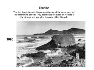
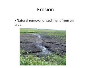
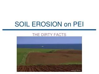
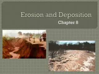
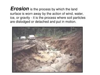
Erosionis the process by which the land surface is worn away by the action of wind, water, ice, or gravity - it is the process where soil particles are dislodged or detached and put in motion.
Sedimentation is the process whereby the detached particles generated by erosion are deposited elsewhere on the land or in our lakes, streams, and wetlands – Impacts on quality of quantity
Channel erosionis caused by: • increased runoff • removal of natural vegetation along the waterway • channel alterations resulting from construction activities.
Overland erosion - occurs on bare slopes as a result of: rain splash runoff
Overland erosion • Sheet erosion -the removal of a uniform layer of soil • Rill erosion - runoff is heavy and water concentrates in rivulets • Gully erosion – when the water concentrates into an area that cannot handle the flow.
Physical Factors Affecting Erosion • Climate - rainfall amount, intensity, frequency • Vegetative cover - the most important physical factor influencing soil erosion • Soil – texture (size), structure (organic matter), and cohesion (binding force) • Slope characteristics – steepness and the length water travels
PRINCIPLES AND STRATEGIES • plan the development to fit the particular topography, soils, waterways, and natural vegetation at a site • expose the smallest practical area of land for the shortest possible time • apply soil erosion prevention practices • apply sediment control practices as a perimeter protection • Inspection and maintenance
It is much more effective to - prevent erosion - than to control or remove the sediment generated from erosion
Controlling Runoff – minimize exposure of bare soil • Staging construction • Preserving vegetation buffers • Covering all areas with temporary seeding and mulch • Establishing permanent seeding as soon as possible
Methods used to minimize erosion include: • Special grading practices • Diversions • Check dams • Grade stabilization structures • Energy dissipaters • Erosion control blankets and other geotextile materials • Snow fence • Chemical soil binders
VEGETATIVE STABILIZATION • Before starting any earth change, critical, and sensitive areas should be identified on the site • Temporary vegetative stabilization - fast growing, robust plants • Permanent vegetative stabilization - grasses, legumes, ground cover • Selecting plant materials
CONTROLLING SEDIMENT • Vegetative sediment control involves using existing or newly planted vegetation to trap or filter sediment from runoff
Critical Areas • A critical area is difficult to stabilize with vegetation once it is graded and the existing vegetation removed • Typical critical areas would include areas with infertile subsoils, droughty soils, concentrated flow, heavy traffic, and long or steep slopes. • Whenever possible, critical areas should not be disturbed
Sensitive areas • Sensitive areas are those areas next to lakes or streams that can be damaged by sediment • Similar to critical areas, it is important that sensitive areas be left undisturbed or stabilized quickly after being disturbed.
Soil conditions that may cause problems • low fertility • acidity • too dry • too wet • The most important steps to take in protecting new seedlings, shrubs, vines, or trees are mulching and holding the mulch in place.
SELECTING PLANT MATERIALS • Climate • Soils • Slopes • Site Use and Maintenance
METHODS TO ESTABLISH VEGETATION • Seeding • Sprigging • Sodding • Planting a root-balled or container-grown shrub or tree
Maintenance • Periodically inspect • fertilizer needed? • insect damage? • spot seeding or replanting is necessary?
Vegetative filters • The effectiveness of filter strips depends on flow patterns, strip width, vegetation type, and density (20 to 25 ft)
STRUCTURAL SEDIMENT CONTROL • Perimeter Barriers
THE DIFFERENCE BETWEEN STORM WATER BASINS ANDSEDIMENTATION BASINS • Storm water basins are permanent structures designed to replace the natural water storage of a site and provide some water quality improvement after the site is completed • Sedimentation basins are used during construction and are specifically designed to control off-site migration of sediment.
Sedimentation Basins • Location • Size • Side slopes should be no greater than 3:1 (horizontal to vertical) • Vegetation should be established on the side slopes prior to use • The outlet structure should be located in or near the embankment to allow for safe and easy access for cleaning
Sedimentation Basins • For effective sediment control, basins should be at least four times as long as wide with the inlet and outlet at opposite ends • If this is not possible due to site constraints, baffles should be placed within the basin to increase the water travel distance
Retention basins are constructed to collect and retain runoff
Detention basins are constructed to collect and temporarily detain runoff
SOIL EROSION AND SEDIMENTATION CONTROL PLANS Part 91, Soil Erosion and Sedimentation Control, of the Natural Resources and Environmental Protection Act (NREPA), 1994 PA 451
The plan must include all strategies and control measures that willbe used to minimize erosion and off-site sedimentation
Include in SESC Plan A site location map, including the property boundaries and limits of the proposed earth change
Include in SESC Plan The proximity of the earth change to lakes, streams, and wetlands Existing vegetation and predominant land surface features Elevation contour intervals or a description of the slopes on the site
A description of existing and propose drainage patterns and slopes • A description of temporary and permanent control measures
0-6 percent low erosion hazard 7-12 percent moderate erosion hazard over 12 percent high erosion hazard