Download
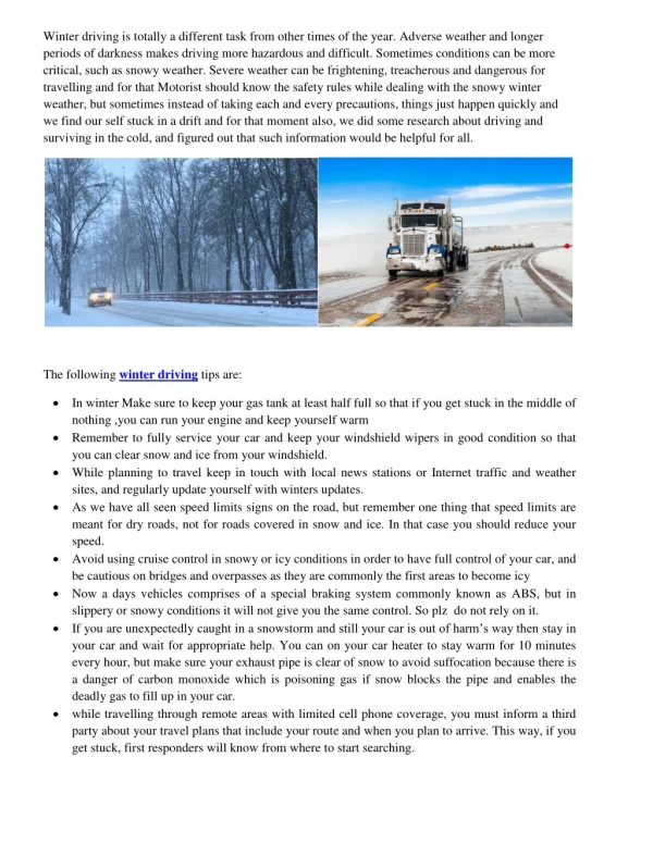
1 / 18
180 likes | 332 Vues
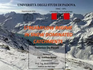
THIS PRESENTATION DESCRIBE MY MSc THESIS WORK. I EVALUAETED AND DEVELOPED A MODEL TO FORECAST THE STREMFLOWS PROBABILITY DISTRIBUTION IN CATCHMENTS SNOW DOMINATED. BOTH IN ITAIAN AND SWISS REGIONS, THE MODEL SEEMS TO WORK REALLY WELL WITHIN ALPINE REGION.

E N D
UNIVERSITÀ DEGLI STUDI DI PADOVA Dipartimento ICEA ENAC – EPFL Laboratory of Ecohydrology STREAMFLOW REGIME IN SNOW DOMINATED CATCHMENTS Federico De Piccoli Relatore Ing. Gianluca Botter Correlatore Prof. Ing. Andrea Rinaldo Academic year 2011-2012
INTRODUCTION Snow covered landscape has acquired notable importance. In particular in relation with: ENVIRONMENTAL ENERGETIC SOCIAL ACTIVITIES
WINTER STREAMFLOW DYNAMICS • TEMPERATURE GOVERNS THE PRECIPITATION REGIME • REDUCED EFFECT OF EVAPO-TRANSPIRATION • INCRESING WATER STORAGE RELEASED IN SPRING • RETARDING EFFECT IN RELEASE DUE TO SNOW PERSISTENCE THIS AFFECTS VEGETATION, SOIL AND DISCHARGE DYNAMICS …a stochastic approach…
TEMPERATURE IS THE MAIN DRIVER Image extracted from DTM, Boite closed at Cancia basin • THESE THREE ZONES ARE CHARACTERIZED BY: • NO SNOW • SNOW EVENTS BUT NO ACCUMULATION • ONLY ACCUMULATION 3000 2500 2000 1500 1000 [m asl] Representation in the hypsographic curve. We divide the fractions as function of Tms Tms = Mean Seasonal Temperature Hypsographic Curve
TO MODEL WINTER STREAMFLOWS … …WE FOCUS ON ZONES 2 AND 3
ZONE 2 – A TRANSITION ZONE 2 - ZONE WITH PRIMARLY SNOW EVENTS AND TEMPORARY ACCUMULATION • Increasing snowfall probability • Area from 1000 to 2100-2300 [m a.s.l] • Mean discharge equal to mean precipitation • Responsive fraction
ZONE 3 – THE HIGHER FRACTION 3 - ZONE OF PURE ACCUMULATION • Tms < - 4 °C • Elevation > 2300 m a.s.l. • Negligible snowmelting • Accumulation area The solution is an atom of probability concentrated in zero pdf(Q)=0
THE THRESHOLD Z* The idea is to assume the existence of a critical elevation Z* that identifies the different part of the basin Tms ≈ -2 °C Z* CALIBRATION PARAMETER CLIMATIC INFORMATION Z*=2000-2300 m a.s.l. GEOMORPHOLOGY
STOCHASTIC ANALYTICAL MODEL Daily precipitation (marked Poisson process) Soil moisture dynamic nearby the field capacity All rainfall is effective (marked Poisson process) Threshold Z* - Rescaling CONTRIBUTING AREA (Calibration parameter Z*) ANALYTICAL SOLUTION Discharge delayed by snow persistence (liner reservoir )
PIAVE RIVER BASIN Surface of the mountain part: 3900 km2 Length of the main reach: 156 km 7 testing catchments Nervesa
RESULTS – Piave river basin Fiorentina closed at Sottorovei Z*= 2100 m a.s.l. 74 % of area Observed Analytical with snow Analytical without snow
RESULTS – Piave river basin Coredevole closed at Saviner Z*= 2130 m a.s.l. 71 % of area Observed Analytical with snow Analytical without snow
SWISS BASINS 26 catchments minimal anthropogenic influence 7 situated in Alpine region Some basins present relevant glacial surface Aletsch glacier in Massa catchment
RESULTS – Swiss watersheds Massa closed nearby Blatten bei Naters Z*= 2210 m a.s.l. 8 % of area Observed Analytical modified Analytical original Observed Analytical with snow Analytical without snow
RESULTS – Swiss watersheds DishmaBach closed at Kriengsmatte (Davos) Z*= 2290 m a.s.l. 38 % of area Observed Analytical modified Analytical original Observed Analytical with snow Analytical without snow
DISCUSSION OF RESULTS P[z<Z*] correlates with the average elevation Threshold Z* nearly constant in most cases (independently on geomorphological attributes)
CONCLUSIONS • The model reproduces satisfactorily the probability distributions of the winter discharges observed in both Italian and Swiss basins through the calibration of the only parameter Z* • The values of Z* resulting from the calibration of the model with snow, are realistic. Z* is found to be inside the range from 2100 to 2300m a.s.l. in most cases • Linear empirical relationships between the fraction of responsive area and the mean and variance of surface heights have been recognized. Such relationships could help improving the predictive power of the model