Download
1 / 44
440 likes | 572 Vues
Learn about glaciers, ice formation, and periglacial processes in this comprehensive guide. Discover the features, distribution, and types of glaciers, and the evolution of glacial ice from snow. Understand concepts like glacial mass balance and the Pleistocene ice age.

E N D
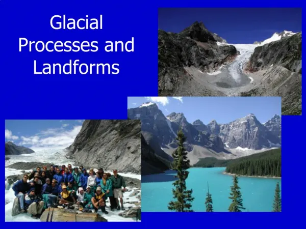
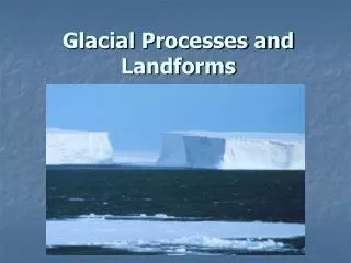
Chapter 17Glacial and Periglacial Processes and Landforms Geosystems 5e An Introduction to Physical Geography Robert W. Christopherson Charlie Thomsen
LAB #3 • Assignment #3 (book report) is due next week!!
Key Learning Concepts: • After this lecture you should be able to: • Differentiate between alpine and continental glaciers and describe their principal features. • Describe the process of glacial ice formation and portray the mechanics of glacial movement. • Describe characteristic erosional and depositional landforms created by alpine glaciation and continental glaciation. • Analyze the spatial distribution of periglacial processes and describe several unique landforms and topographic features related to permafrost and frozen ground phenomena. • Explain the Pleistocene ice age epoch and related glacials and interglacials and describe some of the methods used to study paleoclimatology.
1. Describe the location of most of the freshwater on Earth today. • A large measure of the freshwater on Earth is frozen, with the bulk of that ice sitting restlessly in just two places–Greenland and Antarctica. The remaining ice covers various mountains and fills alpine valleys. More than 29 million km3 of water, or about 77% of all freshwater, is tied up as ice.
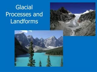
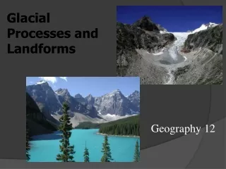
2. What is a glacier? What is implied about existing climate patterns in a glacial region? • A glacier is a large mass of perennial ice, resting on land or floating shelf-like in the sea adjacent to land. Glaciers form by the accumulation and recrystallization of snow. They move under the pressure of their own mass and the pull of gravity. Today, about 11% of Earth's land area is dominated by these slowly flowing ice streams. During colder episodes in the past, as much as 30% of continental land was covered by glacial ice because below-freezing temperatures prevailed at lower latitudes, allowing snow to accumulate. Relative to elevation, in equatorial mountains, the snowline is around 5000 m; on midlatitude mountains, such as the European Alps, snowlines average 2700 m; and in southern Greenland snowlines are down to 600 m.
3. Differentiate between an alpine glacier and a continental glacier. • With few exceptions, a glacier in a mountain range is called an alpine glacier, or mountain glacier. It occurs in several subtypes. One prominent type is a valley glacier, an ice mass constricted within the confines of a valley. Such glaciers range in length from only 100m to over 100 km. The snowfield that feeds the glacier with new snow is at a higher elevation. As a valley glacier flows slowly downhill, the mountains, canyons, and river valleys beneath its mass are profoundly altered by its passage. A continuous mass of ice is known as a continental glacier and in its most extensive form is called an ice sheet. Two additional types of continuous ice cover associated with mountain locations are designated as ice caps and ice fields. Most glacial ice exists in the snow-covered ice sheets that blanket 80% of Greenland and 90% of Antarctica.
4. Name the three types of continental glaciers. What is the basis for dividing continental glaciers into types? Which type covers Antarctica? • The three types are ice sheet, ice cap, and ice field. Both ice caps and ice sheets completely bury the underlying landscape, although an ice cap is somewhat circular and covers an area of less than 50,000 km2. Antarctica alone has 91% of all the glacial ice on the planet as an enormous ice sheet, or more accurately several ice sheets acting in concert. An ice field is the smallest of the three.
5. Trace the evolution of glacial ice from fresh fallen snow. • Snow that survives the summer and into the following winter begins a slow transformation into glacial ice. Air spaces among ice crystals are pressed out as snow packs to a greater density. The ice crystals recrystallize under pressure and go through a process of re-growth and enlargement. In a transition step to glacial ice, snow becomes firn, which has a granular texture. As this process continues, many years pass before denser glacial ice is produced. Formation of glacial ice is analogous to formation of metamorphic rock: sediments (snow and firn) are pressured and recrystallized into a dense metamorphic rock (glacial ice). • The formation of glacial ice is analogous to formation of a metamorphic rock with sediments (snow and firn) pressured and recrystallized into a dense metamorphic rock (glacial ice). The time taken for such a process is dependent on climatic conditions as noted in the text. A dry climate such as that found in Antarctica may produce glacial ice in 1000 years, whereas a wetter climate may take only a few years to complete the formation process.
6. What is meant by glacial mass balance? What are the basic inputs and outputs underlying that balance? • A glacier is fed by snowfall and is wasted by losses from its upper and lower surfaces and along its margins. A snowline called a firn line is visible across the surface of a glacier, indicating where the winter snows and ice accumulation survived the summer melting season. A glacier's area of excessive accumulation is, logically, at colder, higher elevations. The zone where accumulation gain ends and loss begins is the equilibrium line. This area of a glacier generally coincides with the firn line, except in subpolar glaciers, where frozen surface water occurs below the firn line. Glaciers achieve a positive net balance of mass–grow larger–during colder periods with adequate precipitation. In a glacier's lower elevation, losses of mass occur because of surface melting, internal and basal melting, sublimation, wind removal by deflation, and the calving, or breaking off, of ice blocks. In warmer times, the equilibrium line migrates to a higher elevation and the glacier retreats–grows smaller–due to its negative net balance.
7. What is meant by a glacier surge? What do scientists think produces surging episodes? • Some glaciers will lurch forward with little or no warning in a glacial surge. This is not quite as abrupt as it sounds; in glacial terms, a surge can be tens of meters per day. The Jakobshavn Glacier in Greenland, for example, is known to move between 7 and 12 km a year. The exact cause of such a glacial surge is still being studied. Some surge events result from a buildup of water pressure in some layers of the glacier. Sometimes that pressure is enough to actually float the glacier slightly during the surge. As a surge begins, icequakes are detectable, and ice faults are visible along the margins that separate the glacier from the surrounding stationary terrain.
8. How does a glacier accomplish erosion? • Glacial erosion is similar to a large excavation project, with the glacier hauling debris from one site to another for deposition. As rock fails along joint planes, the passing glacier mechanically plucks the material and carries it away. There is evidence that rock pieces actually freeze to the basal layers of the glacier and, once embedded, allow the glacier to scour and sandpaper the landscape as it moves, a process called abrasion. This abrasion and gouging produces a smooth surface on exposed rock, which shines with glacial polish when the glacier retreats. Larger rocks in the glacier act much like chisels, working the underlying surface to produce glacial striations parallel to the flow direction.
9. Describe the evolution of a V-shaped stream valley to a U-shaped glaciated valley. What kinds of features are visible after a glacier retreats? • (Figure 17-10). Illustration (a) shows a typical river valley with characteristic V-shape and stream-cut tributary valleys that exist before glaciation. Illustration (b) shows that same landscape during a later period of active glaciation. Glacial erosion and transport are actively removing much of the regolith (weathered bedrock) and the soils that covered the preexisting valley landscape. Illustration (c) shows the same landscape at a later time when climates have warmed and ice has retreated. The glaciated valleys now are U-shaped, greatly changed from their previous stream-cut form. You can see the oversteepened sides, the straightened course of the valley, and the presence of hanging valleys and waterfalls. The physical weathering associated with a freeze-thaw cycle has loosened much rock along the steep cliffs, falling to form talus cones along the valley sides during the postglacial period. See Figure 17-10 for labeled details of the features that are formed as a result of the formation, growth, passage, and retreat of an alpine glacier.
Figure a: A preglacial landscape with V-shaped stream-cut valleys.
Figure c: When the glaciers retreat, the new landscape is unveiled.
10. How is an iceberg generated? • Where a glacier ends in the sea, large pieces break off and drift away as icebergs. These are portions of a glacier at drift in the sea. When large pieces of an ice shelf break off, such as the portions of the Ross ice shelf in the west Antarctic area have done during the past few years, enormous tabular islands are formed as a type of iceberg.
11. Differentiate between two forms of glacial drift—till and outwash. • Where the glacier melts, debris accumulates to mark the former margins of the glacier—the end and sides. Glacial drift is the general term for all glacial deposits. Direct deposits appear unstratified and unsorted and are called till. In contrast, sorted and stratified glacial drift, characteristic of stream-deposited material, is called outwash (see 2nd slide) and forms an outwash plain of glaciofluvial deposits across the landscape.
12. What is a morainal deposit? What moraines are created by alpine and continental glaciers? • Glacial till moving downstream in a glacier can form a marginal unsorted deposit known as a moraine (see Figure 17-7). A lateral moraine forms along each side of a glacier. If two glaciers with lateral moraines join, their point of contact becomes a medial moraine. Eroded debris that is dropped at the glacier's farthest extent is called a terminal moraine. However, there also may be end moraines, formed wherever a glacier pauses after reaching a new equilibrium. If a glacier is in retreat, individual deposits are called recessional moraines. And finally, a deposition of till generally spread across a surface is called a ground moraine.
Figure 17.7: Examples of a Medial Moraine, End Moraine, and Terminal Moraines.
Picture of an End Moraine: End moraine of a piedmont glacier (large valley glaciers meet to form an almost stagnant sheet of ice), Bylot Island, Canada. The sharp-crested ridge of till (end moraine) was pushed up at the ice margin during the glacier's maximum advance, probably during the Little Ice Age.
Lateral and terminal moraines of a valley glacier, Bylot Island, Canada. The glacier formed a massive sharp-crested lateral moraine at the maximum of its expansion during the Little Ice Age. The more rounded terminal moraine at the front consists of medial moraines that were created by the junction of tributary glaciers upstream.
Columbia Glacier in Alaska encroached on a forest as it surged in the early twentieth century, pushing trees, soil, rocks and debris as it advanced. This photograph was taken in 1914, several years after the glacier had begun to surge, creating a new terminal moraine. Columbia Glacier is located in the Chugach Mountains of Alaska.
13. What are some common depositional features encountered in a till plain? • With the retreat of the glaciers, many relatively flat plains of unsorted coarse till were formed behind terminal moraines. Low, rolling relief and deranged drainage patterns are characteristic of these till plains. As the glacier melts, this unsorted cargo of ablation till is lowered to the ground surface, sometimes covering the clay-rich lodgement till deposited along the base. The rock material is poorly sorted and is difficult to cultivate for farming, but the clays and finer particles can provide a basis for soil development.
14. Contrast a roche moutonnée and a drumlin regarding appearance, orientation, and the way each forms. • Two landforms created by glacial action are streamlined hills, one erosional (called a roche moutonnée) and the other depositional (called a drumlin). A roche moutonnée is an asymmetrical hill of exposed bedrock. Its gently sloping upstream side has been polished smooth by glacial action, whereas its downstream side is abrupt and steep where rock was plucked by the glacier (See Figure 17-16). A drumlin is deposited till that has been streamlined in the direction of continental ice movement, blunt end upstream and tapered end downstream. Multiple drumlins (called swarms) occur in fields in New York and Wisconsin, among other areas. Sometimes their shape is that of an elongated teaspoon bowl lying face down (See Figure 17-17).
Figure 17.16: Glacial Erosion Streamlined Rock. Roche Mountonnée, as exemplified by Lembert Dome in Yosemite National Park, California.
A drumlin in New York State and Drumlin field in Snare Lake, Canada (Figure 17.17).
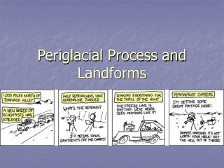
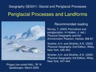
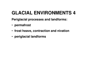
15. In terms of climatic types, describe the areas on Earth where periglacial landscapes occur. Include both higher latitude and higher altitude climate types. • Periglacial regions occupy over 20% of Earth's land surface (See Figure 17-18). The areas are either near permanent ice or are at high elevation, and have ground that is seasonally snow free. Under these conditions, a unique set of periglacial processes operate, including permafrost, frost action, and ground ice. • Climatologically, these regions are in Dfc, Dfd subarctic, and E polar climates (especially ET tundra climate). Such climates occur either at high latitude (tundra and boreal forest environments) or high elevation in lower-latitude mountains (alpine environments).
Figure 17.18: Permafrost Distribution. Distribution of Permafrost in the Northern Hemisphere. Alpine permafrost occurs in high elevations in Mexico, Europe, Japan, and even Hawaii. Sub-sea permafrost occurs in the ground beneath the Arctic Ocean along the margins of the continents.
16. Define two types of permafrost, and differentiate their occurrence on Earth. What are the characteristics of each? • When soil or rock temperatures remain below 0°C (32°F) for at least two years, a condition of permafrost develops.An area that has permafrost but is not covered by glaciers is considered periglacial. Note that this criterion is based solely on temperature and not on whether water is present. Other than high latitude and low temperatures, two other factors contribute to permafrost: the presence of fossil permafrost from previous ice-age conditions and the insulating effect of snow cover or vegetation that inhibits heat loss. • Permafrost regions are divided into two general categories, continuous and discontinuous, that merge along a general transition zone. Continuous permafrost describes the region of the most severe cold and is perennial, roughly poleward of the –7°C mean annual temperature. Continuous permafrost affects all surfaces except those beneath deep lakes or rivers. Continuous permafrost may exceed 1000 m in depth averaging approximately 400 m.
17. Describe the active zone in permafrost regions, and relate the degree of development to specific latitudes. • The active layer is the zone of seasonally frozen ground that exists between the subsurface permafrost layer and the ground surface. The active layer is subjected to consistent daily and seasonal freeze‑thaw cycles. This cyclic melting of the active layer affects as little as 10 cm depth in the north and up to 2 meters in the southern margins of the periglacial region, and 15 m in the alpine permafrosts. (See Figure 17-19).
Figure 17.19: Periglacial Environments. Cross section of a periglacial region in northern Canada, showing typical forms of permafrost, active layer, and talik (discussed in detail in the next question).
18. What is a talik? Where might you expect to find taliks and to what depth do they occur? • A talik (derived from a Russian word) is an unfrozen portion of the ground that may occur above, below, or within a body of discontinuous permafrost or beneath a body of water in the continuous region. Taliks are found beneath deep lakes and may extend to bedrock and soil under large deep lakes (Figure 17-19). Taliks form connections between the active layer and groundwater, whereas in continuous permafrost groundwater is essentially cut off from water at the surface. In this way, permafrost disrupts aquifers and causes water supply problems.
19. What is the difference between permafrost and ground ice? • In regions of permafrost (permanent frost), subsurface water that is frozen is termed ground ice. The moisture content of areas with ground ice may very from nearly absent in regions of drier permafrost to almost 100% in saturated soils. From the area of maximum energy loss, freezing progresses through the ground along a freezing front, or boundary between frozen and unfrozen soil.
20. Describe the role of frost action in the formation of various landform types in the periglacial region. • The 9% expansion of water as it freezes produces strong mechanical forces that fracture rock and disrupt soil at and below the surface. Frost-action shatters rock, producing angular pieces that form a block field, accumulating as part of the arctic and alpine periglacial landscape, particularly on mountain summits and slopes. • If sufficient water undergoes the phase change to ice, the soil and rocks embedded in the water are subjected to frost-heaving (vertical movement) and frost-thrusting (horizontal motions). Boulders and slabs of rock generally are thrust to the surface. Soil horizons may appear disrupted as if stirred or churned by frost action, a process termed cryoturbation. Frost action also produces a contraction in soil and rock, opening up cracks for ice wedges to form. Also, there is a tremendous increase in pressure in the soil as ice expands, particularly if there are multiple freezing fronts trapping unfrozen soil and water between them.
21. Relate some of the specific problems humans encounter in developing periglacial landscapes. • Human populations in areas that experience frozen ground phenomena encounter various difficulties. Because thawed ground in the active layer above the permafrost zone frequently shifts in periglacial environments, the maintenance of road beds and railroad tracks is a particular problem. In addition, any building placed directly on frozen ground will begin to melt itself into the defrosting soil. Thus, the melting of permafrost can create subsidence in structures and complete failure of building integrity (See Figure 17-24).
Figure 17.24: Permafrost melting and structure collapse. Building failure due to improper construction and the melting of permafrost.
22. What is paleoclimatology? Describe Earth's past climatic patterns. Are we experiencing a normal climate pattern in this era, or have scientists noticed any significant trends? • Paleoclimatology is the science of past climates. The most recent episode of cold climatic conditions began about 1.65 million years ago, launching the Pleistocene epoch. At the height of the Pleistocene, ice sheets and glaciers covered 30% of Earth's land area, amounting to more than 45 million km2. The Pleistocene is thought to have been one of the more prolonged cold periods in Earth's history. At least 18 expansions of ice occurred over Europe and North America, each obliterating and confusing the evidence from the one before.
23. Define an ice age. • The term ice age is applied to any such extended period of cold, even though an ice age is not a single cold spell. Instead, it is a period of generally cold climate, called a glacial, interrupted by brief warm spells, known as interglacials. There is a worldwide retreat of alpine glaciers, higher snowlines in Greenland, and at least three accelerating ice streams on the West Antarctic ice sheet. The reduction in alpine glacial mass balances is particularly true of low and middle elevation glaciers. This trend in ice mass reduction may be attributed to the present century-long increase in mean global air temperatures. Additionally, over the past ten years, we have experienced the eight warmest years in instrumental history.
25. Describe the role of ice cores in deciphering past climates. What record do they preserve? • Ice core analysis has opened the way for a new chronology and understanding of glaciation. Chemical and physical properties of the atmosphere and snow that accumulated each year are frozen into place. Locked into the ice cores are the air bubbles from past atmospheres, which indicate ancient gas concentrations, such as greenhouse gases, carbon dioxide and methane. For examples, during cold periods, high concentrations of dust are present, brought by winds from distant dry lands, acting as condensation nuclei. Past volcanic eruptions are recorded in this manner. The presence of ammonia indicates ancient forest fires at lower latitudes and the ratio between stable forms of oxygen is measured with each snowfall.
Movie: Glaciers • Many of the world’s most beautiful landscapes were made by glaciers. This program shows how, explaining glacial formation, structure, movement, and methods of gouging and accumulating earth. The program provides images of glaciers and glacial landforms such as moraines, and discusses how study of glaciers may help us understand ice ages and the greenhouse effect. • http://www.learner.org/resources/series78.html
End of Chapter 17 Geosystems 5e An Introduction to Physical Geography Robert W. Christopherson Charlie Thomsen