Download
1 / 21
210 likes | 349 Vues
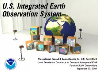
Architecture and Data Management for the U.S. Integrated Earth Observation System (IEOS) First Steps Kathy Fontaine, NASA USGEO ADM Vice Chair ESIP Federation Winter Meeting Washington, DC January 4, 2006. Topics. Background and Context

E N D
Architecture and Data Management for the U.S. Integrated Earth Observation System (IEOS) First Steps Kathy Fontaine, NASA USGEO ADM Vice Chair ESIP Federation Winter Meeting Washington, DC January 4, 2006 ADM-10/26/2005
Topics • Background and Context • More detail on the Integrated Earth Observation System • Architecture and Data Management first steps • Ways to be involved • Next steps ADM-10/26/2005
International Context • GEOSS will be: • comprehensive, by including observations and products gathered from all components required to serve the needs of participating members; • coordinated, in terms of leveraging resources of individual contributing members to accomplish this system, whose total capacity is greater than the sum of its parts; • sustained, by the collective and individual will and capacity of participating members. GEOSS will build step-by-step on current cooperation efforts among existing observing and processing systems within their mandates, while encouraging and accommodating new components. ADM-10/26/2005
National Context National Science and Technology Council ScienceCommittee Environment & NaturalResources Committee Homeland & NationalSecurity Committee TechnologyCommittee Air Quality ResearchSubcommittee Subcommittee on Global Change Research Interagency Working Group onEndocrine Disruptors Ecological SystemsSubcommittee Toxics & Risk AssessmentSubcommittee Biodiversity and EcosystemInformatics Working Group Interagency Working Group onMercury Subcommittee onDisasterReduction Subcommittee on Oceans (also reports to Committee on Science) Subcommittee onWater Availability &Quality US Group onEarth Observations (USGEO) Subcommittee on Healthand the Environment(also reports to Committee on Science and Commission onHomeland and National Security The US GEO Comprises Federal Representatives from 15 Member Agencies and three White House Offices ADM-10/26/2005
USGEO Subcommittee Structure USGEO Executive Committee Co-chairs Executive Secretary Working Group Leaders Planning and Integration USGEO Working Groups Science & Technology Capacity Building & Outreach User Interface Architecture & Data Mgmt. NTO Task Forces Disaster Sea Level Drought Air Quality Global Land ADM-10/26/2005 June 9, 2005
Relationship to Other CENR Entities USGEO Executive Committee Co-chairs Executive Secretary Working Group Leaders Planning and Integration USGEO Working Groups Science & Technology Capacity Building & Outreach User Interface Architecture & Data Mgmt. NTO Task Forces Disaster Sea Level Drought Air Quality Global Land Ecological Systems Global Change Research Disaster Reduction Water Availability & Quality CENR Subcommittees Air Quality & Research Health & the Environment Oceans ADM-10/26/2005
U.S. Integrated Earth Observation System (IEOS) IEOS Vision: Enable a healthy public, economy, and planet through an integrated, comprehensive, and sustained Earth observation system. From a Regional View To a Global Analysis ADM-10/26/2005
What will IEOS do? • Facilitate the sharing & applied usage of: • Global, regional, and local data • Data from satellites, ocean buoys, weather stations and other surface and airborne Earth observing instruments and predictive models • Expected Outcomes: • Users accessing an unprecedented amount of environmental information • Data integrated into new information products that can support decisions and benefit societies and economies worldwide. ADM-10/26/2005
Near-Term Opportunity IEOS Integration Frameworks Architecture and Data Management 1 of 6 Near Term Opportunities (NTO) Identified for IEOS ADM-10/26/2005
What are the goals for the Architecture and Data Management of IEOS? Starting with Near Term Opportunities and expanding to all IEOS data management systems, Architecture & Data Management seeks to: • Enable increased interoperability across existing data management systems • Identify and address integration gaps in data management systems • Utilize community standards for data and metadata • Enable integrated measurements, data, products, and predictive models • Examine the need for future data management requirements ADM-10/26/2005
Architecture and Data ManagementWhy Focus on Integration? We currently have hundreds of separate, but individually efficient, data management systems across agencies • The opportunity is to smooth the way for transfer of data across the wide variety of: • Systems • Disciplines • Formats • Technologies • Dissemination methods • And more • Also an opportunity to leverage the existing cutting-edge technologies within systems such as OPeNDAP, THREDDS, the GeoSpatial One-Stop, and others. ADM-10/26/2005
Architecture and Data ManagementWhy Focus on Integration? We need cross-agency Enterprise Architecture & Integrated Data Management for IEOS to achieve or enable: • Federal Agency coordination of strategies and observation systems • Interoperability/integration among data systems • Linkages: ground-based, aircraft, satellite platforms • Innovative approaches to information and knowledge management across agencies • Standards/protocols for data and metadata • Robust IEOS information security across systems • Conformity to law and policy including OMB Circular A-16, Federal Enterprise Architecture (FEA), Data Quality Act & OMB's Information Quality Guidelines ADM-10/26/2005
Architecture and Data ManagementThe Results and Benefits Societal Benefits • Improve Weather Forecasting • Reduce Loss of Life and Property from Disasters • Protect and Monitor our Ocean Resources • Understand, Assess, Predict, Mitigate and Adapt to Climate Variability and Change • Support Sustainable Agriculture and Combat Land Degradation • Understand the Effect of Environmental Factors on Human Health & Well Being • Develop the Capacity to Make Ecological Forecasts • Protect and Monitor Water Resources • Monitor and Manage Energy Resources • Rapid, timely integration of data, products and predictive models among systems helps first responders. • Leveraged data management activities across all Federal Agencies improves accountability and efficiencies. • Ease of use of data between and among Agencies advances regional and global understanding. • Increased efficiency needed to handle the exponential increase in data volumes that will occur over the next decade. • Increased opportunities for interdisciplinary work. Improved decision makers’ abilities to address policy and societal benefit issues ADM-10/26/2005
Architecture and Data ManagementHow Do We Get There? To achieve the Near-Term Opportunities identified in the Strategic Plan for a US Integrated Earth Observation System there must be an integrated approach to architecture and data management that: • Makes use of and builds upon existing systems to the extent possible • Identifies gaps that can be filled quickly with existing or planned agency efforts • Interfaces capabilities through interoperability specifications • Preserves continuity of observations ADM-10/26/2005
Architecture and Data ManagementSchematic View: Linking Earth Observations to Societal Benefits Predictions Earth System Models Weather Climate Atmosphere Others… Policy Decisions Decision Support Societal Benefits Management Decisions DATA Earth Observation Systems Remotely-sensed In situ Personal Decisions Observations On-going feedback to optimize value and reduce gaps Models play an increasingly important role in all areas of this graphic ADM-10/26/2005
Architecture and Data ManagementThe Solution – Involves All Stakeholders • Everyone has a role to play • Some players can only provide some pieces • All are encouraged to provide what they can ADM-10/26/2005
Architecture and Data ManagementThe Solution – Includes Various Approaches • Use appropriate technologies and methodologies to achieve interoperability, including • Service-oriented architectures • Federal Enterprise Architectures • Industry best practices • Government plans and existing projects • Clearly identify the systems from which to build • Provide a thoughtful spending plan that includes government and private sector contributions ADM-10/26/2005
Architecture and Data ManagementThe Solution – Includes Various Approaches • Create portals for use by other NTOs • Understand the importance of modeling in the overall architecture • Long-term data preservation is critical for model development, assessment, reanalysis, etc. • Archives should be seen as the midpoint of this architecture, rather than an endpoint. ADM-10/26/2005
Architecture and Data ManagementExisting Elements for Leverage Cutting Edge Information & Knowledge Management (Several Examples) Currently used within, but generally not across, data management systems • Thematic Realtime Environmental Distributed Data Services: THREDDS • Web Coverage Service: WCS • Geospatial One Stop • Global Change Master Directory: GCMD • National Model Archive and Distribution System: NOMADS • NSF Cyberinfrastructure initiative - Teragrid • Meteorological Assimilation Data Ingest System: MADIS • Comprehensive Large-Array data Stewardship System: CLASS • EOS Clearinghouse: ECHO • Integrated Ocean Observing System (IOOS)/ Data Management and Communications (DMAC) • And many, many others ADM-10/26/2005
IEOS Roadmap for SuccessIntegrated Observations & Data Management ADM-10/26/2005
For Further Information: US Group on Earth Observations http://iwgeo.ssc.nasa.gov http://earthobservations.org http://www.strategies.org/Alliance/News.htm Eosdis-evolution.gsfc.nasa.gov ADM-10/26/2005