Science and Implementation Plans wmot/thorpex Four sub-programmes + TIGGE
530 likes | 713 Vues
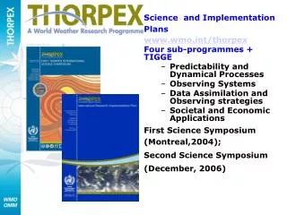
Science and Implementation Plans www.wmo.int/thorpex Four sub-programmes + TIGGE Predictability and Dynamical Processes Observing Systems Data Assimilation and Observing strategies Societal and Economic Applications First Science Symposium (Montreal,2004); Second Science Symposium

Science and Implementation Plans wmot/thorpex Four sub-programmes + TIGGE
E N D
Presentation Transcript
Science and Implementation Plans www.wmo.int/thorpex Four sub-programmes + TIGGE • Predictability and Dynamical Processes • Observing Systems • Data Assimilation and Observing strategies • Societal and Economic Applications First Science Symposium (Montreal,2004); Second Science Symposium (December, 2006)
THORPEX is a significant contribution towards the WMO effort to mitigate the effects of natural disasters THORPEX will fully realise the societal and economic benefits of improved weather forecast especially in developing and least developed countries extend the range of skilful weather forecasts of high impact weather up to 14 days and beyond Develop accurate and timely warnings in a form that can be readily used in decision-making support tools
ORGANISATION • International committee structure for the science established • Regional THORPEX Committees coordinate activities of regional groups of nations • North America (NARC), • Asia (ARC), • Europe (ERC), and • Southern Hemisphere (SHRC) • The International Projects Office directs, coordinates and monitors activities
REGIONAL COMMITTEES • The implementation of the international structure for THORPEX has revitalised activities in each region • The ARC, ERC, NARC and the SHRC are now developing implementation plans for their THORPEX involvement • A first draft of an African (mainly north of the equator) THORPEX plan will be discussed in Niamey in January 2007 • Development of a major international plan for a Pacific Regional Campaign (TPARC) and an integrated plan for European Regional Campaigns
A Major THORPEX deliverable is a Global Interactive Forecast System (GIFS) End-to-end forecast system“tuned” for end users, using targeted observations called on in ‘sensitive areas’, adaptive data assimilation, probabilistic forecasting, grid computing and distributed archives accessible through a single entry point.
REGIONAL CAMPAIGNS Contributing to elements of a GIFS ATREC (2003) many groups are actively working with the data European ETReC – D-Phase (MAP), COPS THORPEX Pacific Asian Regional Campaign (TPARC 2008) – cyclone tracks, extra-tropical transitions, tropical warm-pool physics and down-stream propagation (link to, Beijing Olympics & International Polar Year) Winter Olympics in Canada (2010) Tropical convection (2012)
TIGGE – a major element of a GIFS An enhanced collaboration on development of ensemble prediction, internationally and between operational centres and universities New methods of combining ensembles from different sources and of correcting for systematic errors (biases, spread over-/under-estimation) A deeper understanding of the contribution of observation, initial and model uncertainties to forecast error Real-time support for demonstration projects and field experiments Societal applications leading to increased benefits to society
TIGGE • TIGGE Workshop (March 2006) • Technical proposal for Phase 1 (global) developed by archive centres and agreed by ten potential providers (BMRC, CMA, ECMWF, FNMOC, JMA, KMA, Meteo-France, Environment Canada, NCEP, UKMO) • CMA, ECMWF and NCAR (the three phase 1 archive centres) have been in close contact for some time and test data have been sent routinely from ECMWF to NCAR • Access to the data base of global forecasts will be possible in Autumn 2006
PARTNERSHIPS FOR RESEARCH & DEVELOPMENT With the WCRP Joint project to develop a unified approach to the development of high-resolution systems for weather prediction, seasonal forecasting and climate simulation With GEOSS Contribute to GEOSS societal benefit areas – for health, weather (TIGGE), agriculture and energy With IPY To improve the understanding of physical/dynamical processes in polar regions; utilise improved forecasts for the benefit of society, the economy and the environment With AMMA Involvement with the AMMA field campaign - results in stronger links for observing system experiments, modelling & predictability and societal and economic applications
A Brief Overview Of The THORPEX Pacific Asian Regional Campaign (T-PARC)Assembled ByD. Parsons, P. Harr, and T. Nakazawa
THORPEX Pacific Asian Regional Campaign (T-PARC) • Summer – Fall 2008 • Initial motivation from Asian and North American Regional Committees with hopes for some significant EU participation • Asian societal impacts from heavy rainfall, typhoon and extratropical transition (ET) with research interests in: • tropical cyclone formation • intensification • Motion/track • decay and/or ET • North American societal impacts from downstream effects of Asian and Western Pacific high-impact weather with research interests in • tropical and midlatitude predictability • tropical cyclones, • ET • intense extratropical cyclogenesis
T-PARC Experiments and Collaborative Efforts Upgraded Russian Radiosonde Network for IPY Winter storms reconnaissance and driftsonde NRL P-3 and HIAPER with the DLR Wind Lidar
Proposing InstitutionsAccording to Regional Chairs • North America • US Academic Community: SUNY at Stony Brook, U. of Hawaii, Naval Post Graduate School, U. of North Carolina Charlotte, Pen. State, U. of Washington, U of Maryland, SUNY Albany, U of Miami, U of Wisconsin, Florida State U • US Research Institutions: NCAR, NOAA/NCEP, NOAA/NWS, Naval Research Lab, NASA/Goddard • Canadian: U McGill, MSC and Others • Asia • China: Chinese Academy of Meteorological Sciences, Chinese Meteorological Administration plus members of the Academic Community in China • Japan: Japan Meteorological Agency, Japan Marine Science and Technology Center (JAMSTEC), Kyoto U, Nagoya U, Tohoku U, Tsukuba U, U of Tokyo • Korea: Korean Meteorological Administration, Cheju National U, Ehwa Womans U, Kongju National U, Kyungpook National U, Seoul National U,Yonsei • Collaboration with an expanded DOTSTAR program • Europe • Germany: U of Karlrsuhe, Institut für Physik der Atmosphäre, DLR • Hopefully Met Centers (ECMWF, Meteo France, Met Office, etc) Note work with TIGGE will result in collaborations with all the world’s global forecast centers.
Scientific Objectives • Advancing knowledge of the factors that limit the regional and downstream predictability of high-impact weather events (e.g, persistent deep convection, tropical cyclones, extratropical transition events, and other intense cyclogenesis events) that occur over the North Pacific, adjacent land areas and other downstream areas; • 2)Improvedunderstanding of forecast error growth and the role of scale interactions; • 3)Developing, advancing, and evaluating data assimilation strategies in concert with superior utilization of satellite measurements with the goal of improving prediction of high-impact weather events both over the Pacific rim and downstream locations; • 4)To quantitatively predict the reduction in forecast error variance due to supplemental/targeted observations and to test new strategies andobservational systems for adaptive observing and modeling; What causes decreased predictability? How is predictability decreased? What is needed to prevent decreases in predictability?
Scientific Objectives • 5)Testing the improvement in local and downstream forecast skill afforded by high-resolution, non-hydrostatic modeling of these high-impact weather events; • 6)Improving the interpretation and utility of ensemble forecast systems; • 7)Advancing knowledge of the dynamics that produce high impact weather events over the North Pacific and govern the downstream response to processes over the North Pacific and western Asia; • 8) Understanding and improving society’s response to weather disasters, including the appropriate use and evaluation of probabilistic information, and estimating the “value” to society that results from improvements in forecast skill.
ASIAN THORPEX Committee: supplied by Dr. T. Nakazawa
Examples of Asian and North American Forecast Challenges • Prediction of Tropical Convection, Typhoon Genesis • Prediction of Typhoon Track Forecasts for Recurvature and Extratropical Transition (ET)
Typhoon Tokage, After Killing Almost 100 People, is Worst in Japan in 25 Years; Japan’s 10 Typhoons in 2004 are Record for Worst Ever (Oct. 2004) Total Damages in public infrastructure(agriculture, Road, etc) by Typhoon and Heavy Rainfall in Japan this year are US$10 billion. Typhoon Tokage insurance claims are estimated at 88.5 billion Yen ($839 million). U. S. projectsnationwide hurricane damages in 2004 at $850 million. Tokyo, Japan (HDW) October 23, 2004 -Typhoon Tokage ravaged Kyoto and Tokyo on Japan’s main islands, potentially killing almost 100 people. This typhoon is reported to be the worst since 1979, making it the worst in a generation. Japan has suffered through 10 typhoons this year, which makes this the worst typhoon season by far in Japan’s history. The 2004 season has also been the worst hurricane season on record for the State of Florida within the United States, and the worst typhoon season for the country of China within Asia. Researchers are still trying to setermine exactly what made this one of the worst seasons globally for cyclone activity. The picture above, taken by a NASA satellite, shows Typhoon Tokage devastating the Japanese main islands.Typhoon Tokage was originally expected to weaken, according to the Joint Typhoon Warning Center (JWTC), as it tracked into cooler sea surface temperatures and sucked drier air into itself, but the storm maintained much of its strength as it moved through the ancient Japanese capital of Kyoto, and the modern Japanese capital of Tokyo. This typhoon was originally expected to lose power and spare major Japanese cities from the calamities of other typhoons that have hit Japan in this worst of Japanese typhoon seasons. Typhoon Tokage, however, caused great flooding and heavy rains, and many people are still missing. (http://www.hdweather.com/typhoon/typhoon_361.htm)
Forecast Uncertainty At Recurvature and During ET Results in Major Societal Impacts for East Asia TY Tokage, October 2004 Tracks from the JMA ensemble prediction system Tracks supplied by Dr. T. Nakazawa
Ensemble Forecast for TokageInitial: 8 day before landfall Northward Westward
Examples of Asian and North American Forecast Challenges • Accurate Prediction of Typhoon Genesis • Accurate Prediction of Typhoon Track Forecasts for Recurvature and Extratropical Transition (ET) • Accurate Prediction of ET and Other Intense Middle Latitude Cyclogenesis Events and Their Pronounced Downstream Influence via the Northern Wave Guide
The Arctic: A residence in Shishmaref, Alaska – A Direct Hit By Tokage After ET(Loss of Permafrost Coupled with Wave Actions) Courtesy of James Partain, NWS
20 Oct 2004 27 Oct 2004 Major precipitation event on the west coast of North America at the timeTokage is making landfall on Japan 20 Oct 2004 27 Oct 2004 Downstream Indirect Impacts
200 hPa meridional wind anomalies 40o-60o N 200 hPa TY Tokage West coast rainfall event 20 October
TY Saola TY Nabi Impacts on Numerical Model Performance
200 hPa meridional wind anomalies Period of TY Nabi and pronounced downstream response Period of TY Saola and lack of a pronounced downstream response
Ex-TY Nabi Ex-TY Saola
TY SAOLA a b NOGAPS +120 0000 UTC 23 Sep 2005 NOGAPS +00 0000 UTC 28 Sep 2005 c d GFS +120 0000 UTC 23 Sep 2005 GFS +00 0000 UTC 28 Sep 2005 Forecast Verification 500 hPa heights NOGAPS Forecast Verification GFS
Major Science Issues • Mechanisms • - Sensitivities due to TC/ET characteristics • - influence of TC structure • - outflow • - warm frontogenesis and its impact on the midlatitude flow • - Sensitivities due to midlatitude flow characteristics Midlatitude impactregion Tropical cyclone core region Tropical cyclone-midlatitude interface
Major Science Issues • Mechanisms • - Sensitivities due to TC/ET characteristics • - influence of TC structure • - outflow • - warm frontogenesis and its impact on the midlatitude flow • - Sensitivities due to midlatitude flow characteristics • Predictability (understanding and assessment) • - Ensemble spread • - Forecast difficulty • - Timing/extent/persistence of the downstream response • - Sensitivities to initial conditions and their propagation throughout the forecast cycle • Predictability (increase) • - Data sampling strategies • - adequate sampling of important physical characteristics • - data platform types • -Data assimilation strategies, impacts.
Examples of Asian and North American Forecast Challenges • Accurate Prediction of Typhoon Genesis • Accurate Prediction of Typhoon Track Forecasts for Recurvature and Extratropical Transition (ET) • Accurate Prediction of ET and Other Intense Middle Latitude Cyclogensis Events and Their Pronounced Downstream Influence via the Northern Wave Guide • Accurate Prediction of Tropical Convection, Changes in Tropical Cyclone Intensity and the Downstream Impacts via the Southern Wave Guide
A Series of Three Poorly Predicted Major Downstream Events Initiated by Tropical Convection Western WA flood (Seattle 1-day record) BC’s flood of the Century (18.5”) Materials provided by L. McMurdie, M. Shapiro, and D. Parsons CA Wild Fires (downslope winds)
Region of tropical cyclones BC’s flood of the Century (18.5”) Western WA Flood (Seattle 1-day record) CA Wild Fires (downslope winds)
Examples of Asian and North American Forecast Challenges • Accurate Prediction of Typhoon Genesis • Accurate Prediction of Typhoon Track Forecasts for Recurvature and Extratropical Transition (ET) • Accurate Prediction of ET and Other Intense Middle Latitude Cyclogensis Events and Their Pronounced Downstream Influence via the Northern Wave Guide • Accurate Prediction of Tropical Convection, Changes in Tropical Cyclone Intensity and the Downstream Impacts via the Southern Wave Guide • “To Target or Not to Target That Is The Question!” or is it “When Do We Target and How (satellite, lidar winds or In-situ Sensing?”
T-PARC North American Components TY Nabi, 29 Aug – 8 Sep, 2005 Midlatitude operating region NRL P-3, HIAPER, Aerosonde Extratropical Transition, Winter Storms and Downstream Impacts Japan, Yokota AFB ET characteristics, forcing of downstream impacts, tropical/midlatitude interactions, extratropical cyclogenesis Subtropical operating region Driftsonde, NRL P-3, TC track characteristics, tropical/midlatitude interaction Tropical operating region Driftsonde, NRL P-3, Aerosonde Okinawa, Kadena AFB Tropical Measurements Large-scale circulation, deep convection, monsoon depressions, tropical waves, TC formation Guam, Anderson AFB
T-PARC • Tropical and ET Measurements: • Driftsondes • Launch from Hawaii or suitable location • 30 gondolas, 50 sondes/gondola • Multiple heights to get broad coverage • August-September 2008 • NRL P-3/ NCAR ELDORA/ GPS Dropwindsondes • Operation from Anderson AFB, Guam and Kadena AFB, Okinawa • Portion of 150 research hours (15 missions @ 10 h each ) • Portion of 450 dropwindsondes (30 sondes per mission) • Other Components • DOTSTAR • Tibetan Plateau Observations • Satellite: MTSAT rapid scan, Polar orbiting platforms
NRL P-3 Strategy Simulated Driftsonde Trajectories Monsoon Depression: Pre-TY Robyn Guam (Supplied by W.-C. Lee and M.-D. Chou) Figures from Harr et al. (1996)
T-PARC • Extratropical Transition and Downstream Impacts: • Gulfstream-V High Performance Instrumented Airborne Platform for Environmental Research (HIAPER) • Operation from Yokota AFB, Japan • 150 research hours (15 missions @ 10 h each) • 450 dropwindsondes (30 sondes per mission) • DLR Wind Lidar • NRL P-3/ NCAR ELDORA/ GPS Dropwindsondes • Operation from Kadena AFB, Okinawa and Yokota AFB, Japan • Portion of 150 research hours (15 missions @ 10 h each ) • Portion of 450 dropwindsondes (30 sondes per mission) Other Components • DOTSTAR • Enhanced Siberian Observation network • Korean/Japan contributions to Targeting Aircraft • Satellite: MTSAT rapid scan, Polar orbiting platforms
Midlatitude impactregion Tropical cyclone core region Tropical cyclone-midlatitude interface region Components From Klein et al. (2000) • Downstream impacts may be forced by: • Advection of vorticity by the divergent wind associated with remaining deep convection in the tropical cyclone core region • Diabatic Rossby wave generation due to latent-heat release in an area of strong warm frontogenesis in the tropical cyclone midlatitude interface region • Import of energy into the midlatitudes via interaction between the tropical cyclone outflow and the midlatitude jet in the midlatitude impact region.
Tropical Cyclone – midlatitude interface region NSF/NCAR HIAPER G-V Strategies Midlatitude impact region
T-PARC • Winter Storms and Downstream Impacts Driftsondes • Launch from two locations throughout Japan • Missions at mutliple heights • 30 gondolas with 30 sondes each • 5-week period: Nov-Dec 2008 Other Components • NOAA G-IV Shifted Westward toward Asia • Hurricane Hunter Training flights in Central Pacific for the Winter Reconnaissance Program • Enhanced Siberian Observation network • Satellite: MTSAT rapid scan, Polar orbiting platforms
