Download
1 / 31
310 likes | 464 Vues
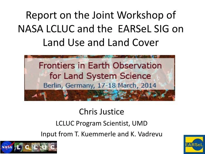
Report on the Joint Workshop of NASA LCLUC and the EARSeL SIG on Land Use and Land Cover . Chris Justice LCLUC Program Scientist, UMD Input from T. Kuemmerle and K. Vadrevu . Hosted by the Geography Department, Humboldt University Berlin, Aldershof 156 researchers from 32 countries .

E N D
Report on the Joint Workshop of NASA LCLUC and the EARSeL SIG on Land Use and Land Cover Chris Justice LCLUC Program Scientist, UMD Input from T. Kuemmerle and K. Vadrevu
Hosted by the Geography Department, Humboldt University Berlin, Aldershof156 researchers from 32 countries
Meeting Approach • 8 paired keynotes (NASA LCLUC and EARSeL) • 100 posters (1 minute introductions) • Workshop Themes • New sensors and emerging opportunities for land use and land cover monitoring, • Advances in Land-Cover and Land-Use Science using Earth Observations, • Mining the archives: better use of existing data for long-term LUCC studies, • Frontiers in Remote Sensing of Land Cover and Land Use. • Post poster session discussions
https://www.geographie.hu-berlin.de/professorships/geomatics/events/earsel-en/workshophttps://www.geographie.hu-berlin.de/professorships/geomatics/events/earsel-en/workshop
We have the most detailed picture of the globe ever • More land-focused satellite sensors than ever before! • Many land-focused higher order products GlobCover V2 (2004-2006) Source: theresilientearth.com, ESA
New sensors and emerging opportunities for land use and land cover monitoring • Observations from new sensors including LANDSAT, VIIRS, Sentinels, ProbaV, CBERS 4, present opportunities and challenges for LCLUC research to continue to monitor, better characterize surface conditions, detect changes as they are occurring; construct comprehensive histories of LCLUC.
New European Systems • SENTINEL sensors, a fleet of Earth Observation satellites will be available from the year 2014 at different spatial scales (10m-300m) and with different systems (Optical, Microwave). Operational Context. • Sentinel-1 – launched 3rd April, 2014 (polar orbiting all weather day/night radar imaging mission). • Sentinel-2a – launch 2015 (polar orbiting, multispectral high resolution mission for Land monitoring), 2b in 2016 • Sentinel-3a /3b –SST, LST, Ocean/land Color • Sentinel-4 – Atmospheric monitoring • Sentinel-5 - Geostationary Atmospheric monitoring mission • Sentinel-6 – Radar altimeter to measure global sea-surface height. • Copernicus program is a European initiative for the implementation of information services dealing with Sentinel-2 missions (2015 launch). All Level-1C products (TOC reflectance and ortho-rectified images) and Level-1B products (radiance images in sensor geometry) will be freely disseminated. • NASA/ESA/USGS/GSFC/CESBIO/UMD – exploring standardized processing
New European Systems Coarse Resolution • Envisat-MERIS- ended in April 2012 that contributed to the Globcover product. SPOT-5 Vegetation de-commissioned in 2014; • Sentinel-3a is expected during 2015. Sea and Land Surface Temperature Radiometer (SLSTR), based on Envisat's Advanced Along Track Scanning Radiometer (AATSR), 500m spatial resolution in the visible and shortwave infrared channels and1 km in the thermal infrared channels. • Belgian-ESA PROBA-V(egetation) satellite was successfully launched on May 7th, 2013 providing daily global 1-km. Daily and 10-day products are readily available – similar to SPOT Vegetation product. (Native resolution 300m in Blue, Red, NIR and 600m SWIR) Currently, the satellite is in commissioning phase.
New European Systems • ENMAP (Environmental Mapping and Analysis) a German (GFZ/DLR) satellite mission providing high resolution Hyperspectral imagery - 244 spectral bands from 420 to 2450 nm with a ground resolution of 30 m x 30 m. The swath width amounts to 30 km at a maximum swath length of up to 5000 km a day. The off-nadir (+/- 30°) pointing feature enables fast target revisit of 4 days. 2015 Launch.
Opportunities for next generation products • Truly exciting times to be involved in remote sensing for land change science! • New sensors • Higher resolution data (lots of it!) • Sensor constellations, multi-scale applications • New technologies • New, automated algorithms • Processing power • New data access policies • Longer time series • Open image archives! Landsat 8 In Orbit as of February 2013 Sentinel 2Scheduled for 2015
Mining of the Archives • Reconstruction of historic LCLUC is essential part of the research. • Historical data exist: • Landsat, MODIS, AVHRR GAC CDR data provide opportunities. • AVHRR 1km, SPOT archives – TBD • Some Challenges: • Securing easy, high-volume data access from all systems (data policies) • Processing requires innovative archiving facilities, data management and mining tools. • There is a need for automated tools for manipulating large, high dimensional data; • Interoperability of data and products from different systems • Integration of RS data and ancillary data at different temporal and spatial scales; • Uncertainty problem (due to class definitions) and data products needs to be addressed
Mining of the Archives • Data blending approaches (e.g. combining LANDSAT with MODIS) are gaining interest - to produce multi-source, time-series datasets useful for LCLUC studies. • Web-based technologies and open source software are emerging to handle multi-source and time-series remote sensing data. • Example: 30m weekly, seasonal, monthly and annual composited LANDSAT data for conterminous US available from WELD, a NASA sponsored WELD product providing a basis for moderate resolution product development
Making full use of all available data • Global Landsat compositing – WELD Top of atmosphere reflectance product for the year 2010 derived from >120,000 Landsat TM/ETM+ images • Source: WELD Project / David Roy
Making full use of all available data • Image compositing to create fine-scale, homogeneous, and cloudfree image datasets across large areas • Here: Carpathians in Eastern Europe
Poland Ukraine Slovakia Hungary • Reconstructing land change histories (1985-2012) at the regional scale • Here: Carpathians in Eastern Europe Romania • Griffiths et al. (2013) Rem. Sens. Env. • Griffiths et al. (2013) Env. Res Letters • Griffiths et al. (2013) IEEE JSTARS
Making full use of all available data • The first global, fine-scale forest change map (2000-2012) • Source: Hansen et al. 2013
Making full use of available data • The Landsat image archive: reconstructing land use histories back to the 1980s! Brazilian Amazon Source: Müller et al, in prep.
Summary: observing land cover • Paradigm shift in earth observation for land change science • Rapid increase in data availability • Analyzing all available data • This will allow • Detect more subtle kinds of land change • Detect change more reliably • Reconstruct comprehensive land change histories • Detect change as it is occurring • But we are only at the beginning
Trends in LCLUC Methods using • Earth Observations • Increasing importance given to projects with Societal Benefit or Policy Implications. • Need for timely and accurate monitoring of the Earth’s surface to inform resource management and policy. • Multi-scale, multi-temporal analytical methods providing opportunities for LCLUC studies • Hybrid and ensemble based classification algorithms for LCLUC studies gaining popularity. • GEOBIA methods being developed for fine resolution data. • Data fusion approaches feasible with new data policy and open source software developments.
Limitations and gaps • Most large-area land cover products still coarse in scale • Mostscience products still snapshots in time – not operational • Continued need for homogenization of legends • Lack of systematically sampled calibration and validation data • Sometimes large differences among alternative thematic maps, especially for dynamic regions and certain classes e.g. agriculture
Limitations and gaps • Differences among global land cover maps • Here: GLC2000, MODIS Land Cover & GlobCover Cropland disagreement Forestdisagreement Cropland & Forestdisagreement Source: www.geo-wiki.org
Identified Frontiers in LULUC at the Meeting • Integrating RS derived LU data and models to understand climate and vegetation dynamics at large spatial scales still seems a challenge. • How socioeconomic shocks affect land use/cover and how long-term legacies of past shocks reverberate in current land use patterns. • Increasing need for integrated approaches in applied discipline areas such as disaster management, food security, ecosystem vulnerability assessments, adaptation, etc., for overall Societal Benefit. • Moving from LC to LU
Moving from land cover to land use • Longer time series help to translate from land cover change to land use change Fallowandactiveagriculture in Europefortheyear 2005 Fallow farmland Active farmland • Source: Estel et al., in prep.
Moving from land cover to land use • Longer time series help to translate from land cover change to land use change Fallow frequency of agricultural land in Europe (2001-2012) Low(0yr) High(12yrs) • Source: Estel et al., in prep.
Moving from land cover to land use • Longer time series help to translate from land cover change to land use change Recultivation of set-aside and abandoned land in 2007 - 2012 1% 100% • Source: Estel et al., in prep.
Assessing land management intensity EU 27 cerealproduction Source: FaoStat Source: Rounsevell et al. 2012, Land Use Policy
Summary: land management • Much room for improvement regarding datasets on land management for larger regions • Advances in earth observation will help • Lack of ground data on land management the most problematic bottleneck • Moving forward • Better data sharing, e.g., GEOSHARE • Crowdsourcing, e.g., GeoWiki • Standardization and harmonization • Validation and documentation of existing datasets
Conclusions • A new era in earth observation for land change science • Using all available data to reconstruct land use histories • Observing changes as they occur • Substantial progress regarding indicators of land management, yet: • Lack of ground data on management • Major data gaps - especially for grazing and forestry • General lack of consistent time series • Detecting land system transitions requires long time series, integrating a range of data, and combining place-based and network analyses
An increasingly popular venue for LCLU community • 12 Parallel Sessions (AGU-like) • 700 Attendees – 500 turned away !! • Next GLP OSM Fall 2016 – tbd