Advances in Vegetation Continuous Fields: Updates on Tree Cover and Ground Layer Assessment
This report outlines the latest developments in Vegetation Continuous Fields (VCF) from the University of Maryland and NASA Goddard. Key updates include new annual layers indicating percent tree cover, bare ground, and herbaceous cover, all at a 250m resolution. Improvements to modeling code, particularly for tree cover assessment in cloudy tropics and sparsely wooded areas, are highlighted. The evaluation of tree cover and ground layers utilizes Lidar data for error estimation. Anticipated product availability is within 2-3 months, aiding global vegetative monitoring.

Advances in Vegetation Continuous Fields: Updates on Tree Cover and Ground Layer Assessment
E N D
Presentation Transcript
Vegetation Continuous Fields: C5/6 Updates Charlene DiMiceli , John Townshend, Matt Hansen, Rob Sohlberg, University of Maryland Mark Carroll, Sigma Space, NASA Goddard
Vegetation Continuous Fields—C5 • Version 1 at LP-DAAC—percent tree cover • 250m resolution, annual • New layers—percent bare, percent herbaceous • Code and models delivered/tested • Minor improvements to bare models ready for testing • Products available in 2-3 months
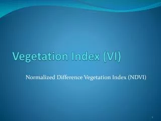
VCF Bare Ground LayerAustralia 2010 Percent Vegetated 100 0
VCF Bare Ground LayerAustralia 2010 Percent Vegetated 100 0
Vegetation Continuous Fields—C6 • MOD44C compositing code—L2G lite version in place • VCF—no code changes • Testing requires 1 year of MOD09
VCF—Next steps • Evaluation of tree cover layer in progress • Tree cover layer improvements: --update training for sparsely wooded drylands --improve persistently cloudy tropics • Evaluation of bare and herbaceouslayers
A global percent tree cover map at Landsat resolution by reflectance-based downscaling of MODIS continuous fields J. O. Sexton, Xiao-Peng Song, M. Feng, P. Noojipady, A. Anand, D.H. Kim, D. Song, K.M. Collins, C. DiMiceli, C. Huang, S. Channan and J. R. Townshend Global Land Cover Facility, University of Maryland
Error estimation based on lidar-measured tree cover Three-dimensional distribution of lidar returns within one MODIS pixel (Sierra Nevada, CA test site). nadir oblique
VCF—Long-term Data RecordsMEaSURES • Annual product, 0.05°resolution • Uses Land Long-term Data Record of Surface Reflectance (Eric Vermote, NASA Goddard) • AVHRR, MODIS • 7 layers—including needleleaf, evergreen, broadleaf, deciduous • Annual regression tree models overcome instrument differences • Smoothing to remove noisy data for change detection
Percent tree cover, Amazon Basin, 1990--Land LTDR AVHRR data