Download
1 / 25
250 likes | 322 Vues
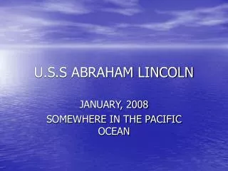
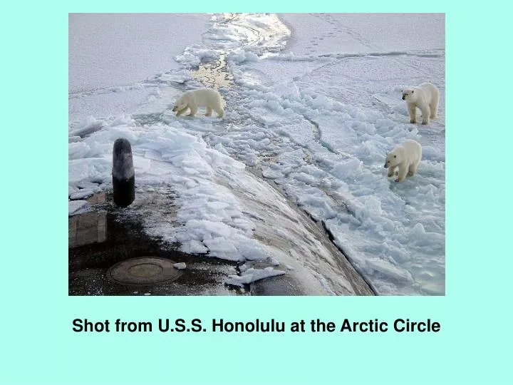
Shot from U.S.S. Honolulu at the Arctic Circle. AS AIR RISES, IT COOLS. AS IT COOLS, IT CAN HOLD LESS MOISTURE, SO CONDENSATION OCCURS. THE TEMPERATURE AT WHICH AIR REACHES 100% RELATIVE HUMIDITY IS CALLED THE DEW POINT.

E N D
AS AIR RISES, IT COOLS. AS IT COOLS, IT CAN HOLD LESS MOISTURE, SO CONDENSATION OCCURS. THE TEMPERATURE AT WHICH AIR REACHES 100% RELATIVE HUMIDITY IS CALLED THE DEW POINT.
LIFTED CONDENSATION LEVEL - THE HEIGHT AT WHICH AIR TEMPERATURE REACHES THE DEW POINT - THE HEIGHT AT WHICH CONDENSATION STARTS (THE BOTTOMS OF CLOUDS) LCL
AN AIR MASS IS A LARGE BODY OF AIR (FREQUENTLY THOUSANDS OF SQUARE KILOMETERS IN AREA) WITH SIMILAR TEMPERATURE AND MOISTURE CONTENT. THEY ARE CLASSIFIED BASED ON WHERE THEY START - THEIR SOURCE REGION. OFTEN, TWO DIFFERENT AIR MASSES WILL DEVELOP A SHARP BOUNDARY BETWEEN THEM. THIS BOUNDARY IS CALLED A FRONT. FRONTS ARE CLASSIFIED AS WARM FRONTS OR COLD FRONTS DEPENDING ON WHICH AIR IS MOVING OR OVERTAKING THE OTHER.
A cold front is the transition zone in the atmosphere where an advancing cold, dry stable air mass displaces a warm, moist unstable subtropical air mass. On a weather map, the cold front is drawn as a solid blue line with triangles. The position of the triangles shows the direction of frontal movement. Cold fronts move between 15 to 50 kilometers per hour in a southeast to east direction.
The formation of clouds and precipitation at the frontal zone is caused by frontal lifting. Precipitation is normally found just behind the front where frontal lifting has caused the development of towering cumulus and cumulonimbus clouds.
IN A WARM FRONT, WARM, MOIST AIR IS OVERTAKES COLDER DRY AIR.
On a weather map, a warm front is drawn as a solid red line with half-circles. The position of the half-circles shows the direction of frontal movement. Warm fronts move about 10 kilometers per hour in a northeast direction. This is less than half the speed of a cold front. The formation of clouds and precipitation ahead of the frontal zone is caused by gradual frontal lifting.
SOME DIFFERENCES: COLD FRONTS ARE NARROWER THAN WARM FRONTS. COLD FRONTS BRING STORMIER WEATHER. COLD FRONTS MOVE FASTER THAN WARM FRONTS.
AN OCCULUDED FRONT CAN OCCUR WHEN A FAST MOVING COLD FRONT OVERTAKES A SLOWER MOVING WARM FRONT.
WHAT DRIVES THE MOVEMENT OF FRONTS? DIFFERENCES IN PRESSURE DRIVE THE MOVEMENT OF FRONTS. WINDS WILL BLOW FROM REGIONS OF HIGH PRESSURE TO REGIONS OF LOW PRESSURE. PRESSURES ON A WEATHER MAP ARE SHOWN AS LINES CONNECTING AREAS OF EQUAL PRESSURE. THESE LINES ARE CALLED ISOBARS.
1013 MILLIBARS = 29.92 inches = 1 atmosphere AVERAGE PRESSURE AT SEA LEVEL = 1013 MILLIBARS
THE WINDS BLOWING INTO A LOW PRESSURE AREA BLOW COUNTER-CLOCKWISE IN THE NORTHEN HEMISPHERE. THIS IS BECAUSE OF THE CORIOLIS FORCE. LOW PRESSURE AREAS ARE CAUSED BY INCREASING TEMPERATURE.
WINDS BLOW CLOCKWISE AROUND A HIGH PRESSURE AREA IN THE NORTHEN HEMISPHERE.
SO, WEATHER IS CAUSED BY UNEVEN HEATING OF THE EARTH BY THE SUN. THIS UNEVEN HEATING PRODUCES AREAS OF HIGH PRESSURE AND AREAS OF LOW PRESSURE. WIND RESULTS AS AIR MOVES FROM HIGH PRESSURE AREAS TO LOW PRESSURE AREAS. AS AIR MASSES MOVE, WEATHER OCCURS ALONG THE BOUNDARIES. WARM AIR IS FORCED UPWARD OVER COLD AIR, AND CONDENSATION OCCURS.
WEATHER MOVES FROM WEST TO EAST IN THE U.S. LOW PRESSURE AREAS ARE ASSOCIATED WITH CLOUDY WEATHER AND PRECIPITATION. HIGH PRESSURE AREAS ARE ASSOCIATED WITH CLEAR WEATHER.
WARM FRONT COLD FRONT OCCLUDED FRONT STATIONARY FRONT WEATHER MAP SYMBOLS