Download
1 / 25
350 likes | 1.12k Vues
Introduction to SonTek RiverSurveyor M9 &S5. River Discharge Measurement System. Hoboken, NJ June 2012. Advancements:. New Doppler engine New transducer configurations New multiple frequency configurations New automated cell-size switching and signal processing (SmartPusleHD)

E N D
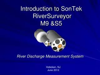
Introduction to SonTekRiverSurveyorM9 &S5 River Discharge Measurement System Hoboken, NJ June 2012
Advancements: • New Doppler engine • New transducer configurations • New multiple frequency configurations • New automated cell-size switching and signal processing (SmartPusleHD) • New housings and power-communications modules • New PC and mobile software • New high-resolution GPS options • New floating platform
S5 & M9 Acoustic Doppler Profilers • Significantly faster ping rates (20-60 Hz) - robust and accurate measurements. • Integrated multiple acoustic frequencies. • Integrated acoustic vertical beam transducers – for depth. • SmartPulseHD – transitions water-profiling automatically. • Large internal recorder (8 Gb) - Discharge processing and data storage is done inside the ADP and in software. • Increased Processing Power for discharge calculations, real-time data quality checking, on-line summary tables, etc… • Dramatically improved bottom tracking resolution and precision.
RiverSurveyor S5 & M9 Enhancements for the user • SmartPage Setup – Guided setup and configuration. • SmartPulseHD – automatically adjusts water velocity measurement technique to adapt to changing river conditions. Requires “NO” user-based setup or configuration. • Moving-bed tests – USGS “Loop-method” and USGS “SMBA-method” included in software. • Redundant depth measurements with low-frequency vertical beam. • High-resolution GPS system integration – ease of use and setup.
RiverSurveyor“S5” Shallow range system • 5 beams, dual frequency • 4 beam Janus for velocity (3.0Mhz) • 1 centered vertical beam (1.0 MHz) • Velocity profiling range (0.06 m to 5.0 m*) • Vertical beam range (0.2 – 15 m) • Discharge Measurement Range • 0.3 to 5m referencing bottom tracking • 0.3 to 15 m referencing GPS • 2.4” diameter transducer housing • Low-flow disturbance * Maximum profiling range can vary depending on conditions
RiverSurveyor“M9” Mid-Range system • 9 beams, tri-frequency, dual Janus array • 4 beam Janus for velocity (3.0Mhz) • 4 beam Janus for velocity (1.0 MHz) • 1 vertical beam (0.5 MHz) • Velocity profiling range (0.06 m – 30.0 m*) • Vertical beam range (80m) • Discharge measurement range • 0.3 to 30m referencing bottom-track • 0.3 to 80 m referencing GPS * Max profiling range can vary depending on conditions
S5/M9 Measurement Distribution • The S5/M9 pings up to about 80 Hz. • Pings are distributed between Bottom-tracking (BT), Water Profiling (WP), Vertical-Beam (VB) to optimize measurements. • Typically BT pings at 5 Hz. • WP pings depend on frequency and depth. • 3 Mhz pings about 55 – 60 Hz • 1 Mhz pings about 12 – 14 hz • VB pings about 8 – 10 Hz • 10-Hz GPS data is easily synchronized with S5/M9 data
Power & Communications Module Battery Compartment System/status lights On/off button (w status light) Connector to power/com cable or dummy plug Connector to M9/S5
Power & Communications Module • Drop-in replaceable/rechargeable 18v battery packs • Battery charger • Bluetooth or FreeWave 900-Mhz Communications • Internal antennas • Wet-mate connections • 10-m cable and AC power supply for direct reading and external power • Modules arefully independent of frequency and can be used with M9 or S5
Power and Communication Module (PCM) Telemetry Configurations Base Unit Bluetooth dongle* 200-m range • Rover PCM and corresponding Base unit are matched and configured at factory • No possibility for data drops – internal ADP calculations and processing Base Unit PCM Radio link only 2000-m range Rover PCM * Connects to laptop Base Unit Bluetooth mobile 60 m range Direct Connect to S5 or M9 Radio or Bluetooth Internal Antennas
RiverSurveyor Software • PC and Mobile Based “Moving-boat” method • Data is stored on PC/Mobile Device and Instrument • Measurement can be started and stopped using different devices • PC and Mobile Based “Stationary-boat” method (optional) • Data is stored only on PC/Mobile Device • Measurement can be continues after interruption • Ice-measurements • Measurement template included (for repeated measurements)
RiverSurveyor Mobile Platform • Windows Mobile • Utilizes Motorola Q phone • Bluetooth telemetry – 60m range • Extremely easy and robust • Complete calculation on the fly. • QA checks during data collection. • Graphics for contour, ship-track, and profiles plots
RiverSurveyorMobile Platform Enables one person operation Protective enclosure provided for foul weather
S5 and M9 GPS Options • Direct connect GPS (customer supplied) • Allows use of existing GPS • Specific requirements for operation with M9/S5 • Differential capable • RS232 output • 10-Hz data rate (minimum) • GGA/VTG NMEA strings • SonTek Differential GPS • For use in streams larger than 20-m in width • SonTek RTK (Includes base station) • For use in streams larger than 1-m in width
S5 and M9 GPS Options • SonTek Differential Solution • GPS electronics are housed in rover PCM • SonTek provides antenna, mount, cable, and pole that attaches to top of S5/M9 ADP housing • Setup is automatic once PCM box is powered. • GPS lock time is typically within minutes. • Useful in streams 20-m in width or larger
SonTek RTK GPS • Automatic setup once PCMs are powered. • Base-Station dose not require precise positioning. • 10-Hz sampling rate • Useful in streams 1-meter in width or larger GPS contained in rover PCM with additional radio link to RTK base station PCM. 1-mile range typical RTK Base station PCM, tripod, and Radio telemetry
Using SonTek RTK GPS SBAS SBAS SBAS SBAS SBAS SBAS GPS GPS GPS GPS GPS GPS GPS GPS GPS Differential Differential Differential Differential Differential Differential Correction Correction Correction Correction Correction Correction GPS GPS GPS GPS GPS GPS GPS GPS GPS GPS GPS GPS Position Data Position Data Position Data (GGA/VTG) (GGA/VTG) (GGA/VTG) Position Data Position Data (GGA/VTG) (GGA/VTG) RTK Correction RTK Correction RTK Correction SonTek SonTek Base Station Base Station SonTek SonTek SonTek RTK Internal Solution RTK Internal Solution RTK Internal Solution
Floating platforms OceanScience Tri-hull SonTek Hydroboard
Welton-Mohawk Canal Drain • USGS Rating = 5.35 m3/s • S5 with RTK/VB provided best (only) solution = 5.35 m3/s COV 1.7% • Too narrow (6.62 m) for differential GPS. RTK precision required. • True channel shape/area measured with vertical beam 4-beam average Vertical Beam
S5 - Welton-Mohawk Canal Main • USGS Rating =13.56 m3/s • S5 measured discharge = 13.50 m3/s COV = 1.2% • Larger trapezoidal canal with sedimentation Vertical Beam – sedimentation clearly visible 4-beam average
Upper Mississippi flooding June 2008 SonTek’s John Sloat sets up RTK base station in cornfield RTK Rover SonTek’s Muthiah Radhakrishnan And ISW’s Jim Slowikowski set up M9 and S5 S5 M9
M9 - Mississippi flooding June 2008 • First full flood measurement including flood plain • RTK GPS used to account for moving bed bias • Max. Depth = 24.5 m • Min. Depth = 0.4 m • Discharge = 3103 m3/s Main Channel Flood Plains
Rio Solimões, Brazil 145’ maximum depth