Deformation and Slip Analysis at Wrightwood Site - Comprehensive Study
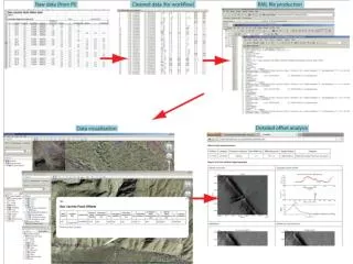
Summary of slip calculations and relative dating at Wrightwood site, incorporating sedimentology and fault analysis for earthquake probability assessment. Detailed examination of stratigraphic horizons and slip rates for seismic hazard evaluation.

Deformation and Slip Analysis at Wrightwood Site - Comprehensive Study
E N D
Presentation Transcript
Much of the deformation at the Wrightwood site is distributed across complicated small faults and folds that, in the few places we have deeply exposed them, root into low angle structures. To calculate the slip associated with these structures we have used a cross sectional area balancing approach often used to relate growth strata or erosional unconformities to detachments at depth.
Summary of the Wrightwood Upper Section’s ages and offsets. Note the huge uncertainties in slip. We did not go here to measure slip per event. But we could not ignore the evidence we were collecting, so we did our best to put it together. See Sept. 2004 GSA Today for details
We know the probability of an earthquake (in M) rupturing the ground surface. Once the surface is ruptured we have relationships between M, L, u (slip) We know how slip varies along strike for a given average displacement. So given an earthquake, we can say what the displacement (including its uncertainty) will be at a point (trench site) on the fault. Using data from trenches, we can determine the resolution (both temporal and to the amount of displacement). Fundamentally based on thickness and frequency of deposition of discrete sedimentary layers. We also need a “rake” factor (angle of slip to bedding) and a “facies” factor (how fast a layer changes character or thickness).
With a sedimentation rate of ~1 m/100 yrs, and individual clastic units representing on average 5-10 years, we can distinguish events that are likely separated by decades. Here are two earthquakes separated by just 20-30 cms, and thus likely 20-30 years (as the C-14 shows).
There are several transtensive step-overs within the closed basin at the Frazier Mtn site. We are working to construct 3d surfaces of critical stratigraphic horizons to quantify the folding associated with individual paleo- events. By comparing the folding formed during prehistoric events to that generated by the ~5 m of 1857 slip we can estimate paleo-slip.
In a few places we have used 3d trenching to determine the slip on minor faults within the deforming zone. Note how the blue unit changes in thickness from NW (top) to SE (bottom) and across the fault. The plot above shows the resulting reconstruction of the lateral component (right!) of the slip.
Composite Stratigraphic Column modern BSSA: Biasi, 2002; Fumal, 2002; Scharer, 2007 Young Section 1500 B.C. 12 meters 44 clastic layers 15 earthquakes Old Section 4 meters 44 clastic layers 14 earthquakes 1500 A.D. 3000 B.C. Middle Section
Wrightwood Stratigraphy • 6,000 years of deposition • Marsh capped periodically by debris flow deposits • No fluvial deposits before 1850’s Volume Time
Dated Interpolated Young Section 12 yr 236 yr Sedimentation Event Return Interval Cumulative Frequency 37 yr Earthquakes 2 cm/yr Clastic Accumulation Rate (cm/yr) Cumulative Thickness (cm) 0.6 cm/yr 0.4 cm/yr Calendar Year (A.D.)
Starting w/ W13 Age of debris flow layer is age of underlying peat.
Of the 111 UCERF-2 slip rates we can associate with USGS Quaternary Faults Database slip rate categories, 96 UCERF rates fall in the consistent USGS category, 6 UCERF rates are too high, and 9 UCERF rates are too low. • We need to check the 15 that are not consistent and do some work to associate the rest of the UCERF rates with their USGS categories so we can check their consistency. • We can use the USGS Quaternary Faults Database to assign slip rate categories to UCERF faults that we don’t have slip rates for.