Download
1 / 20
200 likes | 493 Vues
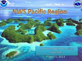
GPS Units in the Pacific Region. Bill Ward PACIFIC REGION 5/5/11. 2/26/09. Outline. Area of Responsibility PR Observing Program/GPS Information Location of sensors Programmatic areas/Data Uses Key Opportunities/Challenges Summary. Area of Responsibility. Pacific Region WFOs / WSOs

E N D
GPS Units in the Pacific Region Bill Ward PACIFIC REGION 5/5/11 2/26/09
Outline • Area of Responsibility • PR Observing Program/GPS Information • Location of sensors • Programmatic areas/Data Uses • Key Opportunities/Challenges • Summary
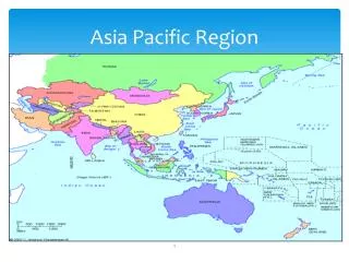
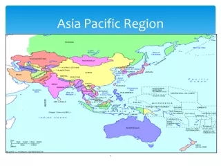
Area of Responsibility • Pacific Region • WFOs / WSOs • Central Pacific Hurricane Center • Pacific Aviation Center Responsibilities • Marine Center Responsibilities • Climate Responsibilities • International Tsunami Information Center • Pacific Tsunami Warning Center • IT/ET (MOBET) service area
PR Observing Program • NWS PR supports numerous islands throughout Hawaii, American Samoa, Guam, CNMI and Micronesia via Weather Surface & Upper air Observations, Satellite Ground Stations, GPS Sensors, Buoys, Ships, Planes, etc.,…. • Invaluable support for our Watch, Warning and Advisory programs • Provides verification and forensic support • Used day to day in our forecasts
PR Observing Program(cont) • Challenges • Communications and infrastructure • Availability of airlines and ships to safely travel to remote locations to setup and maintain • Limited resources for Operations and Maintenance • Highly corrosive environments • High costs for equipment, contracts, travel and shipping
BackgroundWhat is GPS-Met? • GPS-Met is a ground-based system that measures the delay in the GPS radio signal caused by water vapor above the surface station • System uses low cost COTS GPS receivers • collocated with surface meteorological sensors • Accurate, all-weather, requires no external calibration, accuracy thought to improve (vs. degrade) with time • Improvements demonstrated in satellite calibration/validation (Cal/Val), weather forecasting, climate monitoring, and in situ (e.g., rawinsonde) QC
GPSMet Units in PR • Guam Kwajalein • Saipan Lihue • Majuro Hilo • Pohnpei Midway • Chuuk Rose Atoll • Yap Wake Island • Palau • American Samoa
Programmatic Areas • Local Forecasts and Warnings • Supports model validation • Tropical forecasting • Atmospheric Rivers • Tsunami information • Ground displacement • Possible TWC support • Elevation Datum • Climate information • Ground truth/elevation • Tide station data
Mission Applications • GPS-Met currently adds value to a wide range of meteorological applications • Satellite calibration and validation (IPW) • Radiosonde and aviation (TAMDAR & WVSS-2 water vapor QC) • NWP performance (assimilated into GFS, HRRR and others) • Climate reference/GRUAN (observations do not drift over time) • Input into other water vapor products (e.g., Blended Precip) • All-weather capability (during high impact events) • Future value in “initiation of convection”, tropical, hydrologic, aviation, and marine applications, as well as part of National Mesonet • Importance to NOAA • Partnerships with many other organization • Seismic • Climatology • Laboratories • Universities
GPS System Performance • New sites to the deep tropics • Sites completed in April for Micronesia • Monitoring • http://gpsmet.noaa.gov/ • http://amsu.cira.colostate.edu/TPW/ • NCEP • WFO
Wolf Creek, CO Tucson, AZ SSM/I Integrated Water Vapor Image: Northward displacement of tropical IWV
A Kona low lashed the Hawaiian Islands on December 29, 2003. The bluish blob east Of the system's center represents the tops of convective clouds. Courtesy of the Cooperative Institute of Research in the Atmosphere at Colorado State University
Data Quandaries • Pacific Region is data sparse • GPS sensors (Additional locations) • Automated data sites • Wind Profilers (Continuous winds aloft) • Satellite IPW (Future algorithms) • Importance of MJO, TUTT, Tropical Regimes, Subtropical & Mid Latitude Phenomena • Vertical transport of moisture • Meridional transport • Mid lat systems
Summary • Pacific Region covers a vast area of responsibility • Unique region in the NWS in diversity of comms and variety of offices/services • Resource needs reflect a customized and innovative approach to meeting mission requirements
Questions Contact: Bill Ward NWS Pacific Region Headquarters Environmental Scientific & Services Division Chief Bill.Ward@noaa.gov 808.532.6415