Download
1 / 40
400 likes | 787 Vues
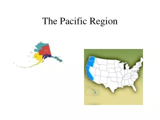
Pacific Coastal Region. Sacramento. California. Oregon. Salem. Olympia. Washington. Hawaii. Honolulu. Alaska. Juneau. History.

E N D
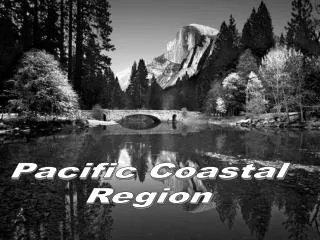
Pacific Coastal Region
Sacramento California Oregon Salem Olympia Washington Hawaii Honolulu Alaska Juneau
In 1848, the discovery of gold at Sutter’s Mill brought over 40,000 people to California in two years. Everyone was hoping to find great fortunes in gold. The gold rush caused a burst in agriculture, industry, commerce, and transportation within the California region. GOLD RUSH Click here to experience the gold rush for yourself.
The Oregon Trail was used as a route to travel from the Missouri River to the Columbia River. It was the most common route west. Families traveled with all of their belongings in covered wagons. Problems along the way included disease, starvation, and flooded streams.
The Pacific states are located on The Ring of Fire, which is a part of the Earth that is prone to earthquake and volcanic activity. VOLCANOES Go on a virtual tour of Mount Saint Helens Virtual volcano
The “Sierras” extend 400 miles in the central part of eastern California. Sierra Nevada Mountains
Mt. McKinley Mt. McKinley is the highest point in North America. It is 20,320 feet high.
Coastal Mountains The coastal mountains run parallel to the Pacific Ocean and span 1,000 miles. The range is composed primarily of metamorphic rock that slope steeply into the Pacific Ocean. The mountains have a drastic effect on the climate in California.
Physical Features: WATER
Pacific Ocean The Pacific Ocean is the largest of the 5 oceans in the world. It covers about 1/3 of the world’s surface.
Bering Sea The Bering Sea is north of the Pacific Ocean and south of the Arctic Ocean. Ships can only travel on the Bering Sea from June to October since it is usually covered with ice.
Bering Strait At 55 miles wide, the Bering Strait lies between NE Asia and NW Alaska. It connects the Arctic Ocean and the Bering Sea. This area used to be connected and a natural bridge was formed between the two continents.
Puget Sound The Puget Sound is the “arm” of the Pacific Ocean. Large ships can travel on it to the numerous ports and large cities.
Arctic Ocean The Arctic Ocean is the smallest ocean. It is located entirely within the Arctic Circle around the North Pole.
Lake Tahoe The lake covers 72 miles of shoreline It is 22 miles long and 12 miles wide. Its greatest depth is 1,645 feet. It averages about 1,000 feet deep. 3rd deepest lake in North America and 10th deepest in the world There is enough water in Lake Tahoe to supply everyone in the U.S. with 5 gallons of water each day for 5 years. Lake Tahoe was formed by fractures in the earth’s crust . Blocks of land sand and rose over several millions of years as the Sierra Nevada Mountains rose from the sea. The lake gets its water from rain, snow and draining creeks.
Columbia River The Columbia River is over 1,200 miles long. It forms a natural border between Oregon and Washington before it enters the Pacific Ocean. The Snake River is a major tributary.
Aleutian Islands At the wildlife preserves, you will find sheep and reindeer. The Aleutian Islands are a chain of volcanic islands that extend about 1,200 miles from Alaska towards Asia. The islands can be dangerous for ships because of the many reefs. There are not many good harbors, but there are active volcanoes.
Hawaiian Islands The Hawaiian Islands are located in the North Pacific Ocean. They extend over 2,000 miles. They have been formed from shield volcanoes over millions of years. Some Hawaiian beaches have black sand that was formed from the reaction of lava and seawater.
Death Valley Death Valley has the lowest point in North America at 282 feet below sea level. It also has the highest ground temperatures in the world and generally gets less than 2 inches of rain each year.
Mojave Desert • The Mojave Desert is located in southern California. It gets about 5 inches of rain each year. • A geothermal energy plant was made there in 1978 in order to research alternate energy sources. • In 1995, a low-level nuclear waste site was developed there. People who care about the environment were upset about this because they thought it would affect the drinking water.
Natural Landmarks
Yosemite National Park Established as a national park in 1890, Yosemite has great glaciers and cliffs. Half Dome and El Capitan are two of its highest peaks. Three of the world’s largest areas of exposed granite are also found here. Yosemite Falls is the highest waterfall in North America.
Redwood National Park • You will find California Redwood trees here- some that are over 2,000 years old. • The world’s tallest tree is located here. It is 367.8 feet high. • One redwood measured 325 feet in diameter!! • The biggest trees are probably about 3,000 years old.
Crater Lake lies in huge pit that was made when the top of a prehistoric volcano was blown off by an eruption. The lake is 20 square miles and gets its water from rain and snowfall. It is the 2nd deepest lake in North America. Crater Lake National Park
Mount Ranier Mount Ranier is located in SW Washington and is part of the Cascade Mountain Range. The volcanic peak is covered with 26 glaciers.
Olympic National Park The Olympic Mountains, which are mostly made of sedimentary rock, are the highest mountains on the Coastal Ranges. The western side of the mountains gets about 130 inches of rain per year. The northeast side of the mountains is one of the driest parts of the West Coast. The national park has a 50-mile stretch of land on the coast that has wildlife sanctuaries.
Hawaii Volcanoes National Park The park contains two of the most active volcanoes in the world- Mauna Loa and Kilaueau
Man Made Landmarks
The first film was made here in 1911, and many movies and television shows have been made here throughout history. It is a major tourist attraction.
Pearl Harbor On Dec. 7, 1941, Japan attacked Pearl Harbor and destroyed many U.S. battleships. It is now a national historic landmark, and a memorial has been built over the USS Arizona. Located on the southern coast of Oahu in Hawaii, Pearl Harbor is one of the largest and best harbors in the Pacific Ocean.
Golden Gate Bridge The bridge was built from 1933-1937. It spans 9,266 feet. It is one of the largest bridges in the world.
Built in 1962 for the World's Fair in Seattle, the 605 foot Space Needle is Seattle's most popular attraction. The observation deck at the 520 foot level provides a 360 degree view of the city as does the Needle's "SkyCity" revolving restaurant at the 500 foot level. When the Space Needle was built in 1962, it was the tallest building west of the Mississippi River. Space Needle
Boating airlines Alaskan Pipeline Movement seaports
Agricultural Products sugarcane fruits vegetables pineapples
Natural Resources Fish Iron ore Copper forests
Language Spoken English Spanish Asian
Interactions with People • Crowded cities • Emission control laws- pollution • Waste disposal • Oil spills • Earthquakes • California: most populated state with a large number of Mexicans and Asian Americans