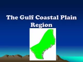
The Gulf Coastal Plain Region
460 likes | 922 Vues
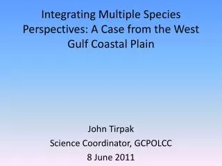
The Gulf Coastal Plain Region. The Piney Woods (blue) Eastern most subregion The Gulf Coast Plain (yellow) South and west of the Piney Woods The Post Oak Belt (purple) West of both Piney Woods and Gulf Coast Plain. 5 Subregions:. The Blackland Prairie (brown)

The Gulf Coastal Plain Region
E N D
Presentation Transcript
The Piney Woods (blue) Eastern most subregion The Gulf Coast Plain (yellow) South and west of the Piney Woods The Post Oak Belt (purple) West of both Piney Woods and Gulf Coast Plain 5 Subregions:
The Blackland Prairie (brown) Stretches west along Post Oak Belt The South Texas Plain (pink) West of the Gulf Coast Plain 5 Subregions:
Piney Woods • The Gulf Coastal Plain can be divided into five subregions or smaller regions. • The easternmost subregion of the Gulf Coast Plains is the Piney Woods. • It is part of a pine forest that covers the entire southern United States from the Atlantic Ocean to Texas.
Piney Woods • .Most of the land in the Piney Woods is rolling hills. • The Piney Woods also has one of the wettest climates of any Texas Subregion. • Rainfall helps support a large timber industry in the heavily forested area of the Piney Woods.
Piney Woods • Gum, hickory, oak and pine trees are an important source of timber and wood products for the subregion. • Farming is also an important part of the subregion’s economy.
Piney Woods • The rich soils and wet climate are ideal for producing many fruits and vegetables. • In areas where farmers have cut down forests, tall grasses have grown. • Farmers raise cattle in these open grassy areas.
Piney Woods • Oil is another valuable natural resource in this subregion. • Large amounts of oil were discovered here in the 1930s. • The oil industry contributes the economy of many regional cities such as Henderson and Kilgore.
Piney Woods • This subregion’s creeks, lakes, and rivers also provide it with significant water sources. • The area includes the Neches, Sabine and Trinity Rivers as well as the Toledo Bend and Sam Rayburn Reservoirs. • These rivers and reservoirs proved many Texans with drinking water and places of recreation.
Piney Woods • Many people in the Pine Woods live in rural areas or small towns. • These towns serve as local markets for farmers and the lumber industry. • The subregion’s largest cities are Longview and Texarkana. • These cities have prospered as the agricultural, oil and lumber industries have grown.
Piney Woods • Texans have taken action to preserve some of the area’s natural resources. • Big Thicket National Preserve was established to protect about 85,000 acres of trees and wildlife in the Piney Woods.
Piney Woods • This subregion also has four national forests: The Angelina National Forest, Davy Crockett National Forest, Sabine National Forest, and Sam Houston National Forest. The state conserves the natural resources of the forests. • When trees are cut down, new trees are planted in their place.
The Gulf Coast Plain • South and west of the Piney Woods lies the Gulf Coast Plain. • This subregion extends south along the Gulf Coast from the Sabine River to Corpus Christi Bay. The Gulf Coastal Plain
The Gulf Coast Plain • A chain of barrier islands runs nearly the entire length of the Texas coast. • These islands are covered by brush, grasses, and sand. • Shallow bays separate the islands from the mainland.
The Gulf Coast Plain • On the mainland near the coast, the land is marshy and full of bayous. • These usually form as tributaries off larger bodies of water. • The water in most bayous moves slowly. • Inland, scattered groves of trees dot the lush grasslands of the plains.
The Gulf Coast Plain • The soil and climate of the Gulf Coast Plain have made it a rich agricultural area. • Farmers grow rice in the eastern areas near the coast. • Farther south, in the Coastal Bend area, farmers produce cotton and grains.
The Gulf Coast Plain • The coastal grasslands also support one of the largest livestock industries in Texas. • The Gulf waters are another valuable resource. • Fishing and shrimping are major sources of income for many Texans.
The Gulf Coast Plain • Oil is another offshore resource, with offshore oil rigs providing many jobs for Texans. • The center of the Texans and U.S. oil industry is Houston and Beaumont.
The Gulf Coast Plain • The area also has a large petrochemicals industry. • Petrochemicals are chemicals made from oil and natural gas. • They are used in most industries.
The Gulf Coast Plain • Ports provide another boost to the economy of the Gulf Coast Plain. • Some of the largest cities in this region are port cities: Houston, Galveston, Beaumont, Corpus Christi and Port Arthur.
The Gulf Coast Plain • Products are shipped in and out of these ports to destinations worldwide. • As global markets have expanded, these ports have become increasingly busy. • Houston is the largest city in Texas and has the fourth largest population in the U.S.
The Gulf Coast Plain • The Houston metropolitan area stretches for 540 square miles. • Although Houston lies about 50 miles inland, a huge ship channel connects the city with the Gulf of Mexico.
The Gulf Coast Plain • Houston has the third largest seaport in the nation and a major center for international shipping. • The natural resources of the Gulf Coast Plain have boosted its industry and have attracted many people to the subregion.
The South Texas Plain • Lies west of the Gulf Coast Plain. • Extends south to the Gulf of Mexico where the land is low and flat. • In the northern and western area, the land gently rises and becomes more hilly
The climate in the subregion is drier than the Gulf Coast Plain. • Grasslands cover this coastal section, but dense brushlands characterize this subregion.
South Texas Plain • The South Texas Plain has one of the richest farming areas in the nation. • Temperatures are warm for most of the year. • The Valley has fertile soils from sediment washed down the Rio Grande.
South Texas Plain • Ranches are common throughout the South Texas Plain. • The subregion is mostly rural. • San Antonio is the largest city in the subregion. • The South Texas region is a major center for international trade.
The Post Oak Belt • The Post Oak Belt begins just outside San Antonio and stretches north the Red River. • It lies west of the Piney Woods and the Gulf Coast Plain. • The Belt has a similar climate to that of the Piney Woods.
The Post Oak Belt • Few part of the Post Oak Belt are covered in trees such as post oak, blackjack oak, elm, hickory, pecan and walnut trees. • Mesquite trees are becoming more common. • The area’s soil is sandier and the land is mostly flat.
The Post Oak Belt • Cotton is a major crop as well as sorghum, corn and grain to feed livestock. • Livestock is a major industry. Farmers raise cattle and hogs. • The regional economy depends on natural resources such as oil and natural gas.
The Post Oak Belt • The regional economy also depends on natural energy resources found underground such as oil and natural gas. • In addition, deposits of lignite, a type of soft coal, are mined there.
The Post Oak Belt • As in the Piney Woods, most residents of the Post Oak Belt live in rural areas. • However, a number of towns and small cities are scattered throughout the area.
The Post Oak Belt • The largest cities are Bryan—College Station and Tyler. • Manufacturing industries such as food processing, furniture construction and metalworking have developed in these cities. Bryan- College Station,Texas
The Post Oak Belt • Texas A & M University, a top educational institution in the state, is located in this subregion. Texas A & M University
The Post Oak Belt • Most people in the Post Oak areas live in rural communities. • The largest cities in the Post Oak Belt are Bryan-College Station
Blackland Prairie • The Blackland Prairie subregion stretches west alongside the Post Oak Belt. • The climate here is similar to the Post Oak Belt’s climate; its wet and mild. • Rolling prairies cover the landscape.
Blackland Prairie • The area’s rich, black soils make it ideal for farming. • Farmers here grow cotton, grains and vegetables. • Farmers also raise cattle, chickens, and hogs.
The Blackland Prairie • The Blackland Prairie is one of the most heavily populated subregions in Texas. • Its many cities include Dallas, Garland, Grand Prairie, Mesquite, Plano Richardson, Sherman, Waco, Temple and Allen.
The Blackland Prairie • Dallas is the second-largest city in Texas. • The city has many industries. • Home to a Federal Reserve Bank, Dallas is the center of the baking industry in both Texas and most of the Southwest.
The Blackland Prairie • Many insurance and oil companies have their corporate headquarters there. • Dallas is also a major center for the international cotton market.
The Blackland Prairie • The computer age began there at Texas Instruments. • The Dallas economy is based in part on the manufacture of items ranging from computer electronics to missile parts and high-fashion clothing.
The Blackland Prairie • Dallas lies 33 miles east of Fort Worth, a city in a neighboring subregion. • The economies of the two cities are so interlinked that people often refer to them as the Metroplex.
The Blackland Prairie • The two cities are a major transportation hub. The Dallas-Fort Worth International Airport is located between them.
The Blackland Prairie • Interstate 35 is an important trade route that runs through both Dallas and Fort Worth. • The highway starts at the Mexican border and runs through the U.S. almost to Canada. • The many roads and railroads around the Metroplex help promote the area’s growth.