Download
1 / 16
160 likes | 263 Vues
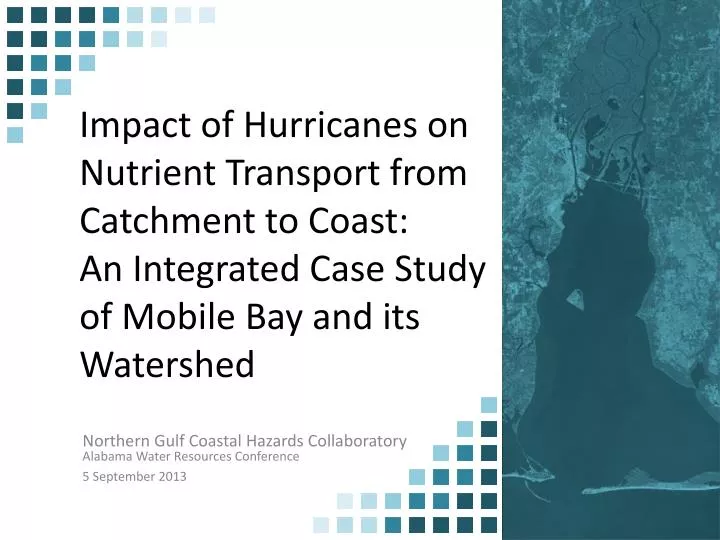
Impact of Hurricanes on Nutrient Transport from Catchment to Coast: An Integrated Case Study of Mobile Bay and its Watershed. Northern Gulf Coastal Hazards Collaboratory . Alabama Water Resources Conference 5 September 2013. Hypothesis & Approach.

E N D
Impact of Hurricanes on Nutrient Transport from Catchment to Coast:An Integrated Case Study of Mobile Bay and its Watershed Northern Gulf Coastal Hazards Collaboratory Alabama Water Resources Conference 5 September 2013
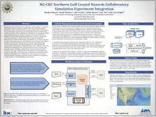
Hypothesis & Approach Does the speed of a hurricane making landfall near Mobile Bay impact the nutrient distribution within the bay? • University of Alabama - Mississippi State University – University of South Alabama – University of Alabama Huntsville Louisiana State University • Loosely coupled models – HSPF – WRTDS – EFDC – ADCIRC • Data Transfer – Analysis – Metadata – Data Extraction
Hypothesis & Approach Seamless DEM, Land Use MODIS/GIRAS, Stream Network, Outlet Locations, River Discharge, Water Quality Concentration, Grids, Wind Models. FUTURE Loose Couple Model HSPF – WRTDS – ADCIRC - HSPF Simulocean Pydap Visualization with CERA Visualization with SULIS
Technical Aspects • Use of Multiple Models • Transferring Large Text Files • Processes are in series, output of one model is the input of the next model • Scale and time issues
WRTDS – Weighted Regressions in Time Discharge and Season HSPF – Hydrological Simulation Program Fortran V. Alarcon, J. Cartwright, W. McAnally Geosystems Research Institute and Northern Gulf Institute A. Maestre, A. Ward, D. Williamson Civil Engineering and Biological Sciences EPA - STORET USGS - NWIS Data Graber / WUDEXT (Simulobot --> Future) Land Use Datasets Seamless DEM Concentrations WinHSPF WRTDS Output: Water Discharge Output: Nutrient Fluxes
Extreme Event Analysis A. Maestre, A. Ward, D. Williamson Civil Engineering and Biological Sciences Track of Category 4 and 5 Hurricanes that landed as Category 3+ Slow Moving Storms (25+ inches) Output: Slow / Fast Storms SLOSH Model Hurricane Dennis (2005)
ADCIRC - The ADvancedCIRCulation model C. Kaiser, K. Hu Center for Computation and Technology HURRICANE DANNY 1997 HURRICANE IVAN 2004 Slow Hurricane Fast Hurricane ADCIRC Output: Water Elevation in the Gulf of Mexico
EFDC – Environmental Fluid Dynamics Code EFDC – Environmental Fluid Dynamics Code K. Park Marine Sciences K. Park, A. Maestre, J. Cartwright Water Discharge EFDC Nutrient Fluxes (Total Nitrogen) Gulf Water Elevation Output: Nutrient Distribution after a Slow and Fast Hurricane
River discharge (QR) & TN load Information needed for EFDC simulation IC Wind Open BC
Water and Nutrient Discharge into Mobile Bay Ivan (2004) Danny (1997) landfall at 01:00 on 09/16 near Gulf Shores, AL landfall at 04:00 on 07/19 near Fort Morgan, AL Peaks in QR and TN load associated with Ivan No peaks in QR and TN load associated with Danny
Wind Fields input into EFDC Max wind = 32.3 m sec-1 Max wind = 32.7 m sec-1
Water level in Mobile Bay during Hurricane Events : During equatorial tide : Large surges : During tropic tide : Small surges
Points to Consider in Evaluating Hypothesis - How to evaluate/interpret model and process (precipitation patterns, track, surge, etc…) interactions that control nutrient peak and distribution - How to make a fair comparison when there was no large surges during Danny? - How to take into account of large rainfall during Danny (>932 mm on Dauphin Island)? - Effect of interaction between tides and hurricane landfall time (e.g. during tropic vs. equatorial tide) Things to try: - Run the model for a relatively long time period : 9/8-9/28 in 2004 for Ivan (landfall on 9/16) :7/11-7/31 in 1997 for Danny (landfall on 7/19) - Compare two hurricanes in terms of percentage of TN input
Outcomes & Future Goals • Created solutions for integrated modeling of hazards across multiple cyber-platforms. • Experiment -- Interaction and collaboration among all NGCHC universities. • Implement results from EFDC in a visualization tool (i.e., Sulis or CERA) • Start the transformation from “loose coupling” to “dynamic coupling” models • Investigate use of the modeling system for further integrated watershed and bay research. • Future proposals to NSF, NOAA, EPA, USACE • Interior flood/surge modeling • Water quality hazards from flooding • Addition of ecosystem models to suite