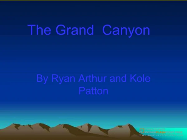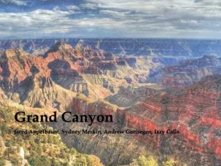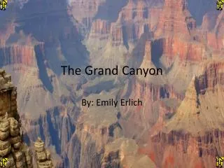
The Grand Canyon
The Grand Canyon. The Grand Canyon is located in the continent of North America. The 7 main continents of the World are shown in figure 1. Where in the World is the Grand Canyon?. Figure 1. Where in North America?. Location?.

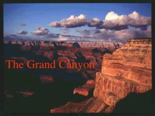
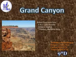
The Grand Canyon
E N D
Presentation Transcript
The Grand Canyon is located in the continent of North America. The 7 main continents of the World are shown in figure 1. Where in the World is the Grand Canyon? Figure 1
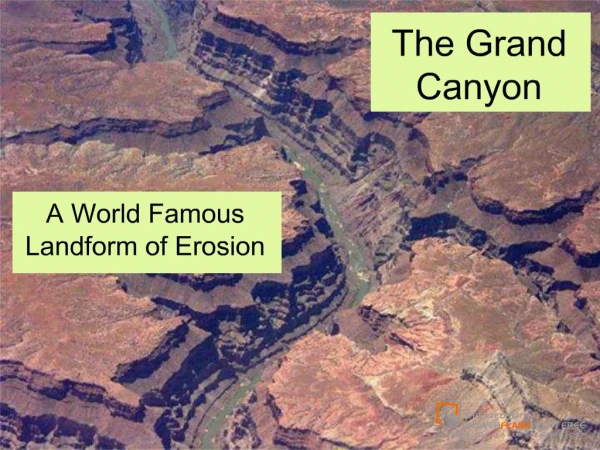
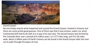
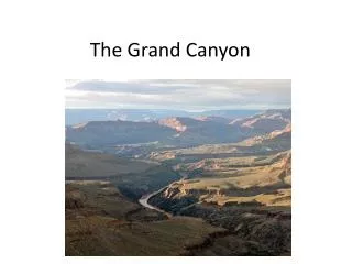
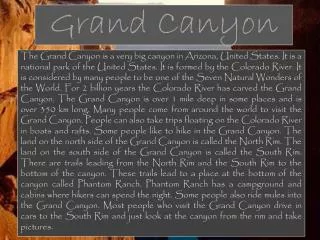
Location? The Grand Canyon is in the Northwest corner of Arizona, close to the borders of Utah and Nevada. The Colorado River, which flows through the canyon, drains water from seven states. The feature we know as Grand Canyon is entirely in Arizona.
There are lots of reasons as to why we learn The Grand Canyon. Here are just a few of them Why do we study about The Grand Canyon?
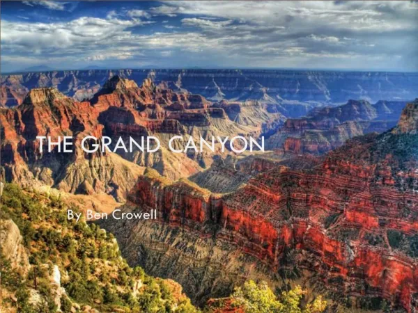
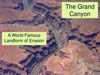
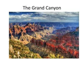
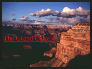
Reason 1: Awesome Landscape! • The Grand Canyon is one of the best examples of erosion anywhere in the World. It is 277 miles long, 18 miles wide and 1 mile deep! Take a tour!
The Formation The most powerful force to have an impact on the Grand Canyon is erosion, primarily by water(and ice) and second by wind. Other forces that contributed to the Canyon's formation are the course of the Colorado River itself, vulcanism, continental drift and slight variations in the earths orbit which caused variations in seasons and climate.
What Role Did Erosion Play? The primary contributing factor in the creation of the Grand Canyon was erosion. Erosion is gradual process of removing soil particles either through wind or water. In the case of the Grand Canyon it would be water. Click on the URL located below for a short demonstration of the creation of the Grand Canyon. www.edu-source.com While at the website use the information provided to answer the question on your handout.
Reason 2: Rampaging River! The Colorado river, all 277 miles of it, winds its way through the Grand Canyon. It continues to erode the steep sides as it moves. It is great for activities like white water rafting.
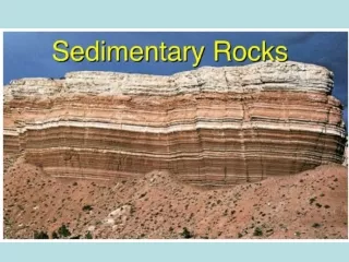
Reason 3: All those rocks! All three rock types can be found here, igneous, metamorphic and sedimentary. They were formed as a result of glaciation, tectonic action and river process.
Where Did The Rock Come From? The fact that the Earth's continents are not fixed in place but rather float on a sea of molten rock, that means that they move around quite a bit. The plate which contains the Grand Canyon, the North American plate, was at one time considerably further south than its present location and therefore had a much different climate. This explains the unusual rock and fossil formations in the Grand Canyon.
Expedition to the Grand Canyon • In May 1869, accompanied by nine men, the scientific explorer John Wesley Powell left on the first expedition by boat through the Grand Canyon to collect scientific data.
Expedition to the Grand Canyon • Go to http://www.pbs.org/wgbh/amex/canyon/maps/map.html and join Powell on his expedition through the Grand Canyon. Scroll down the interactive map to see their route. And click on the dates to read his journal entries that detail the grueling journey that ultimately claimed the lives of three of the explorers.
Geology of the Grand Canyon • Click on the image at the right to see the layers of rock exposed within the Grand Canyon and when in earth’s history they formed… • After reading the intro, click on “scroll down through history”
Wildlife in the Grand Canyon Today 67 different species of mammals are known to inhabit the canyon. These include bobcats, coyote and mountain lions. One of the most celebrated inhabitants is the Albert Squirrel. Many of these squirrels have lost their natural fear of humans and are often seen begging for handouts.
Wildlife in the Grand Canyon More than 290 different bird species make their homes in the canyon. Some of these include the Red Tailed Hawk (pictured at the right), Falcon, Mountain Chickadee, Western Tanager and the Blackchinned Hummingbird.
Wildlife in the Grand Canyon Reptiles are another popular inhabitant of the canyon. These include 22 types of lizards(such as the eastern fence lizard pictured at right) and 24 types of snakes. Most of these are harmless, except of course for the Crotalus Virdis Abyssus, more commonly known as the Rattlesnake!
Location The Salton Sea, A Desert Saga
The Salton Sea was formed in 1905 when massive flooding caused the Colorado River to break through an irrigation canal headwork and flow freely into the Salton Basin for 18 months. Since then, the Sea's existence has been maintained primarily by agricultural return flows from the Imperial, Coachella, and Mexicali Valleys.
The Salton Basin is an 8,360 square mile, closed, sub-sea level basin in the low desert of southern California and northern Mexico. The basin is actually part of the Colorado River delta: in the last thousand years, the Colorado River has meandered west and filled the basin at least three times forming a freshwater lake called Lake Cahuilla. Each time, the River eventually returned to its more easterly channel leaving the lake to evaporate
The Salton Sea is California's largest lake. At a surface elevation of 227 feet below sea level, it has a surface area of 243,718 acres (381 square miles). The maximum depth of the Sea is about 51 feet and the average depth 31 feet. The annual inflow to the Sea averages about 1,300,000 acre-feet, carrying approximately 4,000,000 tons of dissolved salt
Values of the Salton Sea The Salton Sea is a key stop on the Pacific flyway for many species of migratory birds; its importance has been magnified by the tremendous loss of wetlands in California. The Salton Sea National Wildlife Refuge has over 380 species of birds, among the highest totals of all national refuges.
Values of the Salton Sea • The Salton Sea provides important habitat for several endangered species including the desert pupfish, Yuma clapper rail, and brown pelican.
In the 1950s the California Department of fish and Game (CDFG) stocked a variety of fish species into the Salton Sea in a successful attempt to create a sportfishery. For decades the Sea was a noted destination for anglers. A 1985 CDFG study found that the Salton Sea was more productive (fish caught per angler hour) than any California marine fishery and equal to the most productive freshwater fisheries.
Salton Sea Problems Because the Sea has no outlet, water is lost only through evaporation , leaving dissolved salts behind and graually raising salinity. The Sea's salinity has now reached 44 parts per thousand (ppt), about 25% higher than ocean water. This elevated salinity may partially explainan apparent decline in orangemouth corvina, the most popular sportfish
The Sea's elevation has also gradually risen. Homes and businesses have been flooded and abandoned