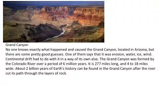
Exploring Grand Canyon: Geology, Features & Conservation
Discover the formation, rocks, landforms, and environmental issues of the Grand Canyon. Explore the park's use of technology and facts about its history and visitors.

Exploring Grand Canyon: Geology, Features & Conservation
E N D
Presentation Transcript
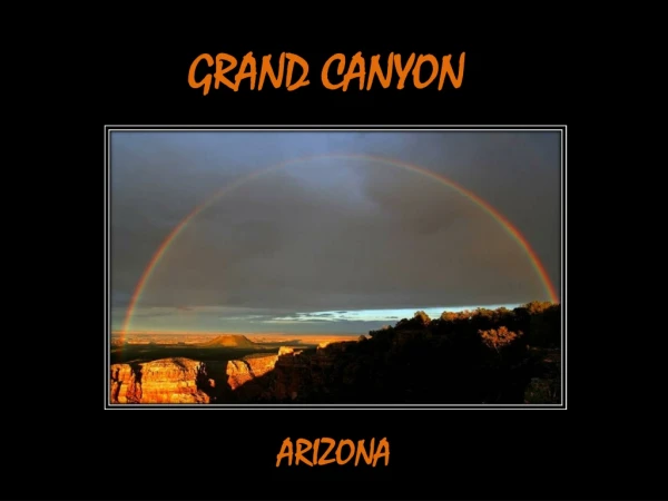
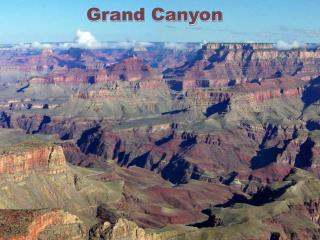
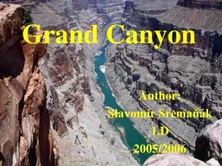
Grand Canyon By: Karis
When did the Grand Canyon become a park and why? • The Grand Canyon was established February 26, 1919. Grand Canyon became a national park in order to give it the best protection we, as a nation, have to offer. The mission of the National Park Service, here and elsewhere, is to preserve the park and all of its features, including the processes that created them, and to provide for it’s enjoyment by park visitors in a way that will leave the canyon unspoiled for future generations. Now, more than ever, we recognize how complex and difficult a task that can be.
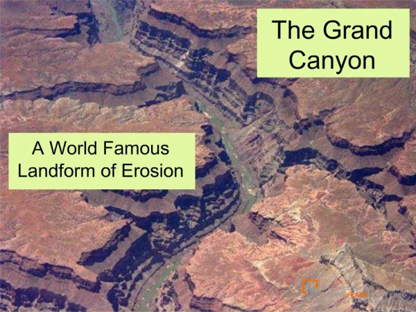
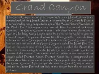
Grand Canyon was formed • The Grand Canyon was formed by the Earth’s crust and it began to stretch thinner and thinner. It is also changing because of erosion is some areas due to weather
Types of rocks in the Grand Canyon • Layered Paleozoic Rocks Kaibab limestone Toroweap Formation Coconino Sandstone Hermit Shale Supai Group Red wall Formation Temple Butte Formation Mavu limestone Bright Angle Shale Tapeats Sandstone Sedimentary rock is the most commomnin the Grand Canyon
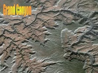
Grand Canyon landforms/features • Many forest fires • Plateaus • Cliffs • Mesas • Buttes • Rivers • Lakes
How is the landform changing • The combination of the Colorado river and the plateau. Created a geological basal, a deep groove that which the river could no longer free it self from the formation. but so fourth the Grand Canyon is mostly changing by the erosion and weather.
How is technology used in the Grand Canyon • In the Grand Canyon, they use hidden cameras to make sure the Grand Canyon is safe. Also in the Grand Canyon they have a Skywalk to get visitors or guests to see the Grand Canyon great features down bellow them
Environmental Issues • Visitors ( by how much waste they throw in the Grand Canyon) • Fire Management (The Grand Canyon has many forest fires) • The air • Endangered animals( they're habitats are getting ruined by the waste people throw)
Facts • The Grand Canyon was made a national monument in 1908 and became a national park in 1919 • It covers an area of 1,900 square miles • The Grand Canyon is 190 miles long • It contains some 277 miles of the Colorado River • Also populated by five Indian tribes: The Hopi, Navajo, Havasupai, Paiute and Hualapai • The Grand Canyon has about 15 million visitors a year.
Bibliography • http://explorethecanyon.com/explore-learn/grand-canyon-facts/ • http://www.bobspixels.com/kaibab.org/geology/gc_layer.htm • http://en.wikipedia.org/wiki/Grand_Canyon • http://wiki.answers.com/Q/What_kind_of_landform_is_the_Grand_Canyon • http://www.environment911.org/205.Major_environmental_issues_in_grand_canyon_national_park • http://www.nps.gov/grca/index.htm • http://www.youtube.com/watch?v=ktf73HNZZGY&NR=1&feature=endscreen • http://www.nature.nps.gov/geology/parks/grca/