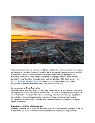
Aerial Imagery
Aerial Imagery. David Davis USDA Farm Service Agency Aerial Photography Field Office. USDA-FSA-APFO. USDA-FSA-APFO. Aerial Imagery Platforms. Balloons Rockets Kites Pigeons Airplanes, Helicopters, UAV’s Satellites, Space Shuttle, Space Station. USDA-FSA-APFO.


Aerial Imagery
E N D
Presentation Transcript
Aerial Imagery David Davis USDA Farm Service Agency Aerial Photography Field Office USDA-FSA-APFO
USDA-FSA-APFO Aerial Imagery Platforms • Balloons • Rockets • Kites • Pigeons • Airplanes, Helicopters, UAV’s • Satellites, Space Shuttle, Space Station
USDA-FSA-APFO View of Boston from Balloon Queen of the Air, 1860
USDA-FSA-APFO View of German Landscape by Alfred Maul’s Rocket, 1904
USDA-FSA-APFO Kite CamerasArthur Batut and Lt. Hugh Wise
USDA-FSA-APFO View of San Francisco from a Kite, 1906
USDA-FSA-APFO Pigeon CameraPatented by Julius Neubronner, 1903
USDA-FSA-APFO 35mm Aerial Photography
USDA-FSA-APFO Large Format Aerial Photography9”x9” Film
USDA-FSA-APFO 9” x 9” Film Canister
US Department of Agriculture Salt Lake City, Utah USDA-FSA-APFO Over 10 million frames from 1955 to present
USDA-FSA-APFO Image Acquisition Film and Digital • Small Format • 35mm Film Camera • 3 sq. miles@8,000 feet • Large Format • Mapping Camera • 9”x 9” film • 25 sq. miles@20,000 feet
USDA-FSA-APFO Large Format Digital Aerial Cameras
USDA-FSA-APFO Image Acquisition Always Changing Pigeon to Predator
USDA-FSA-APFO UAV, UAS, UCAV Unmanned Aerial Vehicle, Systems, Combat
USDA-FSA-APFO Satellites Satellite, Space Shuttle, Space Station
USDA-FSA-APFO Before GIS Paper photos
USDA-FSA-APFO Measure & Draw on the Photographs
USDA-FSA-APFO GIS
USDA-FSA-APFO Photo Identification • Basics • Shape, tone, location, texture, size, pattern, shadow, association • Buildings, roads, rivers, railroad, fields • Change over time • Fields and homes, new roads, commercial sites • Time machine. Can see back in time. • Identify places we haven’t seen before • Cities, states, countries, buildings, rivers, ….
USDA-FSA-APFO Where was this photo taken?
USDA-FSA-APFO Disney World, Epcot Center Florida 1969 1980 1998
USDA-FSA-APFO Where was this photo taken?
USDA-FSA-APFO Dasht-e Kevir, Iran • Dasht-e KevirImage taken 10/24/2000 The Dasht-e Kevir, or valley of desert, is the largest desert in Iran. It is a primarily uninhabited wasteland, composed of mud and salt marshes covered with crusts of salt that protect the meager moisture from completely evaporating. • Dasht-e Kevir can be found on Landsat 7 WRS Path 162 Row 36, center: 34.62, 54.71. • USGS Earth As Arthttp://earthasart.gsfc.nasa.gov/kevir.html
USDA-FSA-APFO Online Maps & ImageryDowntown Salt Lake City (Nov 2009)
USDA-FSA-APFO Online Maps & ImageryDowntown Salt Lake City (Nov 2009)
USDA-FSA-APFO Google Street View
USDA-FSA-APFO Bing Bird’s Eye
USDA-FSA-APFO National Agriculture Imagery Program(NAIP)
USDA-FSA-APFO NAIP Camera TrendsFilm Cameras vs. Digital Sensors Estimate
USDA-FSA-APFO PixelsGround Sample Distance
USDA-FSA-APFO Aerial Imagery Options • Oblique or vertical • Number of bands • 1 Grayscale, 3 RGB or CIR, 4 RGBIr, 8 • Ground Sample Distance (pixel resolution) • Data format • Raw, TIFF, JPEG, GeoTIFF, MrSID, JP2, … • Leaf-on, leaf-off, flying date, flying season • Coverage • Others
USDA-FSA-APFO GIS & Remote Sensing Careers • Careers vs. Jobs • Short & long term opportunities • What is interesting and enjoyable • Required education • Salary, benefits, stability • Benefit to yourself, your family, your community
USDA-FSA-APFO GIS & Remote Sensing Careers • Acquiring aerial imagery • Aircraft • UAVs • Satellite • Government, Military, & Business • Sensors • Satellites • Cameras • LiDAR, Radar, other non-imagery sensors
USDA-FSA-APFO GIS & Remote Sensing Careers • Storing & Archiving • Image files are ENORMOUS (petabyte capacity equipment) • Short and long term storage • Data formats, including compression • Creating orthoimagery • GPS, ground control, DEM • Rectification, photogrammetry • Image manipulation, tone balancing, etc • Serving and Web Services • Data downloads • Web browser viewers • View from GIS or other desktop software
USDA-FSA-APFO GIS & Remote Sensing Careers • Creating data from imagery • Digitizing roads, street lights, parcels, …. • Land use & land cover change • GIS & Remote Sensing Applications • Real Estate • Police, Fire, Emergency services • Health, disease tracking • Business location • Routing for garbage collection • Web services • Vehicle GPS and Mapping • Google Maps, Bing, others