Download
1 / 26
260 likes | 422 Vues
Utilizing ITS to Reduce Truck Overturn Crashes Due to High Winds at Bordeaux, Wyoming. Edward Offei Rhonda Young, PhD, PE. Outline. Background Project Location Data Sources Data Analysis High Wind Warning System. Background.

E N D
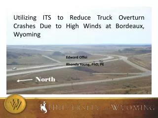
Utilizing ITS to Reduce Truck Overturn Crashes Due to High Winds at Bordeaux, Wyoming Edward Offei Rhonda Young, PhD, PE
Outline • Background • Project Location • Data Sources • Data Analysis • High Wind Warning System
Background • Wyoming is noted for frequent severe wind conditions especially at the southeastern part of the state. • Many wind farms established due to the high wind conditions. • Wind speeds reach 30 to 40 mph and wind gust speeds of 50 to 60 mph during the winter.
Background • Wind direction effect is greatest if it is perpendicular to the road. • High profile vehicles (empty or lightly loaded) are vulnerable to the high wind. • Previous research have investigated how wind speeds correlated with truck safety.
Research Objectives • Conduct field studies to provide an overview of the study location and chose the suitable locations for the installation of the monitoring equipment. • Confirm the relation between high wind conditions and high risk of truck crashes. • Determine appropriate threshold values for the high wind warning system. • Analyze crash data to create baseline conditions to monitor the future effectiveness of the system. • Develop final recommendations for the High Wind Warning System.
Data Sources • Road Weather Information System (RWIS) Tower • Two Wavetronix Speed Sensors • 2 Pan-Tilt-Zoom (PTZ) Cameras attached to a 2 channel Pelco 4000 Digital Video Recorder
ITS Equipment RWIS TOWER
ITS Equipment Speed Sensor Cabinet
ITS Equipment HOBO Weather Station
TRUCK CRASHES THAT OCCURRED DURING 2008 – 2010 WINTER SEASONS
TRUCK CRASHES THAT OCCURRED DURING 2008 – 2010 WINTER SEASONS
Data Analysis • Multiple Logistic Regression Model • Response Variable: Overturning Truck Crash, 1 is assigned for overturning and 0 otherwise • Predictor Variables: All weather condition parameters • Modeling Methodology • 95% confidence intervals • All parameters included in initial model • Parameters with p-value larger than 0.05 removed from model one at a time starting with largest p-value variable • Filtering loop continue until all parameters have p-value < 0.05 • Hosmer and Lemeshow goodness-of-fit test to determine how well the model fit the data
Data Analysis • Multiple Logistic Regression Model Equation
RWIS vs. HOBO • RWIS located near the top of an adjacent hillside. • HOBO located 40 feet near the roadside. • Positive difference indicate RWIS Data > HOBO Data. • RWIS wind speeds higher than HOBO wind speeds. • Difference increases as the wind speed increases.
Operational Levels • Level 1: 30mph wind speed threshold was recommended for advisory warning messages on the DMS’s. • Level 2: 40 mph wind speed threshold was determined for road closure to all high-profile, light-weight vehicles. • Level 3: 45mph wind speed threshold was determined for road closure to all trucks.
High Wind Warning System • DMS signs (2 were installed adjacent to the corridor) • CB Wizard • Highway Advisory Radio (HAR) • 511 Phone Service • Website (WYDOT) • Weigh-In-Motion (WIM) • Over Height Vehicle Detector (OHVD)
QUESTIONS Edward Offei eoffei@uwyo.edu