Download
1 / 22
220 likes | 432 Vues
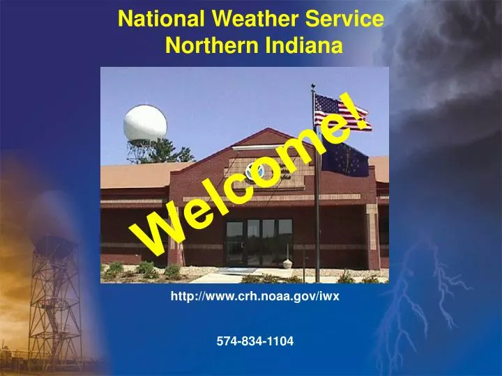
National Weather Service Northern Indiana. Welcome!. http://www.crh.noaa.gov/iwx 574-834-1104. Why W e’re Here. The National Weather Service Produces Weather, Water and Climate Forecasts and Warnings For All Americans To Protect Life and Property To Enhance the National Economy

E N D
National Weather Service Northern Indiana Welcome! http://www.crh.noaa.gov/iwx 574-834-1104
Why We’re Here • The National Weather Service Produces Weather, Water and Climate Forecasts and Warnings • For All Americans • To Protect Life and Property • To Enhance the National Economy • Data and Products to: • Government Agencies • Private Sector • The Public • Global Communities • Economic Decisions Are Based on NWS Data and Products • “Weather Impacts $1.7 Trillion [per Year] of Our Economy” – Weather Risk Management Association, Jan. 2001 • Growing Weather Risk Management Industry Approaching $8 Billion per Year – Weather Risk Management Association, Jan. 2001
Why We’re HereWeather Jolts Society and Shakes the Economy • More Than 500 Americans Die Each Year in Weather- and Flood-Related Events • More Than 5,000 are Injured • Annual Weather- and Flood-Related Losses Cost America $14 Billion Each Year Courtesy Cathy Benko Courtesy Paul Huffman, Elkhart Truth
Organization Department of Commerce (DOC) National Oceanic and Atmospheric Administration (NOAA) National Weather Service (NWS) Central Region (CR) (part of area of responsibility is in Eastern Region) Weather Forecast Office (WFO) Northern Indiana (IWX)
We’ve Been Around for a While… • 1870 – President Grant signed into existence a national weather observing service, as part of the Army Signal Service • 1870 – 1891 – Part of the War Department • 1891 – 1940 – Weather Bureau, in the Department of Agriculture • 1940 – 1970 – Weather Bureau, in the Department of Commerce • 1970 – present – National Weather Service, in the Department of Commerce Former Fort Wayne Office 1911 - 1998 Former South Bend Office 1939 - 1998 IWX 1998 - present
What We Do At WFO Northern Indiana (IWX) Maintain 24/7 Weather Watch for County Warning and Forecast Area (CWFA) 37 counties 3 states 2 time zones
How America Gets Weather InformationThe average person only sees the tip of the iceberg TV Radio Internet Private Weather Companies NATIONAL WEATHER SERVICE 123 Weather Forecast Offices Weather and Flood Forecasts and Warnings 13 River Forecast Centers River Forecasts (used for Hydropower, Flood warnings, Irrigation, River Navigation) National Centers for Environmental Prediction Model Simulations Climate & Seasonal Outlooks Aviation & Marine Forecasts Storm & Tornado Prediction, Hurricane Tracks Observations Radar Network, Satellites, Weather Balloons, Ground-level Observations at Airports, Aircraft, Lightning Network, Data Buoys, Stream Gauge Network, 11,000 Volunteer Daily-Data collectors, Thousands of Volunteer Storm Spotters
Warnings and Forecasts • Convective Warnings (Tornado, Severe, and Flash Flood) • Nonconvective Watches and Warnings (Wind Chill, High Wind, Heavy Snow etc.) • Zone Forecast (Text, Digital, and Graphical) • Terminal and Route Aviation Forecasts • Short Term Forecasts • River Forecasts and Warnings • Climatology Products • Marine Forecasts, Statements and Warnings
Observation Tools - Ground LevelAutomated Surface Observation System (ASOS) • Rainfall • Temperature/Dewpoint • Weather • Wind • Sky Cover • Freezing Rain • Thunderstorm • Visibility • Pressure • Benton Harbor • Defiance • Fort Wayne • Goshen • Lima • South Bend
WSR-88D World’s most powerful radar • 28-foot diameter antenna transmits and receives energy (750,000 Watts) • While rotating, samples up to 14 elevation scans in the atmosphere • Range of 250 miles • In addition to capabilities of older radars, can also identify rotation and strong winds inside of thunderstorms
WSR-88D Reflectivity ImageFort Wayne, Indiana (North Side) F2 TornadoMay 26, 2001
WSR-88D Velocity ImageVan Wert, Ohio F4 TornadoNovember 10, 2002
Analysis and ForecastingForecasters analyze myriad surface, upper air , radar, satellite, and numerical model data to create a plethora of forecasts
Forecast and Warning Distribution To... • County Officials via National Warning System (NAWAS), Emergency Managers Weather Information Network (EMWIN), and phone • Media by Associated Press, Family of Services, and NOAA Weather Radio (Emergency Alert System) • Amateur Radio Network by radio operator at WFO IWX • Public by NOAA Weather Radio and Internet (http://www.crh.noaa.gov/iwx)
NOAA Weather Radio • Voice of the National Weather Service • Network of more than 900 stations nationwide (Dec ‘05) • NOAA Weather Radio can be heard by more than 85% of the U.S. population • Continuous weather information broadcasts from local forecast offices: • Warnings • Watches • Forecasts • Observations • For more information, visit the NOAA Weather Radio Web Site at http://www.nws.noaa.gov/nwr/nwrbro.htm
Customer and Community Interaction in Addition to Forecasts and Warnings... • Build and maintain relationships with local, state, and Federal governments and the media • Provide expert advice to Emergency Operations Centers and the media • Solicit feedback from customers (that’s you!) • Conduct community awareness and education programs • Train volunteer observers and storm spotters (SKYWARN)
NOAA All-Hazards Radio Coverage Areas For Northern Indiana Fort Wayne WXJ-58, 162.550 Mhz Marion WXM-98, 162.450 Mhz South Bend WXJ-57, 162.400 Mhz Angola WXI-94, 162.425 Mhz North Webster WWG-45, 162.500 Mhz Oshtemo WWF-34, 162.475 Mhz Toledo WXL-51, 162.550 Mhz Lima WXJ-93, 162.400 Mhz Monticello WXK-74, 162.475 Mhz Laporte KJY-62, 162.500 Mhz Hebron WNG-689, 162.450 Mhz
Our Jobs at IWX:The Good, The Bad, and the Ugly • Good • Interesting and always challenging career • Competitive salary and benefits compared to private sector • Job opportunities across the nation • Excellent benefits and job security as Federal employees • Bad • Salaries do not compare to TV meteorologists in large markets • Can be called in on off-hours to assist during severe weather • Ugly • Shifts: office is operating 24 hours a day, shift changes every several days, working holidays, attempting complex scientific thought at 3 o’clock in the morning… • And especially: When forecasts go awry…!!
Education Requirements • High School • Math • Physics • Chemistry • College • Bachelor of Science 4 year degree required for NWS and most private sector jobs • Masters and PhD aid career progression
Contact WFO IWX USPS: National Weather Service Northern Indiana 7506 E 850 N Syracuse, IN 46567 E-mail: w-iwx.webmaster@noaa.gov Phone: 574-834-1104 Mon – Fri, 8:30am – 3:30pm