Web Feature Server (WFS) Pilot Project
Web Feature Server (WFS) Pilot Project. Project Results and Demonstration Jonathan Doig - NSW Department of Land and Water Conservation Maurits van der Vlugt - Sinclair Knight Merz. Agenda. 3:30 Context, Purpose and Outcomes 3:45 Demonstration 4:10 Q&A - Discussion 4:30 End Session.
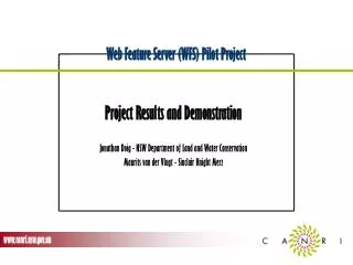

Web Feature Server (WFS) Pilot Project
E N D
Presentation Transcript
Web Feature Server (WFS) Pilot Project Project Results and Demonstration Jonathan Doig - NSW Department of Land and Water Conservation Maurits van der Vlugt - Sinclair Knight Merz
Agenda • 3:30 Context, Purpose and Outcomes • 3:45 Demonstration • 4:10 Q&A - Discussion • 4:30 End Session
1- Context, Purpose and Outcomes • What is WFS? • Purpose • Audience • Dependent Projects • Participants • Outcomes
What is WFS (Web Feature Server) ? • Open GIS Interface Specification • Specification released Sept. 2002 • Enabling Technology for • Direct access to Geographic Features in remote, distributed Datasets • Standard format - vendor independent
Who is planning to use WFS? • Australia and NZ jurisdictions (ANZLIC/ASDI Standing Committee) • Endorsed OpenGIS as enabling technology for ASDI • NSW Natural Resource Agencies • CANRI
Where can I get one? • Known scheduled/announced releases • ESRI ArcIMS • MapInfo: MapXtreme/Encounter • Intergraph Geomedia product family • Social Change Online WFS Lite, Webmap Composer • FreeFS (http://geoserver.sourceforge.net/html/index.php) • Full list on OGC website (www.opengis.org)
The CANRI Framework • Vision: “To fully realise the strategic value of natural resource information to support overall Government objectives to achieve sustainable management of NSW natural resources” • Providing • Coordination • Communication • Enabling • Data (publish, find, bind) • Systems (technology, vendor independent) • Information Products • Standards (open)
But CANRI already has WMS (Web MAP Server)! • WMS is standard for ‘rendered images’: • Viewing and minimal query (“scratch & sniff”) • WFS allows access to ‘raw data’: • Geographic objects (points, lines, polygons) • Attribute Data Query (e.g. observations) • filter • download • thematic mapping • graphs and tables • Transactional access (add, edit, delete)
CANRI WFS involvement • Requirement • Reporting on Environmental Indicators • SoE (local, State, Commonwealth, Global) • Catchment Blueprints (NAP, NHT) • Sponsor of OGC’s Open Web Services Testbed (OWS 1.1) • WFS Pilot for Water Quality
WFS Pilot Project - Participants • Agencies • DLWC - Data supply & coordination • EPA - SWMCC Data exchange & reporting • MDBC - Observer • Contractors • Sinclair Knight Merz - Project Management • Navigate - ESRI WFS data serving • Social Change Online - WFS data serving & viewing application
Purpose of this Pilot Demonstrate two critical points: 1. The technicalfeasibility of WFS-based interoperable access to cross-government natural resource data stores using the CANRI framework 2. The feasibility of using this technical capability to present the data to users in a simple, useful and meaningful viewing application.
Technical Requirements • Link multi source water quality data • Heterogeneous • Using open standards (WFS) • Integrated Internet delivery of reports, maps & downloads
Two Components • Data serving • Two different WFS serving platforms (ESRI; SCOL) • Standards Based Commercial Off The Shelf (SCOTS) • Viewing Application - Customisation • Query Multiple Databases (Keysites & IDMS) • Display indicators (map, report) • Download selected data
Architecture Network WFS Pilotapplication server Viewer (Browser) Towns, Rivers, States (GA - WMS) Keysites (ArcIMS - WFS) Catchment Boundaries (DLWC - WMS) IDMS (WFS- Lite)
Outcomes • Server Installations & Application • ESRI server @ Navigate partially OK • ESRI WFS experimental (pre-Beta-release) • Not fully OGC compliant • Does not yet process attribute/spatial queries • SCO server (“WFS lite”) • Application Prototype developed • Demonstration - click for live demo or see snapshots on following slides
2 - Demonstration Network WFS Pilotapplication server Viewer (Browser) Towns, Rivers, States (GA - WMS) Keysites (ArcIMS - WFS) Catchment Boundaries (DLWC - WMS) IDMS (WFS- Lite)
Find sampling site on map Click above for live demo or see snapshots on following slides
Data summary Click above for live demo or see snapshots on following slides
Next Steps… CANRI Provisional funding for WFS implementation in Natural Resources Reporting - Water Quality Need to resolve Interoperability issues CANRI Board / NRIMS Systems Working Group to decide
Next Steps… Australian OGC Interoperability Pilot Build ASDI reference implementation Services (WMS, WFS) Catalogs Clients Showcase in real world scenario Demonstration late 2003 /early 2004
Resources CANRI DIY Manual: www.canri.nsw.gov.au/diy CANRI WFS Pilot: www.canri.nsw.gov.au/activities/projects/2001 OGC: www.opengis.org WFS-dev discussion list: mail.opengis.org/mailman/listinfo/wfs-dev Active OGC members in Australia: SCOL: webmap.socialchange.net.au SKM: www.skmconsulting.com CSIRO Exploration and Mining: www.dem.csiro.au Your GIS Vendor