Download
1 / 20
200 likes | 304 Vues
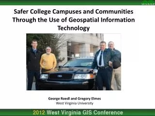
Safer College Campuses and Communities Through the Use of Geospatial Information Technology. George Roedl and Gregory Elmes West Virginia University. Quick Facts. U.S. college campuses report ~90,000 crimes 98% crimes are property crimes (non-violent)

E N D
Safer College Campuses and Communities Through the Use of Geospatial Information Technology George Roedl and Gregory Elmes West Virginia University
Quick Facts U.S. college campuses report ~90,000 crimes 98% crimes are property crimes (non-violent) 93% crimes against college students occur off-campus Campuses have lower crime rates than surrounding communities No consensus on what community factors affect campus crime or student victimization
Increasing Student and Community Safety partnership Establish crime mapping and analysis capability across multiple jurisdictions to support providing a safer campus and communities; Utilize geospatial technologies to provide spatial and non-spatial information for problem oriented, intelligence-led decision making and resource allocation by law enforcement agencies and policy makers; Enhance community crime reduction participation through increased awareness and information dissemination with a multi-faceted combination of in-person and online solutions, including an interactive map server; Promotes coordination and cooperation among additional law enforcement agencies in the same area and with other researchers.
Study Area Morgantown WV 29,600 2010 Census ~100,000 county West Virginia University 37,699 2010 Enrollment + Staff
Campus Disclosure Act (Clery Report) • Arson • Assault/Battery • Aggravated, simple, intimidation • Burglary • Destruction/Vandalism • Forgery • Murder • Negligent, non-negligent, justified • Robbery • Sexual Assault • Theft • Pick-pocket, purse snatching, shoplifting, from building, from vehicle, from coin operated device, vehicle parts, all others • Vehicle Theft Categories of Interest
Analyses of Discussion Temporal Trend Analysis Spatial Trend Analysis Spatio-temporal Analysis Spatial Regression Analysis
By Time of Day High degree of similarity between WVU and Morgantown which varies slightly each year
Under certain conditions, times or locations, crimes exceed the average or expected rates to form distinct clusters known as hot spots Crime can be characterized as having random, dispersed, or clustered patterns There are a variety of ways to measure intensity of crime incidents to identify hot spots. One method is Kernel Density (KD) Spatial Characteristics of Crime
Some crime incidents are likely to happen within defined spatial and temporal proximity of previous incidents • Most studies focus on a single LEA jurisdiction • Knox Space-Time Interaction Test Spatio-temporal Analysis Close in time, not space Close in space & time Not close in space or time Close in space, not time
Burglaries close in space and time Examples Theft from vehicles close in space and time
LISA Clusters 98 High/High 20 Low/Low 20 High/Low Threshold p=0.05 925 total census blocks Examining potential causes of crime
Spatial regression analysis used to identify possible associations between spatially clustered census blocks and demographic predictor variables
Findings & Implications (short list) Incidents follow university trends Planning and resource allocation should consider activities and extra population JOINTLY!! Large number of cross-jurisdictional hotspots Student safety is more than Clery statistics Demographics/places not very good predictors Opportunity & Alcohol Supports previous reports of campus low/declining crime rates relative to community Gap in the literature when it comes to addressing student safety off campus GIS a valuable tool for exploring gaps Very little done where college students are considered victims despite the statistically significant difference between crime on and off campus involving students Potential to influence decision makers at colleges and within college town Empirical demonstration and case studies
Thank You,Questions? This project is supported by Award No. 2009-IJ-CX-0205 awarded by the National Institute of Justice, Office of Justice Programs, U.S. Department of Justice. The opinions, findings, and conclusions or recommendations expressed in this presentation are those of the authors and do not necessarily reflect those of the Department of Justice. Forthcoming: Elmes and Roedl (In-press). The Use of Geospatial Information Technology to Advance Safer Campus Communities. In: Leitner M (ed.) Crime Modeling and Mapping Using Geospatial Technologies. Springer New York.