
Geography
Geography. A look at our home planet, Earth. Geography i s the study of. Earth’s physical features. An important tool used to study geography is a. Map!. Cardinal Directions. Compass Rose. Prime Meridian. Map reading is an important skill, with a vocabulary all its own!. Longitude.

Geography
E N D
Presentation Transcript
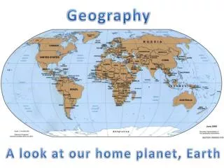
Geography A look at our home planet, Earth
Geography is the study of Earth’s physical features
Cardinal Directions Compass Rose Prime Meridian Map reading is an important skill, with a vocabulary all its own! Longitude The Equator Latitude Lines of Parallel
Cardinal Directions are North, East, South and West.
Latitude is shown on a map as a horizontal line.
Lines of Latitude are parallel lines. They go around, but never touch or intersect each other.
The Equator is a line of latitude which is the midway point between the northern and southern hemispheres
Longitude is a vertical line seen on a globe or map. The long lines goes top to bottom.
Latitude and Longitude work together on a map or globe to find exact locations.
Something New For You! Each half of the Earth is called a Hemisphere And Hemispheres are our next set of lessons!
We live in the Western Hemisphere We live here ->
TheWestern Hemisphere begins at 0 degrees longitude, (the PRIME MERIDIAN). It includes North and SouthAmerica.
North and South America make up half the world, a hemisphere. It is known as the Western Hemisphere.
North America is a continent made of 7 small countries of Central America and 3 large countries, which are Canada, Mexico and the United States. Western Hemisphere But Hemispheres are another lesson
America is a country located on the continent of North America
Canada is another country found on the continent of North America. It is northof the United States.
Mexico is another country located on the continent of North America. It is southof the United States.
REVIEW: The continent of North America Is made of 3 large countries And 7 smaller countries of Central America Canada America Mexico
Mexico is a country of North American continent And it is the northern most country in the region of Latin America.
Latin America Is also in the Western Hemisphere the Caribbean Islands the Caribbean Islands Middle America, and South America. Middle America Latin America Is made up of 3 regions: South America 1. Middle America 2. Caribbean Islands 3. South America
The most northern region of Latin America is Middle America. Latin America Latin America Latin America Middle America is made up of Mexico and seven nations south of it.
The most northern region of Latin America is Middle America. 1 1 Middle America is made up of Mexico and seven nations south of it. 1 1 1 1 1 1 Let’s use this slide and use our geography skills to map out Middle America by answering questions 32 A – F.
Middle America forms a crooked, narrow isthmus in southern most part of Central America. The most northern region of Latin America is Middle America. Middle America is made up of Mexico and seven nations south of it. An isthmus is a thin piece of land surrounded by water on two sides. 1. 2. 3. 4. 5. 6. 7. It usually connects two larger land masses. The Isthmus of Panama connects North America to South America.
In Class Quiz! Use the compass rose to help answer questions 38 – 44 on your study guide. North America The Isthmus of Panamaconnects North America to South America. • South • America • A continentwhich is in Latin America and the Western Hemisphere
North and South America are two of the world’s 7 continents. A continent is one of seven major land masses on the earth. There are seven continents - Africa, Antarctica, Asia, Australia, Europe, North America, and South America.
In a while Crocodile!


