Download
1 / 27
270 likes | 422 Vues
PBO H2O Water Cycle Studies Using The Plate Boundary Observatory . PBO H2O Water Cycle Studies Using The Plate Boundary Observatory . Funding and support

E N D
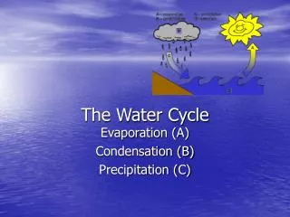
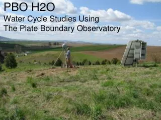
PBO H2O Water Cycle Studies Using The Plate Boundary Observatory
PBO H2O Water Cycle Studies Using The Plate Boundary Observatory Funding and support NSF: Climate and Large-Scale Dynamics, Instrumentation and Facilities, EarthScope, Hydrologic Sciences NASA: Terrestrial Hydrology, SENH, ESS Grad. Fellowship UNAVCO Sevilleta and Niwot LTERs Eric Small, Kristine Larson, John Braun, Felipe Nievinski, Clara Chew, Sarah Evans, Maria Rocco, Praveen Vikram, Ethan Gutmann Geological Sciences and Aerospace Engineering Sciences, CU UCAR, NCAR http://xenon.colorado.edu/reflections
Goal: Use multipath measured by PBO network to estimate terrestrial hydrologic variables Outline Terrestrial Water Cycle GPS Reflectometry Soil moisture Vegetation Snow Hard Easy
transpiration New technique to monitor water stored on land in: Soil Plants Snow
Global Terrestrial Observing System Essential Climate Variables (ECVs) ECVs: “environmental parameters considered to be the most important for understanding, detecting, monitoring, and assessing the impact of climate change.” We study three: 1. Soil moisture: land-atmosphere interactions; runoff and infiltration; plant productivity 2. Snow: Timing and amount of runoff; influences climate 3. Above-ground biomass: global carbon budget; influences climate
Studying the hydrological cycle1. Models2. In situ data3. remote sensing data • Products derived from GPS reflections are a hybrid of in situ and remotely sensed data • Validation of satellite products • Quantify water cycle stores and fluxes • Incorporate into modeling
Kurc and Small, 2007 In situ data • Positives • High frequency • Environmental conditions constrained • Monitor at all depths • Negatives • Small sampling area • Networks not homogenous • Networks are sparse SCAN soil moisture network
NASA SMAP (2014) Soil Moisture Active: high resolution, L-band Passive: low resolution radiometer SMAP slide • Positives • Global coverage • Negatives • Course resolution • Frequency = ~3 days • Signal ‘incomplete’ • ‘surface’ soil moisture • Snow depth, not SWE • Veg greenness, not amount
Using GPS-reflectometry for terrestrial hydrology studies Geodetic-quality GPS antenna/receiver “ignore” direct signal Focus on the multipath
How can you quantify the effects of multipath? Signal-to-Noise Ratio (SNR) direct Marshall, CO L2 SNR Trimble NetRS multipath
Use interference pattern to estimate hydrologic variables Detrended multipath signal Soil moisture phase shift Snow depth frequency Vegetation amplitude & MP1
GPS reflection footprint for “standard” geodetic antenna (2 m high) Sensing Footprint ~1000 m2
Use data from PBO network to make snow, vegetation and soil moisture products Positives • Extensive network exists • Data freely available • Same frequency as satellites • Footprint intermediate in scale • Negatives • Antenna not designed for reflections • Site conditions vary
Challenge #1: antenna suppresses reflections Gain pattern: Choke ring antenna (L2) Multipath RHCP Gain (dB) LHCP 0 50 180 150 100 Angle from zenith (degrees)
Challenge #2: Sites not chosen for sensing terrestrial hydrologic variables P013, Paradise Valley, NV P015, Show Low, AZ Good: natural ecosystems, undisturbed surface, simple topography BAD: Buildings, roads, complex topography, cows
Algorithm Development: 10 test sites with identical GPS and hydrology infrastructure SMAP ISST-C
P041 (CO) Soil Moisturevolumetric water content is linearly related to phase of interference pattern Need good example here
Soil moisture validationin situ probes gravimetric sampling Marshall, CO (co-located with P041) In situ GPS
NASA’s SMAP in situ sensor test bed GPS phase shift and in situ soil moisture Correlation stronger with soil moisture at 2.5 cm 7.5 cm 2.5 cm Vol. Soil Moisture (x100) Vol. Soil Moisture (x100) GPS PHI GPS PHI
Vegetationcomplex effects on SNR:phase, amplitude and frequency Experiments: Isolate effects of vegetation on GPS reflections 1. measure vegetation water content (kg/m2) and plant height weekly 2. Compare to SNR data
VegetationMP1: L1 pseudorange multipath intensity (produced by teqc). We use MP1rms as a proxy for water in vegetation
Validation of vegetation productCompare MP1rms fluctuations to measurements of vegetation water content at PBO sites 2011 PBO Survey: UT, ID, MT Field Sampling
P101 (Utah) Snow Depth estimate reflector heightfrom frequency of interference pattern
snow depth validationhand measurementsSNOTELcameras and polesultrasonic range sensorslaser
Continued efforts • validation using surveys at PBO sites • modeling for retrieval of hydrologic variables • Snow: estimate snow density, convert depth to SWE • Veg: water content time series from MP1rms • Soil moisture: product for SMAP validation
Partnerships and Outreach • National and international collaboration with GPS network operators. e.g., pilot project with NOAA-NGS to convert the DoT Minnesota network for snow sensing. • Public code for users to produce water cycle products. • SMAP Cal-Val • SNOTEL, NSIDC • Outreach • Working with UNAVCO to develop webtools for data distribution. • Web-based outreach