Download
1 / 34
360 likes | 583 Vues
Earth’s Seafloors Ocean Basins and Continental Margins. Introductory Oceanography. Ray Rector - Instructor. OCEAN BASINS and CONTINENTAL PLATFORMS Key Concepts. I. Earth’s rocky surface covered by of two types of crust Dense, thin, low-standing oceanic crust

E N D
Earth’s Seafloors Ocean Basins and Continental Margins Introductory Oceanography Ray Rector - Instructor
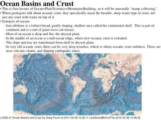
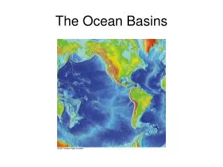
OCEAN BASINS and CONTINENTAL PLATFORMSKey Concepts I. Earth’s rocky surface covered by of two types of crust • Dense, thin, low-standing oceanic crust • Light, thick, high-standing continental crust II. Seafloor is divided into two topographic regions • Shallow continental margins • Deep-sea oceanic basins III. Continental margins and Deep Ocean basins are fundamentally different • Composition • Structure • Age • Tectonic origin IV. Ocean basins are rugged and have a wide variety of topographic features • Mid-oceanic ridges and Transform fracture systems • Abyssal Hills and Plains • Oceanic islands, Seamounts, and Guyots • Trenches and Island Arcs
Earth Processes That Create Seafloor Features Continental Margins 1) Features resulting from Continental Rifting • Continental Shelf and Slope • Deep-Sea Oceanic Basins 1) Features generated by Seafloor Spreading • Mid-Ocean Ridges and Fracture Systems • Oceanic Islands, Seamounts and Plateaus 2) Features generated by Subduction • Trenches and Island Arcs • Forearc Islands 3) Features resulting from Sedimentary processes • Abyssal Plains and Hills • Continental Rises • Submarine Canyons
Elevation Relief Profile of Earth Surface 1. Sea level 2. Continental shelf 3. Continental slope 4. The deep ocean floor 5. Mean depth of ocean = 4 km below sea level 6. Mean altitude of land = 1 km above sea level 7. Mt. Everest = 8848m 8. Marianas Trench = 11022m
Four Principle Methods of Mapping the Ocean Bottom 2. Satellite-based Radar 1. Ship-based Sonar 3. Ship-based Seismic Reflection 4. Submersible Survey
Means of Mapping the Ocean Bottom Satellite Radar • Use of space-based radar to reflect off ocean surface, giving a very precise sea surface profile; sea surface profile anomalies closely mimic the underlying seafloor profile
Means of Mapping the Ocean Bottom Seismic Reflection • Use of underwater explosions to penetrate seafloor with seismic waves that reflect back, providing a subsurface image
Means of Mapping the Ocean Bottom Deep Sea Drilling • Use of underwater drilling to penetrate seafloor and recover core samples of seafloor down to depths of over 3000 meters
Two Primary Types of Earth Crust OceanicContinental
Cross-Section Profile of an Ocean Basin Large-Scale Ocean Bottom Features • Continental shelf, slope, and rise • Abyssal plains and hills • Mid-ocean ridge and rift valley • Oceanic islands, seamounts, and guyots • Ocean trench
AGE PROFILE OF NORTH AMERICA Tectonic Provinces of North America: (Ages are in Billions of Years)
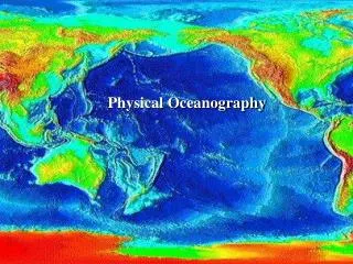
Continental Margins of the World Submerged continental margins are shown in pale orange color
Two Types of Continental Margins Passive = Constructive = Atlantic Type Active = Destructive = Pacific Type Passive Margins • Broad shelves • Subdued coastline • Little to no tectonic activity • No Plate Boundary Active Margins • Narrow shelves • Rugged coastline • Tectonically active • Plate Boundary
Active versus Passive Margins Excellent Example: South America Active = West Coast Passive = East Coast
Continental Margin Features Major Features Continental Shelf Continental Slope Slope Break Continental Rise Submarine Canyons
Passive Continental Margin Example: Eastern Siberia -- Arctic Ocean Basin
Earth’s Deep-Sea Basin Features Mid-Oceanic Ridge and Transform Fracture Systems Abyssal Hills and Plains Seamounts and Guyots Oceanic Islands and Plateaus Trenches and Island Arcs Profile: North Atlantic Ocean Basin
Mid-Ocean Ridge and Fracture Systems Key Points • Mid-ocean ridge systems represent the most extensive chain of active mountains on Earth • Active faulting and volcanism • Sea bottom is covered by rugged bedrock of young pillow basalt • Little to no pelagic sediment • Site of active hydrothermal vents
Mid-Ocean Ridge and Fracture Systems Key Points • Mid-ocean ridge systems represent the most extensive chain of active mountains on Earth • Active faulting and volcanism • Sea bottom is covered by rugged bedrock of young pillow basalt • Little to no pelagic sediment • Site of active hydrothermal vents
Abyssal Plains and Hills Key Points • Thick pelagic sediment covers a rugged subsurface bedrock of basalt • Abyssal plains are the flattest, most featureless provinces on Earth • Abyssal hills are tops of seamounts sticking out • Abyssal plains and hills cover the most extensive tracts of ocean seafloor • Subsurface imaging of abyssal plains and hills from seismic reflection • studies and deep sea drilling
Abyssal Plains and Hills Key Points • Abyssal sediments are predominately clays and oozes • Soft pelagic sediment is loaded with benthic organisms • Benthic organisms crawl over and and burrow through the sediment = Bioturbation
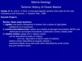
PLATE TECTONICS and the SEAFLOOR • Seafloor Spreading • Subduction • Transform Faulting • Continental Rifting and Collision • Hot Spots
Earth Processes That Create Seafloor Features Continental Margins 1) Features resulting from Continental Rifting • Continental Shelf and Slope • Deep-Sea Oceanic Basins 1) Features generated by Seafloor Spreading • Mid-Ocean Ridges and Fracture Systems • Oceanic Islands, Seamounts and Plateaus 2) Features generated by Subduction • Trenches and Island Arcs • Forearc Islands 3) Features resulting from Sedimentary processes • Abyssal Plains and Hills • Continental Rises • Submarine Canyons
OCEAN BASINS and CONTINENTAL PLATFORMSSummary of Concepts I. Earth’s rocky surface covered by of two types of crust • Dense, thin, low-standing oceanic crust • Light, thick, high-standing continental crust II. Seafloor is divided into two topographic regions • Shallow continental margins • Deep-sea oceanic basins III. Continental margins and Deep Ocean basins are fundamentally different • Composition • Structure • Age • Tectonic origin IV. Ocean basins are rugged and have a wide variety of topographic features • Mid-oceanic ridges and Transform fracture systems • Abyssal Hills and Plains • Oceanic islands, Seamounts, and Guyots • Trenches and Island Arcs