Download
1 / 16
160 likes | 261 Vues
Evaluation of GPS-derived precipitable water vapor data from the southern Alberta GPS network during the UNSTABLE 2008 period, comparing with radiosonde data and 1km GEM-LAM model outputs. Initial results, biases, correlations, and suggested future work are discussed.

E N D
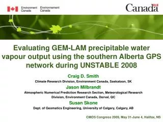
Evaluating GEM-LAM precipitable water vapour output using the southern Alberta GPS network during UNSTABLE 2008 Craig D. Smith Climate Research Division, Environment Canada, Saskatoon, SK Jason Milbrandt Atmospheric Numerical Prediction Research Section, Meteorological Research Division, Environment Canada, Dorval, QC Susan Skone Dept. of Geomatics Engineering, University of Calgary, Calgary, AB CMOS Congress 2009, May 31-June 4, Halifax, NS
Background: GPS Derived PWV • GPS signal is refracted or “delayed” by the atmosphere • Through post-processing techniques, the signal delay due to Precipitable Water Vapour (PWV) can be isolated • Requires precise P0 • PWV at temporal resolution of 30 to 60 minutes • no costly expendables • all weather conditions • Accuracies of ± 1-2 mm PWV
Alberta GPS Atmospheric Moisture Evaluation Background: GPS Derived PWV • July 2003 and 2004 • ~110 radiosonde flights • Olds, Airdrie, and Sundre • July 2004: 10 GPS point intercomparisons with the 15km GEM REG • Oct-2008 A-O
A-GAME Airdrie Olds Sundre *Bias = (GPS – RS) (Smith et al, 2008)
UNSTABLE 2008 • 8 GPS receivers, 2 fixed radiosondes • 1km GEM LAM • Same physics package as 15km GEM REG • Enhanced (1km) topography and land-cover • July 7-23 (IOP) • Initialized daily at 15Z, 12 1-hour prognosis including PWV • During IOP: severe weather forecasting and mission guidance • Post IOP: generated output for examining pre-storm processes and storm evolution • Requires validation • No vertical or horizontal interpolation • Preliminary results
UNSTABLE 2008 Limestone Mt Olds Cremona EA3 WVX Cochrane UofC Strathmore Priddis Vulcan
UNSTABLE 2008: GPS vs. Radiosonde PWV *Bias = (GPS – RS)
UNSTABLE 2008: 1km GEM LAM vs. GPS PWV *Bias = (GEM – GPS) (Includes Limestone)
Summary and Conclusions • GPS vs. RS intercomparison of PWV at EA3/Olds very good • Overall, 1km GEM LAM is too wet (average bias of 1.0 mm) • Bias starts low at initialization and peaks between 21Z and 23Z • Correlations start high but drop towards 19Z before increasing to a peak towards the end of the model run - ???? • GEM vs. GPS correlations unaffected by elevation but the bias tends to increase with elevation (can’t all be explained by Delta-Z)
Further Work • Figure out what is wrong with GEM LAM data at Limestone and fix • Add some missing GPS data (Rocky Mt. House and Okotoks) • More spatial and temporal trend analysis • Include more of the mobile RS data • Add 2.5km GEM LAM and revisit the 15km GEM REG for UNSTABLE 2008