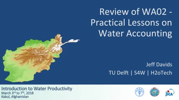
Review of WA02 - Practical Lessons on Water Accounting
Explore the essential concepts of Water Accounting with Jeff Davids at TU Delft. This comprehensive review emphasizes the importance of measuring and estimating water fluxes and changes in storage to manage resources effectively. Key topics include precipitation mechanisms, streamflow measurements, and evapotranspiration methods, alongside practical tools like manual gauges and remote sensing technologies. As Lord Kelvin noted, “You can’t manage a resource you don’t measure,” making these lessons vital for sustainable water management practices.

Review of WA02 - Practical Lessons on Water Accounting
E N D
Presentation Transcript
Review of WA02 - Practical Lessons on Water Accounting Jeff Davids TU Delft | S4W | H2oTech
“You can’t manage a resource you don’t measure.” - Lord Kelvin
Water Accounting (WA) Source: Molden and Sakthivadivel 1999 and http://www.ruralwaterresources.com/wp-content/uploads/2013/09/Hydrological-Cycle.jpg
Outline • Measuring or Estimating Fluxes and Changes in Storage • Partitioning Between WA Categories • Uncertainty in WA
Outline • Measuring or Estimating Fluxes and Changes in Storage • Partitioning Between WA Categories • Uncertainty in WA
Source: http://science.sciencemag.org/content/313/5790/1068.full
Precipitation • Mechanisms of precipitation include: • Stratiform • Convective • Orographic Source:https://en.wikipedia.org/wiki/Precipitation
Stratiform - Cold Front Source:http://apollo.lsc.vsc.edu/classes/met130/notes/chapter11/graphics/cf_xsect.jpg
Stratiform - Warm Front Source:http://www.atmos.washington.edu/~hakim/101/fronts/ahrens_0818.jpg
Convective Source:https://i.ytimg.com/vi/T9cKm8T_DD0/maxresdefault.jpg
Orographic Source:https://i.ytimg.com/vi/T9cKm8T_DD0/maxresdefault.jpg
S4W-Nepal Manual Gauges Onset Tipping Bucket DHM CoCoRaHS
Radar (Doppler) • High energy microwave radio • Reflectivity measures intensity • Doppler shift measures velocity • Topography limits Source:weather.gov
Remote Sensing • TRMM/GPM • GPM Microwave Imager (GMI) • Dual-Frequency Precipitation Radar (DPR) • Unprecedented data Source: https://www.nasa.gov/mission_pages/GPM/overview/index.html
Streamflow Measurements • Water stage measurements + stage-discharge • Direct velocity measurements • Mechanical meters • Hydroacoustics • Surface radar velocimetry • Numerical modeling (e.g. rainfall - runoff) • Remote sensing
Projects – GCID Gradient Facility and Drain Flow Measurements
Evapotranspiration Measurements • Reference ET * Crop Coefficient (FAO 56) • Dependent on good land use land cover (LULC) data • Eddy Covariance • Lysimeters • DTS Bowen Ratio • Remote Sensing (e.g. SEBAL, METRIC, ETLook, etc.)
FAO56 (Reference ET * Crop Coefficient) Source: www.fao.org/3/a-f2430e.pdf
Lysimeters Source:https://commons.wikimedia.org/wiki/File:Lysimeter_g1.svg
Vegetative index (e.g. NDVI, etc.) Sourcehttps://earthobservatory.nasa.gov/Features/MeasuringVegetation/measuring_vegetation_2.php
Energy balance (e.g. SEBAL, MOD16, etc.) Source: WGM Bastiaanssen, M Menenti, RA Feddes, AAM Holtslag Journal of hydrology 212, 198-212
Change in Storage • Changes in groundwater storage, soil moisture, reservoirs, snow/ice, etc. • Measurements of groundwater table, reservoir levels, snow/ice depth, etc. • Measure pumping rates, recharge, etc.
What Happens When Pump a Well? • Concept of Capture as formulated by Theis (1940) in his “The Source Of Water Derived From Wells.” • Well water comes from a combination of: • Change in Storage • Induced Recharge • Reduced Discharge • Capture = Sum of Induced Recharge and Reduced Discharge • Sustainable Capture: Concepts for Managing Stream Aquifer Systems (Davids and Mehl 2014) Source: Theis, 1940
Groundwater - Surface Water Source: The Nature Conservancy
Groundwater Storage - Storativity • “Storativity - the volume of water released from storage per unit decline in hydraulic head in the aquifer, per unit area of the aquifer.” Source:http://www.kgs.ku.edu/HighPlains/atlas/porfig.gif
Groundwater Flow - Darcy’s Law • Q = K x A x dh/dl • Where: • K = Hydraulic conductivity (m/day) • A = Cross-sectional Area (m2) • dh = change in head (vertically) (m) • dl = horizonal distance (m) Source:http://blogs.egu.eu/network/geosphere/2013/09/
Outline • Measuring or Estimating Fluxes and Changes in Storage • Partitioning Between WA Categories • Uncertainty in WA
Partitioning Between WA Categories Process Non-Proc Beneficial Depleted Non-Ben Inflow Committed Outflow + = ΔS Non-Com Utilizable Outflow Non-Util Source: Molden and Sakthivadivel 1999
Partitioning Between WA Categories Inflow (90) Depleted (60) Beneficial (40) Process (25) Gross Inflow Non-Process (15) Available Net Inflow Non-Beneficial (20) Outflow (40) Utilizable (10) • Uncommitted (20) Non-Utilizable (10) Committed (20) ΔS (10) Source: Molden and Sakthivadivel 1999
Outline • Measuring or Estimating Fluxes and Changes in Storage • Partitioning Between WA Categories • Uncertainty in WA
Uncertainty in Water Balances • To properly interpret Water Balances (WA), understanding uncertainty is critical! • Uncertainty in all measured/estimated fluxes propagates through to the “closure” term • Garbage In = Garbage Out • Uncertainty depends on data availability, methodology, etc.
Uncertainty in Water Balances • Key Sources of Uncertainty • Measurement uncertainty (human and instrument) • Theoretical or empirical uncertainty (lack of complete understanding of processes) • Spatial uncertainty • Temporal uncertainty • Uncertainty can be random and systematic