Download
1 / 38
380 likes | 404 Vues
Explore the joint Bulgarian-Greek project for optimal water management of Mesta/Nestos catchment. Learn about cooperation, GIS development, and HEC-HMS model calibration.

E N D
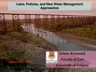
Towards Integrated Water Resources Management of the Mesta/Nestos Catchment by HEC-HMS modellingEmil Bournaski, Eleni Eleftheriadou, Ivan Ivanov Yannis MylopoulosBulgarian Academy of SciencesAristotle University of Institute of Water Problems, Thessaloniki, Sofia, Bulgaria Greece
A NEW PERCEPTION OF WATER CALLSFOR NEW APPROACHES “Water has an economic value in all its competing uses and should be realized as an economic good” (Principle 4, Dublin Conference, 1992)“Integrated water resources management should be based on the perception of water as an integral part of the ecosystem, a natural resource and a social and economic good” (Agenda 21, chapter 18, Rio de Janeiro, 1992)
“Water has social, economic and environmental values and should therefore be managed so as to realize the most acceptable and sustainable combination of those values” (Protocol on Water and Health, 1999) “Water is not a commercial product like any other but, rather, a heritage which must be protected, defended and treated as such.” (Water Framework Directive, 2000)
The catchment is divided between the two countries with the 60% of the area belonging to Bulgaria while the rest to Greece. The Mesta/Nestos River basin
Beautiful uplands and great natural wealth, biosphere reserves protected by UNESCO
virgin forests, and delta protected by Ramsar
The Mesta River in Bulgaria is used for irrigation, domestic use, fishery, tourism, waste disposal and slightly for energy production.River Nestos in Greece is used for energy production, irrigation, domestic use, fishery, waste disposal and tourism purposes.
ISSUES FOR COOPERATION ON MESTA-NESTOS WATER • Rational use of water • Pollution prevention from settlements and industry • Prevention of accidental water pollution • Common water monitoring, etc.
The TRANSCAT project deals with optimal management of water resources in borderland regions. It is carried out under the FP5 of the European Commission, program “Energy, Environment and Sustainable Development”, under the RTD priority “Operational management schemes and decision support systems”.
TRANSCAT includes 5 pilot areas in Europe TRANSCAT project is part of CATCHMOD cluster of EC projects
The main goal of the TRANSCAT project is to create an operational and integrated comprehensive Decision Support System (DSS) for optimal water management of catchment in borderland regions, in context of the implementation of the EU Water Framework Directive.
The DSS system includes modules that allow numerical modelling and simulation of different natural and socio-economic conditions, particularly hydrological and hydro-geological modelling.
One of the important features of the TRANSCAT DSS system is the realization of a connection to hydrological and hydrogeological modelling software. It should provide services of numerical modelling in these areas for various tasks in water management.
A JOINT BULGARIAN-GREEK MESTA-NESTOS GIS WAS DEVELOPEDArcView in BulgariaMapInfo in Greecedigitizing paper maps in scale 1:50 000 • Contours of relief • Rivers, Lakes and artificial dams • River Streamflow Monitoring stations • Settlements • Roads • Land cover – CORINE classification • Forests – main species • Protected areas, etc.
Some joint maps Bulgaria Mesta Nestos Greece
Rivers and runoff monitoring stations Mesta Nestos
HEC-HMS software Hydrologic Modeling System (HEC-HMS)models rain-fall run-off process in a river catchment and is suitable for continuous and event hydrologic modeling.It is developed by Hydrologic Engineering Center (HEC) of the US Army Corps of Engineers.http://www.hec.usace.army.mil/software/hec-hms/hechms-hechms.htmlpublic available
Development of a HEC-HMS 2.2.2 hydrologic model of the Mesta-Nestos river and calibration of the model for continuous hydrologic modeling
We started with selecting hydro-climatic data for calibration and verification of the Mesta-Nestos HEC-HMS model from available hydro-climatic records.The Bulgarian - Greek team is conversant with the streamflow and precipitation regimes of the Mesta-Nestos river.
3 main steamflow monitoring stations in Bulgarian territory: Yakoruda Momina kula Hadjidimovo similar in Greek territory
For model calibration and validation in Bulgaria we have used daily values of precipitation and streamflow measured at respective stations for period respectively May 2001 – Sept.2002 (17 months) and Jan.2003 – April 2004 (16 months).Similarly in Greece daily precipitation was used for one year (October 2000 - September 2001) from six rain gauging station in the catchment.
Methodologyof Mesta-Nestos HEC-HMS model development and its calibration – 4 main steps:
1Use of Mesta-Nestos GIS for estimating the catchment’s hydrologic parameters:Initial caclulation:Parameter values for relevant component were averaged based on area.Sub-basin calculation: Many physical characteristics vary spatially. With the aid of the GIS, sub-basinaverage parameter values were calculated.2GeoHMS (and GIS) was used to form a background of sub-basins
The Mesta catchment in Bulgaria was divided into 11 sub-basins in accordance with existing geographic and hydrologic characteristics of the pilot area by use of Mesta GIS.
Similarly the Nestos catchment in Greece was divided into 4 sub-basins in accordance with existing geographic and hydrologic characteristics by use of Nestos GIS.
3-aHydrologic HEC sub-models used according the peculiarity of the territory and the available data (Bulgaria):* Loss Methods – Loss rate: Green&Ampt* Transform (direct runoff)– Snyder Unit Hydrograph* Baseflow – Constant Monthly* River Reach - Muskingum-Cunge-Standard
3-bHydrologic HEC sub-models used according the peculiarity of the territory and the available data (Greece):* Loss Methods – Initial and Constant Rate Loss Method* Transform – Soil Conservation Service (SCS) Unit Hydrograph* Baseflow – Constant Monthly* River Reach – Lag Model
4Calibration of the Mesta-Nestos HEC-HMS model :Both manual and automated calibrated methods were used in this study
We consider the HEC model validation as a process of demonstrating that the site-specific model is capable of making accurate predictions for periods outside a calibrationperiod.
CONCLUSIONS:This study demonstrates that a suitable HEC-HMS hydrologic model of the Mesta/Nestos river can be developed and parameters for relevant submodels can be derived fromhistoric streamflow and precipitation records and GIS databases of the territory.It can be used in the integrated water resources management of the Mesta/Nestos river and in relevant DSS.
TRANSCAT project http://www.transcat-projects.netonly in Bulgarian language:http://www.iwp.bas.bg/projects/transcat/index.htm cTD system can be seen onhttp://transcat.vsb.czThank you for your attention.