Data Management for Mojave Network
This document outlines the data management support provided to the Mojave Inventory and Monitoring (I&M) Network from June 2002 to March 2008. Key activities included project management, spatial data acquisition, analysis, and dissemination, as well as GIS support for springs field inventories and vital signs monitoring reports. The project also involved database development, programming, and metadata training. Reports and plans detailing the findings and methodologies are included, ensuring the Mojave Network's data management framework is effective and compliant with required standards.


Data Management for Mojave Network
E N D
Presentation Transcript
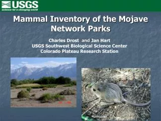
Data Management for Mojave Network Craig Palmer Harry Center for Environmental Studies UNLV
Background • Data management support provided to the Mojave I&M Network • 6/1/2002 to 9/30/2005 • Mojave Network Data Manager • 6/1/2006 to 3/1/2008 • Mojave Network Data Management Support
Current Task Information • Project management & reports • Acquisition, analysis, and dissemination of spatial data • Database development and programming for existing datasets and databases • Assist with network data management plan • July 15, 2006 – March 1, 2008
Project management & reports • Project work plan (Aug. 2006) • FY 2006 Annual Report (Nov. 2006) • FY 2007 Annual Report (Nov. 2007) • Draft final report (Jan. 15, 2008) • Final report (Jan. 31, 2008)
Acquisition, analysis, and dissemination of spatial data • Provide GIS support for springs field inventories • Begin compilation of spatial data for 12 basic inventories • Provide GIS maps for Phases II and III Vital Signs Monitoring Reports • Provide GIS metadata training module
Provide GIS support for springs field inventories • Guidance for GPS data collection • Assist with processing a verifying raw GPS data • Data review and cleanup • Create shapefiles
Begin compilation of spatial data for 12 basic inventories • Base cartography • Soils • Geology • Weather & Climate • Air quality & stations • Water quality • Water bodies • Vegetation • Species lists • Distribution and abundance of species
Provide GIS maps for Phases II and III Vital Signs Monitoring Reports • Overview of network • Land ownership • Ecoregions • 303(d) impaired water bodies • Class A waters (GRBA) • Visitation trends • Air quality monitoring • Major climatic trends
Provide GIS metadata training module • NPS metadata training module • NPS metadata tools and editor • ITIS taxonomy tool • Parsing and posting metadata • NR-GIS Metadata and Data Store • Dataset catalog
Database development and programming • Enhance functionality of spring’s database • Make compliant with NPS Natural Resource Database Template • Develop user manual for springs database • Prepare developers manual for springs database • Prepare Mojave network natural resource database using Klamath network model • Assist network Data Manager with Visual Basic and SQL programming as needed
Assist with network data management plan • Assist with data management plan outline • Design of network framework data • Initial QA/QC development section of network data management plan • Evaluate an enterprise GIS approach • How to incorporate non-programmatic data