Download
1 / 6
70 likes | 692 Vues
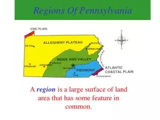
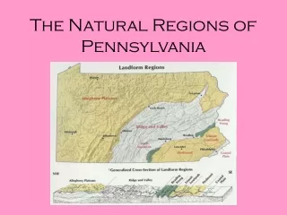
The 5 Major Geographic Regions of Pennsylvania. The Atlantic Coastal Plain Region. Very Narrow and Flat Southeastern Tip of Pa along the Delaware River First part of our state to be settled Location of Pa’s first industries and farms Climate is the mildest part of the state

E N D
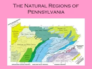
The Atlantic Coastal Plain Region • Very Narrow and Flat • Southeastern Tip of Pa along the Delaware River • First part of our state to be settled • Location of Pa’s first industries and farms • Climate is the mildest part of the state • This provides a longer growing season before the first frost
The Piedmont Region • Most of the Southeastern part of the state • Piedmont is French for “the foot of the mountains” • Contains rich limestone soil for excellent farming • Also contains a large amount of iron ore • Many immigrants found this region to be second to none
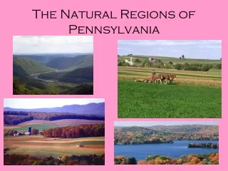
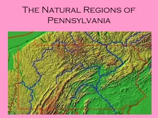
The Ridge and Valley Region • Very large region that includes about one third of the state • This region is mostly made up by the Appalachian Mountains • The most important feature in this region is The Great Valley • The Great Valley was formed by wind and rain and is excellent for farming
The Allegheny Plateau Region • This is the largest region in the state • Comprised mostly of rolling hills, valleys and streams • The region also contains the states highest point. Mount Davis 3,213 feet above sea level • Iron ore, soft coal, oil and gas helped this part of the state to become a great industrial area • It also contains the center of the states lumber industry
The Erie Plain Region • This region is very narrow and fertile • It extends a few miles inland along the shore of Lake Erie • The Erie Plain land has rich fertile soil • Today the region contains vineyards, orchards and farmland • The region also has a mild climate