
Geography
Geography. Vocabulary LEVEL 1. Maps , mapping. Navigational maps , road maps , military maps , physical maps , relief maps , gological maps … Scale Legends, captions The compass rose A compass An / to outline : un contour, dessiner des contours

Geography
E N D
Presentation Transcript
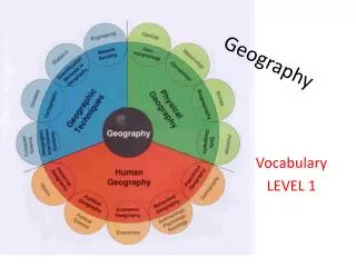
Geography Vocabulary LEVEL 1
Maps, mapping Navigationalmaps, road maps, militarymaps, physicalmaps, relief maps, gologicalmaps… Scale Legends, captions The compass rose A compass An / to outline: un contour, dessiner des contours Features: traits, caractéristiques Depth: profondeur Height: hauteur The map-makingprocess cartography Distortions: déformations (du dessin) Accuracy: exactitude Accurate: exact Placenames : toponymes Boundary: limite Border: frontière (capital) city, boroughs (bourgades), villages, hamlet (hameau) Geographiccoordinates Latitude, longitude An orthoplanic projection The WinkelTripel projection (to) include, feature : inclure, figurer Provide information as to
Roads Classez les termes ci-dessus du plus large au moins large en fonction de la taille des routes: A path – a street - a footpath (sente) – a sunkenlane (chemin creux) - an alleyway – a road – a thoroughfare – a motorway – a car-track – a lane – a towpath (chemin de halage) – a country road – an avenue – a boulevard – a secondary road – a main road
Find the odd one in the list • Weathering – abrasion – erosion – cooling • Bedrock – ash - flint – limestone – pebble • Coast – peninsula – islet – outcrop – island - dam • Factory – mill – seabed - stack – warehouse • Ore – rubber – brass – tin – copper – silver • Supply – devise- provide – produce • Field – meadow – orchard – stream – pasture • Mountain range - summit – pit – peak – hill – mound • Cliff – reef – rock face – steepslope – cove – timber • Landslide – drift - tornadoe – gust – earthquake – flood • Stream – river – throw - rivulet – flow into – swell – shore
Population The distribution(repartition) of the population Population density – population growth Life expectancy Migration and population flows To measure – measurement Demographic data Birth / death rate Collect date – census A highly/ sparselypopulated area Overcrowding Standard of living – quality of life - humandevelopment index
Thème Les côtes de Grande-Bretagne ont été touchées par des rafales de vent extrêmement fortes. Un boulevard à 4 voies relie le nord et le sud de l’agglomération. La rivière grossit le fleuve puis se jette dans l’océan. Les contours du comté montrent qu’il s’étend au nord plus qu’à l’est. La frontière partagée avec l’Ecosse posa de nombreux problèmes. La densité de population dans cette zone de l’Angleterre est la plus grande. Peu de zones côtières sont aussi bien préservées que celles de la partie la plus à l’ouest de l’île. La bourgade fut dévastée par un glissement de terrain après la construction du barrage.


